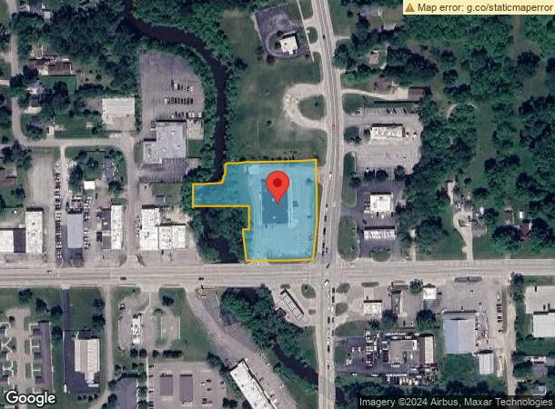
Property Record
4519 Richfield Rd, Flint, MI 48506
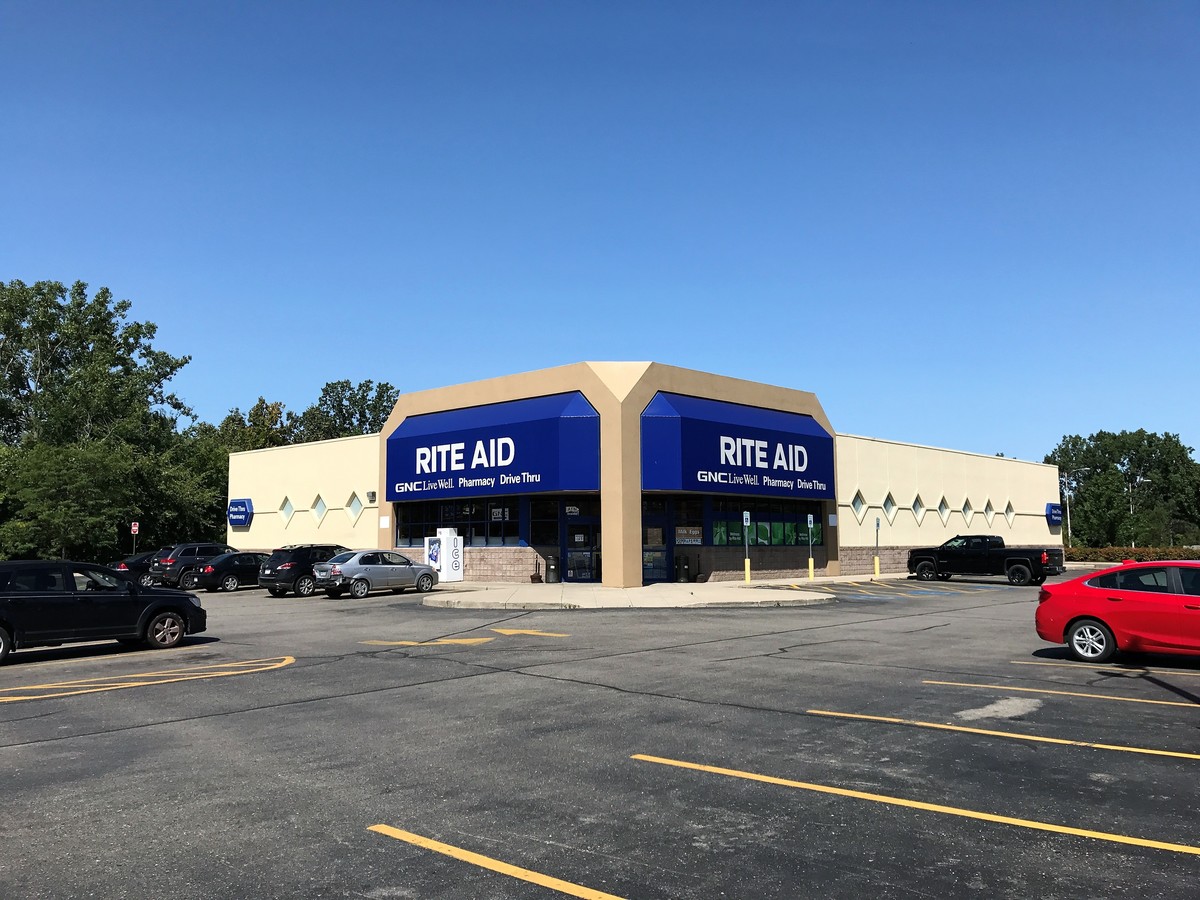
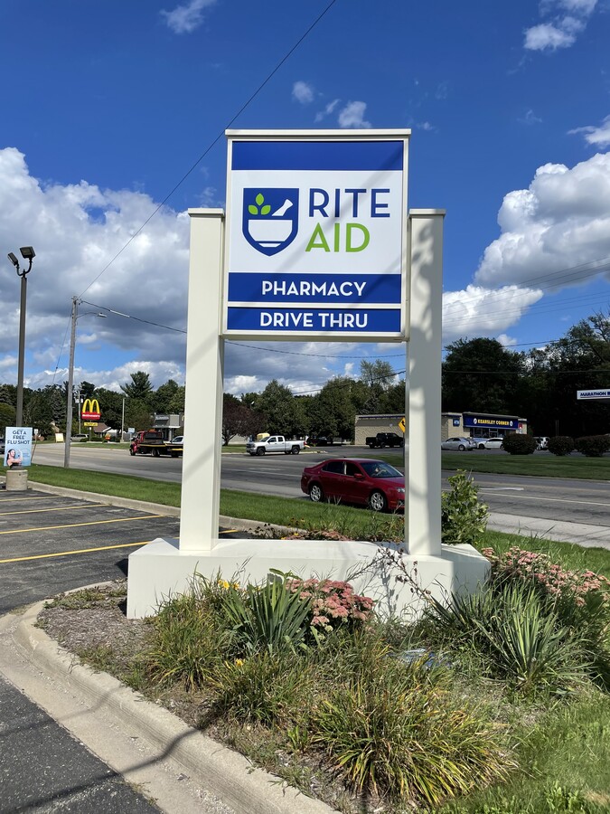
This Property Is For Sale
Current Lease Availabilities
NEARBY LISTINGS FOR SALE OR LEASE
Property Detail
4519 Richfield Rd
Flint, MI
Kearsley Creek Subdivision
11-34-577-049
PART OF LOTS 34 THRU 38 DESC AS BEG AT INTERSECTION OF N R/W LINE OF RICHFIELD RD AND W R/W LINE OF GENESEE RD TH N 89 DEG 57 MIN W 212 FT TH N 5 DEG 47 MIN W 100 FT TH S 89 DEG 57 MIN E 20 FT TH N 5 DEG 47 MIN E 20.6 FT TH S 89 DEG 57 MIN E 4.09 FT
Commercialnec
Genesee
AE
Michigan
26049C0211D
34-38
2023
1.51 AC
2024
Flint
012006
Detroit
10,875 SF
DEMOGRAPHICS near 4519 Richfield Rd
1 Mile
3 Mile
5 Mile
2024 Total Population
3,823
33,658
99,908
2029 Population
3,692
33,441
100,592
Pop Growth 2024-2029
(3.43%)
(0.64%)
+ 0.68%
Average Age
44
40
40
2024 Total Households
1,638
13,596
41,918
HH Growth 2024-2029
(3.42%)
(0.80%)
+ 0.63%
Median Household Inc
$55,585
$44,920
$41,161
Avg Household Size
2.30
2.40
2.30
2024 Avg HH Vehicles
2.00
2.00
1.00
Median Home Value
$141,394
$111,267
$99,793
Median Year Built
1958
1959
1963
Nearby Places
- Restaurants
- Banks
- Shops
- Fitness
- Groceries
PUBLIC TRANSPORTATION
COMMUTER RAIL
Flint Amtrak Station (Blue Water - Amtrak)
Drive
Walk
Distance
Flint Amtrak Station (Blue Water - Amtrak)
10 min
4.9 mi
AIRPORT
Bishop International
Drive
Walk
Distance
Bishop International
29 min
14.5 mi
Freight Ports
Port of Toledo
Drive
Walk
Distance
Port of Toledo
144 min
120.3 mi
Nearby Properties
Address
Land Use
TOTAL SIZE
Lot Size
Zoning
Address
Land Use
TOTAL SIZE
Lot Size
Zoning
MOBILE
Address
Land Use
TOTAL SIZE
Lot Size
Zoning
227669
25.87 AC
C-2
Address
Land Use
TOTAL SIZE
Lot Size
Zoning
49.55 AC
Address
Land Use
TOTAL SIZE
Lot Size
Zoning
371636
12.50 AC
M-1
Address
Land Use
TOTAL SIZE
Lot Size
Zoning
290267
79 AC
Address
Land Use
TOTAL SIZE
Lot Size
Zoning
111882
5.36 AC
C-4
Address
Land Use
TOTAL SIZE
Lot Size
Zoning
215000
Address
Land Use
TOTAL SIZE
Lot Size
Zoning
412500
57.18 AC
M-2
Address
Land Use
TOTAL SIZE
Lot Size
Zoning
136506
16.54 AC
C-4
Address
Land Use
TOTAL SIZE
Lot Size
Zoning
Address
Land Use
TOTAL SIZE
Lot Size
Zoning
14.84 AC
Address
Land Use
TOTAL SIZE
Lot Size
Zoning
217389
37.64 AC
Address
Land Use
TOTAL SIZE
Lot Size
Zoning
Address
Land Use
TOTAL SIZE
Lot Size
Zoning
105072
5.18 AC
RETAIL
Address
Land Use
TOTAL SIZE
Lot Size
Zoning
192900
6.50 AC
Address
Land Use
TOTAL SIZE
Lot Size
Zoning
118210
6.60 AC
Address
Land Use
TOTAL SIZE
Lot Size
Zoning
55080
6.41 AC
C-2
Address
Land Use
TOTAL SIZE
Lot Size
Zoning
173312
23.49 AC
Address
Land Use
TOTAL SIZE
Lot Size
Zoning
28476
3.39 AC
Address
Land Use
TOTAL SIZE
Lot Size
Zoning
19744
3.52 AC
C-2
Address
Land Use
TOTAL SIZE
Lot Size
Zoning
43751
3.14 AC
Address
Land Use
TOTAL SIZE
Lot Size
Zoning
4260
301 AC
Address
Land Use
TOTAL SIZE
Lot Size
Zoning
726
10.40 AC
R-4 MANUF
Address
Land Use
TOTAL SIZE
Lot Size
Zoning
57.47 AC
R-4 MANUF
Address
Land Use
TOTAL SIZE
Lot Size
Zoning
48411
16.05 AC
Address
Land Use
TOTAL SIZE
Lot Size
Zoning
114221
6.16 AC
G
Address
Land Use
TOTAL SIZE
Lot Size
Zoning
138232
16.84 AC
C-4
Address
Land Use
TOTAL SIZE
Lot Size
Zoning
118616
Address
Land Use
TOTAL SIZE
Lot Size
Zoning
40369
20.76 AC
D-6
Address
Land Use
TOTAL SIZE
Lot Size
Zoning
43978
2.69 AC
M-1
Start a new search to find other properties for sale or lease
Connect with us
© 2024 CoStar Group
The information above has been obtained from sources believed reliable. While we do not doubt its accuracy we have not verified it and make no guarantee, warranty or representation about it. It is your responsibility to independently confirm its accuracy and completeness. Any projections, opinions, assumptions, or estimates used are for example only and do not represent the current or future performance of the property. The value of this transaction to you depends on tax and other factors which should be evaluated by your tax, financial, and legal advisors. You and your advisors should conduct a careful, independent investigation of the property to determine to your satisfaction the suitability of the property for your needs.