Property Record
452 S State St, Poplar Grove, IL 61065
NEARBY LISTINGS FOR SALE OR LEASE
-
-
View all Poplar Grove listings for sale on LoopNet.com
Property Detail
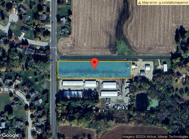
452 S State St
Rockford, IL
Etes Sub
04-19-351-018
19-45-4 LOT 1 ETES SUB FINAL PLAT
Commercialacreage
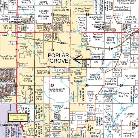
Boone
X
Illinois
17007C0105C
1
2023
2.50 AC
2023
Boone County
0106022052
Chicago
DEMOGRAPHICS near 452 S State St
1 Mile
3 Mile
5 Mile
2024 Total Population
2,368
9,924
16,258
2029 Population
2,414
10,079
16,313
Pop Growth 2024-2029
+ 1.94%
+ 1.56%
+ 0.34%
Average Age
36
38
39
2024 Total Households
787
3,374
5,585
HH Growth 2024-2029
+ 2.29%
+ 1.69%
+ 0.41%
Median Household Inc
$112,959
$88,806
$92,442
Avg Household Size
3.00
2.90
2.90
2024 Avg HH Vehicles
2.00
2.00
2.00
Median Home Value
$186,901
$162,990
$182,275
Median Year Built
2005
2000
1997
Nearby Places
- Restaurants
- Banks
- Shops
- Fitness
- Groceries
PUBLIC TRANSPORTATION
AIRPORT
Chicago/Rockford International
Drive
Walk
Distance
Chicago/Rockford International
41 min
27.6 mi
Freight Ports
Port Milwaukee
Drive
Walk
Distance
Port Milwaukee
98 min
80.2 mi
SALE & LEASE HISTORY
LISTING DATE
SALE/LEASE

Oct 07, 2021
For Sale
Nearby Properties
Address
Land Use
TOTAL SIZE
Lot Size
Zoning
Address
Land Use
TOTAL SIZE
Lot Size
Zoning
1824
45.62 AC
Address
Land Use
TOTAL SIZE
Lot Size
Zoning
1946
46.97 AC
Address
Land Use
TOTAL SIZE
Lot Size
Zoning
100
5.35 AC
R1
Address
Land Use
TOTAL SIZE
Lot Size
Zoning
38731
3.45 AC
Address
Land Use
TOTAL SIZE
Lot Size
Zoning
14.24 AC
Address
Land Use
TOTAL SIZE
Lot Size
Zoning
18180
3.14 AC
Address
Land Use
TOTAL SIZE
Lot Size
Zoning
9301
1.34 AC
Address
Land Use
TOTAL SIZE
Lot Size
Zoning
9.22 AC
Address
Land Use
TOTAL SIZE
Lot Size
Zoning
11585
2.10 AC
Address
Land Use
TOTAL SIZE
Lot Size
Zoning
1448
1.30 AC
110
Address
Land Use
TOTAL SIZE
Lot Size
Zoning
4426
1.94 AC
Address
Land Use
TOTAL SIZE
Lot Size
Zoning
13495
2.02 AC
Address
Land Use
TOTAL SIZE
Lot Size
Zoning
17248
0.98 AC
Address
Land Use
TOTAL SIZE
Lot Size
Zoning
11391
8.43 AC
Address
Land Use
TOTAL SIZE
Lot Size
Zoning
5319
17 AC
A1
Address
Land Use
TOTAL SIZE
Lot Size
Zoning
5000
4.72 AC
4
Address
Land Use
TOTAL SIZE
Lot Size
Zoning
15591
2.22 AC
Address
Land Use
TOTAL SIZE
Lot Size
Zoning
14.15 AC
Address
Land Use
TOTAL SIZE
Lot Size
Zoning
3222
0.99 AC
Address
Land Use
TOTAL SIZE
Lot Size
Zoning
6771
0.70 AC
Address
Land Use
TOTAL SIZE
Lot Size
Zoning
3689
0.71 AC
Address
Land Use
TOTAL SIZE
Lot Size
Zoning
1.44 AC
Address
Land Use
TOTAL SIZE
Lot Size
Zoning
2744
1.77 AC
R1
Address
Land Use
TOTAL SIZE
Lot Size
Zoning
100
6.85 AC
R1
Address
Land Use
TOTAL SIZE
Lot Size
Zoning
2073
49 AC
Address
Land Use
TOTAL SIZE
Lot Size
Zoning
50.24 AC
A1
Address
Land Use
TOTAL SIZE
Lot Size
Zoning
4.63 AC
4
Address
Land Use
TOTAL SIZE
Lot Size
Zoning
Address
Land Use
TOTAL SIZE
Lot Size
Zoning
2656
5 AC
B1
Address
Land Use
TOTAL SIZE
Lot Size
Zoning
4780
0.58 AC
Start a new search to find other properties for sale or lease
Connect with us
© 2024 CoStar Group
The information above has been obtained from sources believed reliable. While we do not doubt its accuracy we have not verified it and make no guarantee, warranty or representation about it. It is your responsibility to independently confirm its accuracy and completeness. Any projections, opinions, assumptions, or estimates used are for example only and do not represent the current or future performance of the property. The value of this transaction to you depends on tax and other factors which should be evaluated by your tax, financial, and legal advisors. You and your advisors should conduct a careful, independent investigation of the property to determine to your satisfaction the suitability of the property for your needs.