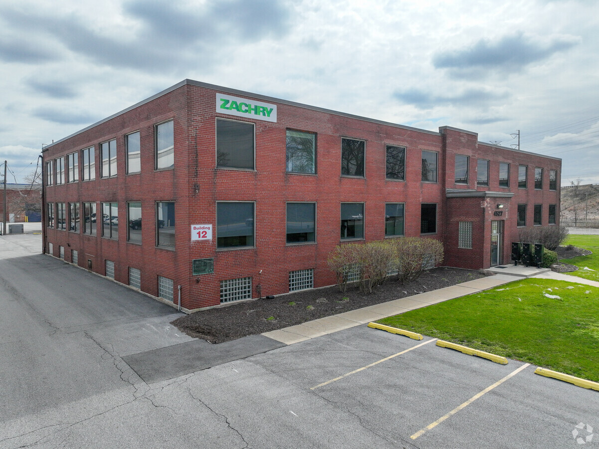
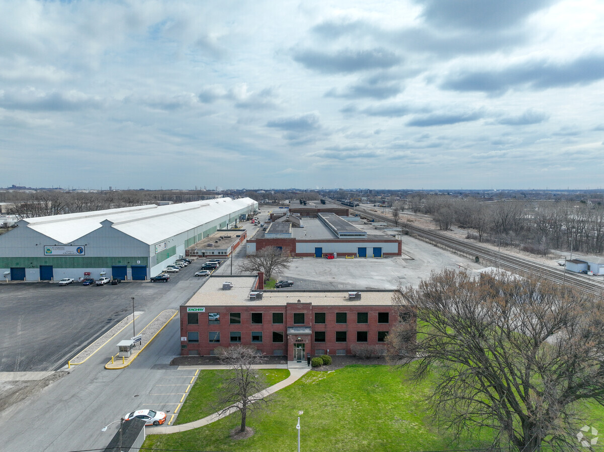
Property Record
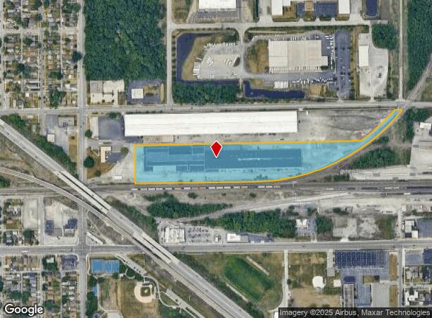
4527 Columbia Ave, Hammond, IN 46327
Current Lease Availabilities
NEARBY LISTINGS FOR SALE OR LEASE
Property Detail
4527 Columbia Ave
Chicago-Naperville-Elgin, IL-IN-WI
Hammond Enterprise Center
45-03-30-401-003.000-023
HAMMOND ENTERPRISE CENTER LOT A-2
Lightindustrial
Lake
X
Indiana
18089C0038F
a-2
2023
12.37 AC
2024
Indiana
020400
Chicago
244,324 SF
DEMOGRAPHICS near 4527 Columbia Ave
1 Mile
3 Mile
5 Mile
2024 Total Population
13,249
77,822
190,810
2029 Population
13,145
77,416
188,020
Pop Growth 2024-2029
(0.78%)
(0.52%)
(1.46%)
Average Age
36
37
39
2024 Total Households
4,534
28,268
71,940
HH Growth 2024-2029
(0.82%)
(0.63%)
(1.65%)
Median Household Inc
$43,774
$43,551
$51,676
Avg Household Size
2.70
2.60
2.50
2024 Avg HH Vehicles
2.00
2.00
2.00
Median Home Value
$95,691
$110,719
$138,072
Median Year Built
1947
1948
1955
Nearby Places
- Restaurants
- Banks
- Shops
- Fitness
- Groceries
PUBLIC TRANSPORTATION
COMMUTER RAIL
Hammond Station (South Shore Line - Northern Indiana Commuter Transportation District (South Shore Line))
DRIVE
WALK
Distance
Hammond Station (South Shore Line - Northern Indiana Commuter Transportation District (South Shore Line))
4 min
1.2 mi
East Chicago Station (South Shore Line - Northern Indiana Commuter Transportation District (South Shore Line))
DRIVE
WALK
Distance
East Chicago Station (South Shore Line - Northern Indiana Commuter Transportation District (South Shore Line))
8 min
5.0 mi
AIRPORT
Chicago Midway International
DRIVE
WALK
Distance
Chicago Midway International
37 min
20.8 mi
Freight Ports
Port Milwaukee
DRIVE
WALK
Distance
Port Milwaukee
137 min
106.1 mi
Nearby Properties
Address
Land Use
TOTAL SIZE
Lot Size
Zoning
Address
Land Use
TOTAL SIZE
Lot Size
Zoning
27,934 SF
37.50 AC
Address
Land Use
TOTAL SIZE
Lot Size
Zoning
791,664 SF
13.02 AC
Address
Land Use
TOTAL SIZE
Lot Size
Zoning
796,761 SF
12.32 AC
Address
Land Use
TOTAL SIZE
Lot Size
Zoning
509,210 SF
34.39 AC
Address
Land Use
TOTAL SIZE
Lot Size
Zoning
240,900 SF
10.62 AC
Address
Land Use
TOTAL SIZE
Lot Size
Zoning
254,500 SF
30.06 AC
Address
Land Use
TOTAL SIZE
Lot Size
Zoning
255,500 SF
14.30 AC
Address
Land Use
TOTAL SIZE
Lot Size
Zoning
399,000 SF
23.92 AC
Address
Land Use
TOTAL SIZE
Lot Size
Zoning
181,760 SF
13.32 AC
Address
Land Use
TOTAL SIZE
Lot Size
Zoning
126,648 SF
3.71 AC
Address
Land Use
TOTAL SIZE
Lot Size
Zoning
443,065 SF
36.69 AC
Address
Land Use
TOTAL SIZE
Lot Size
Zoning
144,256 SF
2.91 AC
R3
Address
Land Use
TOTAL SIZE
Lot Size
Zoning
115,612 SF
4.20 AC
Address
Land Use
TOTAL SIZE
Lot Size
Zoning
99,042 SF
255 AC
Address
Land Use
TOTAL SIZE
Lot Size
Zoning
303,132 SF
21.23 AC
Address
Land Use
TOTAL SIZE
Lot Size
Zoning
221,190 SF
109.74 AC
Address
Land Use
TOTAL SIZE
Lot Size
Zoning
186,608 SF
18.11 AC
R3
Address
Land Use
TOTAL SIZE
Lot Size
Zoning
6,139 SF
78.90 AC
Address
Land Use
TOTAL SIZE
Lot Size
Zoning
113,381 SF
9.31 AC
Address
Land Use
TOTAL SIZE
Lot Size
Zoning
244,773 SF
65.01 AC
Address
Land Use
TOTAL SIZE
Lot Size
Zoning
16,644 SF
52.10 AC
Address
Land Use
TOTAL SIZE
Lot Size
Zoning
55,800 SF
7.25 AC
Address
Land Use
TOTAL SIZE
Lot Size
Zoning
126,900 SF
75.99 AC
Address
Land Use
TOTAL SIZE
Lot Size
Zoning
292,953 SF
8.93 AC
Address
Land Use
TOTAL SIZE
Lot Size
Zoning
68,885 SF
5.93 AC
Address
Land Use
TOTAL SIZE
Lot Size
Zoning
224,611 SF
7.31 AC
Address
Land Use
TOTAL SIZE
Lot Size
Zoning
115,509 SF
5.95 AC
Address
Land Use
TOTAL SIZE
Lot Size
Zoning
786,811 SF
37.23 AC
Address
Land Use
TOTAL SIZE
Lot Size
Zoning
527,227 SF
33.52 AC
R33
Address
Land Use
TOTAL SIZE
Lot Size
Zoning
91,644 SF
29.28 AC
The World's #1 Commercial Real Estate Marketplace
Connect with us
© 2025 CoStar Group
The information above has been obtained from sources believed reliable. While we do not doubt its accuracy we have not verified it and make no guarantee, warranty or representation about it. It is your responsibility to independently confirm its accuracy and completeness. Any projections, opinions, assumptions, or estimates used are for example only and do not represent the current or future performance of the property. The value of this transaction to you depends on tax and other factors which should be evaluated by your tax, financial, and legal advisors. You and your advisors should conduct a careful, independent investigation of the property to determine to your satisfaction the suitability of the property for your needs.