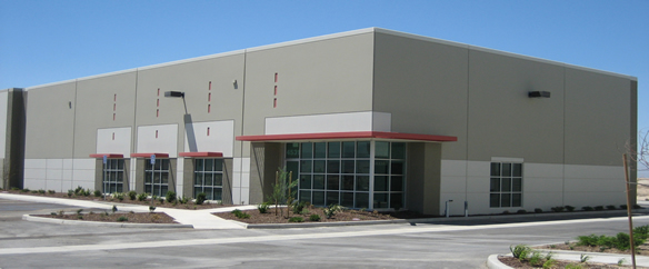
Property Record
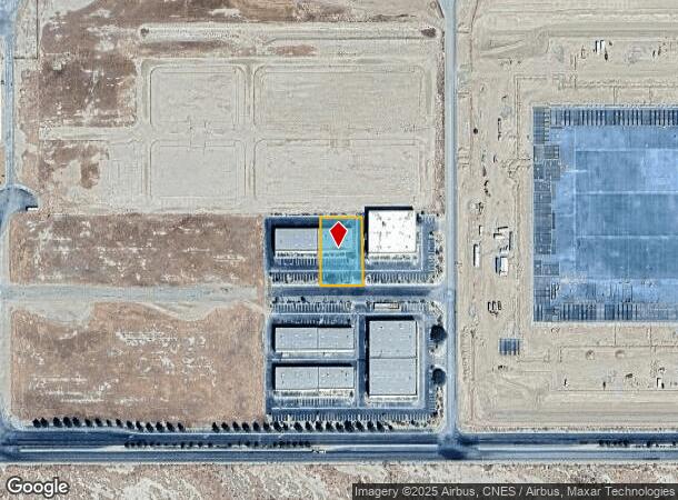
4531 Runway Dr, Lancaster, CA 93536
NEARBY LISTINGS FOR SALE OR LEASE
Property Detail
4531 Runway Dr
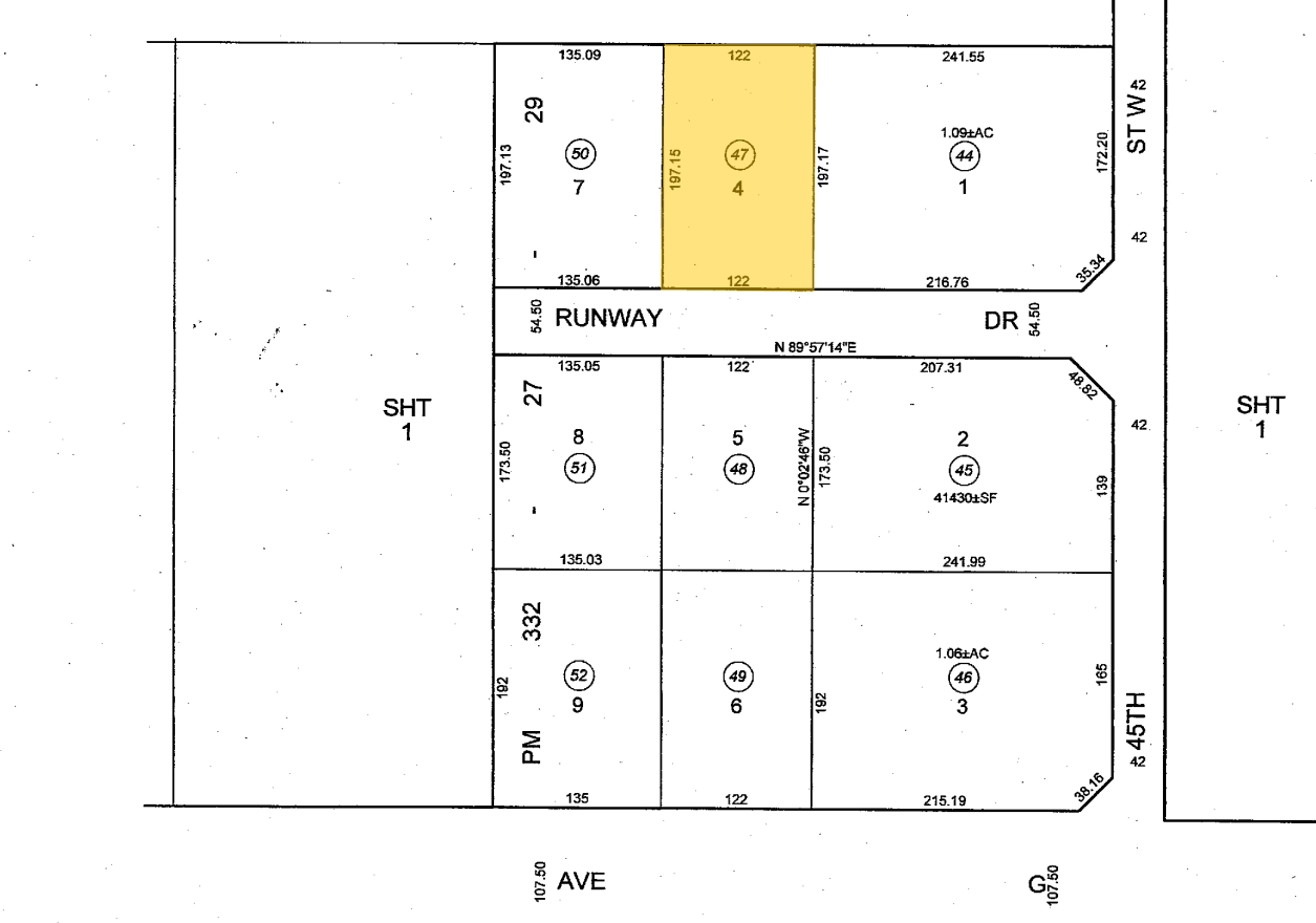
3105-001-047
P M 332-27-29 LOT 4
Warehouse
Los Angeles
X
California
06037C0405F
4
2024
0.55 AC
2024
Antelope Valley
900901
Los Angeles
6,370 SF
Los Angeles-Long Beach-Glendale, CA
DEMOGRAPHICS near 4531 Runway Dr
1 Mile
3 Mile
5 Mile
2024 Total Population
5
2,881
65,452
2029 Population
5
2,802
63,626
Pop Growth 2024-2029
0.00%
(2.74%)
(2.79%)
Average Age
0
37
38
2024 Total Households
2
910
21,068
HH Growth 2024-2029
0.00%
(3.08%)
(3.02%)
Median Household Inc
$0
$72,584
$74,727
Avg Household Size
1.00
3.10
3.00
2024 Avg HH Vehicles
2.00
2.00
2.00
Median Home Value
$0
$407,798
$367,269
Median Year Built
2010
2004
1987
Nearby Places
- Restaurants
- Banks
- Shops
- Fitness
- Groceries
PUBLIC TRANSPORTATION
COMMUTER RAIL
Lancaster (Antelope Valley Line - Southern California Regional Rail Authority (Metrolink))
DRIVE
WALK
Distance
Lancaster (Antelope Valley Line - Southern California Regional Rail Authority (Metrolink))
11 min
6.6 mi
Freight Ports
Port of Long Beach
DRIVE
WALK
Distance
Port of Long Beach
115 min
98.4 mi
Nearby Properties
Address
Land Use
TOTAL SIZE
Lot Size
Zoning
Address
Land Use
TOTAL SIZE
Lot Size
Zoning
2,922,905 SF
85.01 AC
LRLI
Address
Land Use
TOTAL SIZE
Lot Size
Zoning
465,697 SF
27.82 AC
LRSP*
Address
Land Use
TOTAL SIZE
Lot Size
Zoning
249,045 SF
19.74 AC
LRMPD*
Address
Land Use
TOTAL SIZE
Lot Size
Zoning
89,351 SF
17.97 AC
LRMDR
Address
Land Use
TOTAL SIZE
Lot Size
Zoning
81,668 SF
5.47 AC
LRSP80-01*
Address
Land Use
TOTAL SIZE
Lot Size
Zoning
198,494 SF
9.78 AC
LRSP*
Address
Land Use
TOTAL SIZE
Lot Size
Zoning
32.02 AC
LRSP
Address
Land Use
TOTAL SIZE
Lot Size
Zoning
99,247 SF
10.11 AC
LRA12*
Address
Land Use
TOTAL SIZE
Lot Size
Zoning
57,050 SF
4.28 AC
LRLI
Address
Land Use
TOTAL SIZE
Lot Size
Zoning
259,447 SF
4.51 AC
LRD22*
Address
Land Use
TOTAL SIZE
Lot Size
Zoning
31,200 SF
2.28 AC
LRLI
Address
Land Use
TOTAL SIZE
Lot Size
Zoning
19,580 SF
2.02 AC
LRM120000*
Address
Land Use
TOTAL SIZE
Lot Size
Zoning
14,581 SF
0.95 AC
LRSP*
Address
Land Use
TOTAL SIZE
Lot Size
Zoning
14,581 SF
1.06 AC
LRSP*
Address
Land Use
TOTAL SIZE
Lot Size
Zoning
21,808 SF
2.30 AC
LRM120000*
Address
Land Use
TOTAL SIZE
Lot Size
Zoning
1,500 SF
4.73 AC
LRD22*
Address
Land Use
TOTAL SIZE
Lot Size
Zoning
410,335 SF
9.76 AC
LRSP80-01*
Address
Land Use
TOTAL SIZE
Lot Size
Zoning
6,457 SF
2.26 AC
LRLI*
Address
Land Use
TOTAL SIZE
Lot Size
Zoning
7,858 SF
0.60 AC
LRSP*
Address
Land Use
TOTAL SIZE
Lot Size
Zoning
16,614 SF
1.09 AC
LRSP*
Address
Land Use
TOTAL SIZE
Lot Size
Zoning
12,200 SF
2.22 AC
LRLI*
Address
Land Use
TOTAL SIZE
Lot Size
Zoning
6,370 SF
0.54 AC
LRSP*
Address
Land Use
TOTAL SIZE
Lot Size
Zoning
2,672 SF
4.52 AC
LRC*
Address
Land Use
TOTAL SIZE
Lot Size
Zoning
7,858 SF
0.54 AC
LRSP*
Address
Land Use
TOTAL SIZE
Lot Size
Zoning
7,858 SF
0.61 AC
LRSP*
Address
Land Use
TOTAL SIZE
Lot Size
Zoning
7,150 SF
1.13 AC
LRLI
Address
Land Use
TOTAL SIZE
Lot Size
Zoning
7,250 SF
0.57 AC
LRM12000*
Address
Land Use
TOTAL SIZE
Lot Size
Zoning
6,370 SF
0.49 AC
LRSP*
Address
Land Use
TOTAL SIZE
Lot Size
Zoning
3,405 SF
2.32 AC
LRMPD*
Address
Land Use
TOTAL SIZE
Lot Size
Zoning
4,450 SF
2.31 AC
LRM120000*
The World's #1 Commercial Real Estate Marketplace
Connect with us
© 2025 CoStar Group
The information above has been obtained from sources believed reliable. While we do not doubt its accuracy we have not verified it and make no guarantee, warranty or representation about it. It is your responsibility to independently confirm its accuracy and completeness. Any projections, opinions, assumptions, or estimates used are for example only and do not represent the current or future performance of the property. The value of this transaction to you depends on tax and other factors which should be evaluated by your tax, financial, and legal advisors. You and your advisors should conduct a careful, independent investigation of the property to determine to your satisfaction the suitability of the property for your needs.