Property Record
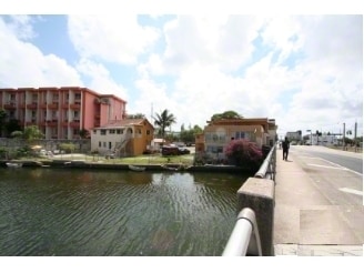
454 Ne 79Th St, Miami, FL 33138


NEARBY LISTINGS FOR SALE OR LEASE
Property Detail
454 Ne 79Th St
Miami-Miami Beach-Kendall, FL
Federal Way
01-3207-000-0120
7 53 42 .31 AC M/L BEG 15FTS & 170FTE OF NW COR OF E1/2-SW1/4 S150FT E TO C/L LITTLE RIV NLY ALG C/L RIV TO PT E OF BEG W TO BEG LESS W40FT LESS R/W LOT SIZE 14950 SQUARE FEET OR 20624-3238 0802 2 (2) COC 23179-0521-22 01 2005 2
Retailwithmorethanonenonretailuse
Miami/Dade
AE
Florida
12086C0302L
a
2024
0.34 AC
2025
Biscayne Corridor
001302
South Florida
1,503 SF
DEMOGRAPHICS near 454 Ne 79Th St
1 Mile
3 Mile
5 Mile
2024 Total Population
26,132
169,920
507,545
2029 Population
25,823
168,035
505,608
Pop Growth 2024-2029
(1.18%)
(1.11%)
(0.38%)
Average Age
41
39
40
2024 Total Households
11,300
64,581
198,846
HH Growth 2024-2029
(1.34%)
(1.20%)
(0.16%)
Median Household Inc
$44,551
$48,039
$49,873
Avg Household Size
2.20
2.50
2.40
2024 Avg HH Vehicles
1.00
1.00
1.00
Median Home Value
$518,053
$402,452
$391,302
Median Year Built
1969
1966
1970
Nearby Places
Map Layers
Map Styles
 Street
 Aerial
- Restaurants
- Banks
- Shops
- Fitness
- Groceries
PUBLIC TRANSPORTATION
COMMUTER RAIL
Northside (Metrorail Green Line - Miami-Dade Transit (Metrorail/Metromover))
DRIVE
WALK
Distance
Northside (Metrorail Green Line - Miami-Dade Transit (Metrorail/Metromover))
9 min
4.1 mi
Dr. Martin Luther King Jr. Plaza (Metrorail Green Line - Miami-Dade Transit (Metrorail/Metromover))
DRIVE
WALK
Distance
Dr. Martin Luther King Jr. Plaza (Metrorail Green Line - Miami-Dade Transit (Metrorail/Metromover))
10 min
4.5 mi
AIRPORT
Miami International
DRIVE
WALK
Distance
Miami International
26 min
12.4 mi
Fort Lauderdale/Hollywood International
DRIVE
WALK
Distance
Fort Lauderdale/Hollywood International
29 min
19.3 mi
Freight Ports
Port of Miami
DRIVE
WALK
Distance
Port of Miami
17 min
6.6 mi
Nearby Properties
Address
Land Use
TOTAL SIZE
Lot Size
Zoning
Address
Land Use
TOTAL SIZE
Lot Size
Zoning
1,938,271 SF
6.62 AC
6402
Address
Land Use
TOTAL SIZE
Lot Size
Zoning
1,075,124 SF
1.61 AC
6405
Address
Land Use
TOTAL SIZE
Lot Size
Zoning
868,860 SF
2.14 AC
6402
Address
Land Use
TOTAL SIZE
Lot Size
Zoning
615,785 SF
3.81 AC
4604
Address
Land Use
TOTAL SIZE
Lot Size
Zoning
701,056 SF
1.58 AC
6402
Address
Land Use
TOTAL SIZE
Lot Size
Zoning
600,250 SF
2.03 AC
6402
Address
Land Use
TOTAL SIZE
Lot Size
Zoning
908,095 SF
8.17 AC
6400
Address
Land Use
TOTAL SIZE
Lot Size
Zoning
519,775 SF
2.27 AC
6100
Address
Land Use
TOTAL SIZE
Lot Size
Zoning
768,663 SF
2.85 AC
4600
Address
Land Use
TOTAL SIZE
Lot Size
Zoning
595,100 SF
0.92 AC
4604
Address
Land Use
TOTAL SIZE
Lot Size
Zoning
264,272 SF
2.18 AC
6110
Address
Land Use
TOTAL SIZE
Lot Size
Zoning
657,769 SF
6.12 AC
6200
Address
Land Use
TOTAL SIZE
Lot Size
Zoning
567,884 SF
4.51 AC
4000
Address
Land Use
TOTAL SIZE
Lot Size
Zoning
520,016 SF
1.89 AC
5000
Address
Land Use
TOTAL SIZE
Lot Size
Zoning
456,344 SF
1.29 AC
6110
Address
Land Use
TOTAL SIZE
Lot Size
Zoning
763,761 SF
8 AC
6402
Address
Land Use
TOTAL SIZE
Lot Size
Zoning
179,418 SF
1.95 AC
6101
Address
Land Use
TOTAL SIZE
Lot Size
Zoning
446,109 SF
3.54 AC
4600
Address
Land Use
TOTAL SIZE
Lot Size
Zoning
68,304 SF
2.27 AC
6405
Address
Land Use
TOTAL SIZE
Lot Size
Zoning
656,930 SF
37.70 AC
8200
Address
Land Use
TOTAL SIZE
Lot Size
Zoning
363,010 SF
19.13 AC
8000
Address
Land Use
TOTAL SIZE
Lot Size
Zoning
1,168 SF
4.60 AC
6402
Address
Land Use
TOTAL SIZE
Lot Size
Zoning
121,320 SF
2.22 AC
6101
Address
Land Use
TOTAL SIZE
Lot Size
Zoning
99,433 SF
2.27 AC
6402
Address
Land Use
TOTAL SIZE
Lot Size
Zoning
272,311 SF
9.64 AC
3800
Address
Land Use
TOTAL SIZE
Lot Size
Zoning
253,926 SF
2.79 AC
3900
Address
Land Use
TOTAL SIZE
Lot Size
Zoning
569,763 SF
31.75 AC
3900
Address
Land Use
TOTAL SIZE
Lot Size
Zoning
260,820 SF
1.63 AC
6100
Address
Land Use
TOTAL SIZE
Lot Size
Zoning
293,276 SF
39.44 AC
8200
Address
Land Use
TOTAL SIZE
Lot Size
Zoning
28,694 SF
1.07 AC
6110
The World's #1 Commercial Real Estate Marketplace
Connect with us
© 2025 CoStar Group
The information above has been obtained from sources believed reliable. While we do not doubt its accuracy we have not verified it and make no guarantee, warranty or representation about it. It is your responsibility to independently confirm its accuracy and completeness. Any projections, opinions, assumptions, or estimates used are for example only and do not represent the current or future performance of the property. The value of this transaction to you depends on tax and other factors which should be evaluated by your tax, financial, and legal advisors. You and your advisors should conduct a careful, independent investigation of the property to determine to your satisfaction the suitability of the property for your needs.