Property Record
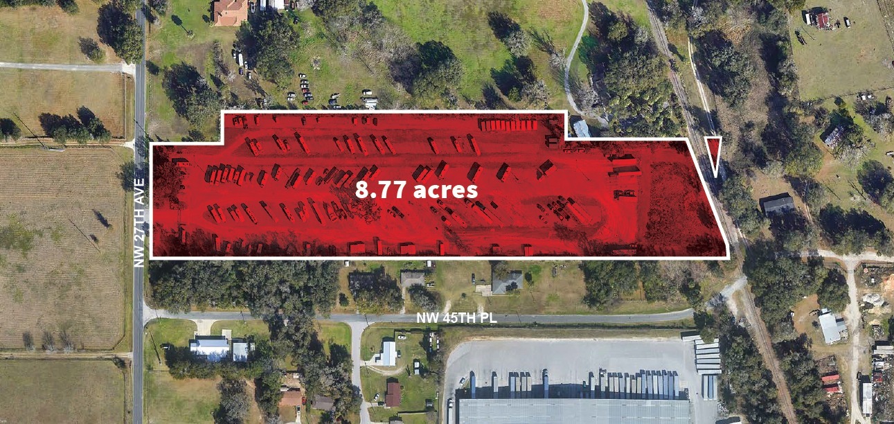
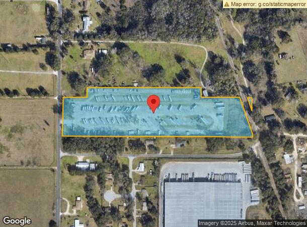
4545 Nw 27Th Ave, Ocala, FL 34475
NEARBY LISTINGS FOR SALE OR LEASE
Property Detail
4545 Nw 27Th Ave
13829-000-00
SEC 36 TWP 14 RGE 21 COM AT NW COR OF SEC 36 TH S 00-03-41 W 1052.38 FT TH S 89-49-07 E 25 FT TO THE POB TH CONT S 89-49-07 E 154.55 FT TH N 00-03-41 E 65.73 FT TH S 89-49-07 E 776 FT TH S 00-03-41 W 65.73 FT TH S 89-49-07 E 275.20 FT TH S 19-14-14 E
Publicstorage
Marion
A
Florida
12083C0506E
8.77 AC
2023
Outlying Marion County
2023
Ocala
001500
Ocala, FL
DEMOGRAPHICS near 4545 Nw 27Th Ave
1 Mile
3 Mile
5 Mile
2024 Total Population
1,324
19,043
63,249
2029 Population
1,512
21,581
71,337
Pop Growth 2024-2029
+ 14.20%
+ 13.33%
+ 12.79%
Average Age
39
43
41
2024 Total Households
565
7,918
25,037
HH Growth 2024-2029
+ 14.16%
+ 13.31%
+ 12.97%
Median Household Inc
$28,343
$47,837
$44,125
Avg Household Size
2.30
2.30
2.30
2024 Avg HH Vehicles
1.00
2.00
2.00
Median Home Value
$65,686
$202,482
$172,580
Median Year Built
1983
1990
1983
Nearby Places
- Restaurants
- Banks
- Shops
- Fitness
- Groceries
PUBLIC TRANSPORTATION
AIRPORT
Gainesville Regional
DRIVE
WALK
Distance
Gainesville Regional
55 min
41.4 mi
SALE & LEASE HISTORY
LISTING DATE
SALE/LEASE

Feb 05, 2024
For Sale
Nearby Properties
Address
Land Use
TOTAL SIZE
Lot Size
Zoning
Address
Land Use
TOTAL SIZE
Lot Size
Zoning
704,765 SF
71.04 AC
GU
Address
Land Use
TOTAL SIZE
Lot Size
Zoning
612,196 SF
50.06 AC
M1
Address
Land Use
TOTAL SIZE
Lot Size
Zoning
617,520 SF
46.08 AC
M2
Address
Land Use
TOTAL SIZE
Lot Size
Zoning
441,040 SF
150.01 AC
M1
Address
Land Use
TOTAL SIZE
Lot Size
Zoning
444,381 SF
60 AC
M1
Address
Land Use
TOTAL SIZE
Lot Size
Zoning
350,895 SF
27.85 AC
M1
Address
Land Use
TOTAL SIZE
Lot Size
Zoning
140,920 SF
28.09 AC
M2
Address
Land Use
TOTAL SIZE
Lot Size
Zoning
9,854 SF
55.14 AC
B2
Address
Land Use
TOTAL SIZE
Lot Size
Zoning
79,199 SF
13.54 AC
B2
Address
Land Use
TOTAL SIZE
Lot Size
Zoning
112,663 SF
32.72 AC
INST
Address
Land Use
TOTAL SIZE
Lot Size
Zoning
160,796 SF
25.59 AC
M2
Address
Land Use
TOTAL SIZE
Lot Size
Zoning
384,930 SF
17.76 AC
M1
Address
Land Use
TOTAL SIZE
Lot Size
Zoning
94,360 SF
17.51 AC
B5
Address
Land Use
TOTAL SIZE
Lot Size
Zoning
116,876 SF
23.78 AC
M2
Address
Land Use
TOTAL SIZE
Lot Size
Zoning
73,361 SF
23.20 AC
GU
Address
Land Use
TOTAL SIZE
Lot Size
Zoning
64,438 SF
12.27 AC
B4
Address
Land Use
TOTAL SIZE
Lot Size
Zoning
11,351 SF
3.51 AC
B2
Address
Land Use
TOTAL SIZE
Lot Size
Zoning
47,984 SF
448.37 AC
PUD
Address
Land Use
TOTAL SIZE
Lot Size
Zoning
1,085,670 SF
89.70 AC
M1
Address
Land Use
TOTAL SIZE
Lot Size
Zoning
66,531 SF
26.96 AC
B2
Address
Land Use
TOTAL SIZE
Lot Size
Zoning
35,518 SF
9.98 AC
B2
Address
Land Use
TOTAL SIZE
Lot Size
Zoning
63,200 SF
6.30 AC
B4
Address
Land Use
TOTAL SIZE
Lot Size
Zoning
Address
Land Use
TOTAL SIZE
Lot Size
Zoning
30,082 SF
7.92 AC
PUD
Address
Land Use
TOTAL SIZE
Lot Size
Zoning
176,710 SF
11.88 AC
M1
Address
Land Use
TOTAL SIZE
Lot Size
Zoning
44,100 SF
9.60 AC
R3
Address
Land Use
TOTAL SIZE
Lot Size
Zoning
72,855 SF
47.31 AC
B2
Address
Land Use
TOTAL SIZE
Lot Size
Zoning
89,640 SF
33.21 AC
B5
Address
Land Use
TOTAL SIZE
Lot Size
Zoning
79,249 SF
14.46 AC
R3
Address
Land Use
TOTAL SIZE
Lot Size
Zoning
458,983 SF
35.14 AC
M1
The World's #1 Commercial Real Estate Marketplace
Connect with us
© 2025 CoStar Group
The information above has been obtained from sources believed reliable. While we do not doubt its accuracy we have not verified it and make no guarantee, warranty or representation about it. It is your responsibility to independently confirm its accuracy and completeness. Any projections, opinions, assumptions, or estimates used are for example only and do not represent the current or future performance of the property. The value of this transaction to you depends on tax and other factors which should be evaluated by your tax, financial, and legal advisors. You and your advisors should conduct a careful, independent investigation of the property to determine to your satisfaction the suitability of the property for your needs.