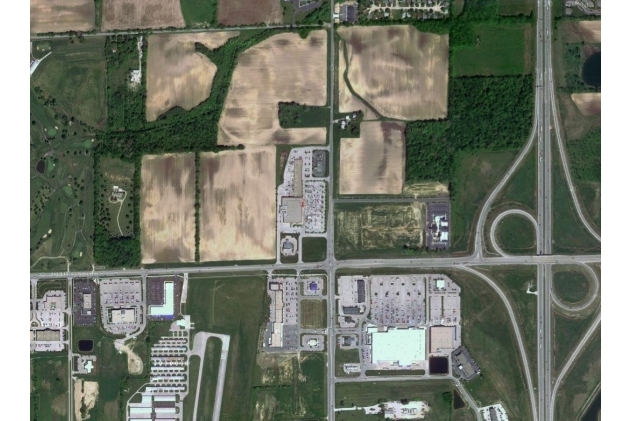
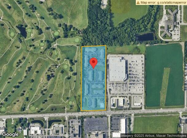
Property Record
4545 Scarlet Oak Way, Indianapolis, IN 46237
NEARBY LISTINGS FOR SALE OR LEASE
Property Detail
4545 Scarlet Oak Way
49-15-21-111-001.000-500
PT SW1/4 SE1/4 S21 T14 R4 BEG 78.58N OF SW COR N 1261.92 E 480.04 S 1291.84 W 351 NW 42.02 W 94.82 TO BEG 14.151 ACRES (13.926AC TAX)
Apartment
Marion
A
Indiana
18081C0039E
14.15 AC
2023
Edgewood/South County
2023
Indianapolis
381205
Indianapolis-Carmel-Anderson, IN
5,576 SF
DEMOGRAPHICS near 4545 Scarlet Oak Way
1 Mile
3 Mile
5 Mile
2024 Total Population
7,427
79,181
188,350
2029 Population
7,505
80,479
191,157
Pop Growth 2024-2029
+ 1.05%
+ 1.64%
+ 1.49%
Average Age
37
38
38
2024 Total Households
2,817
32,219
72,758
HH Growth 2024-2029
+ 1.38%
+ 1.88%
+ 1.55%
Median Household Inc
$72,880
$67,882
$71,435
Avg Household Size
2.50
2.40
2.50
2024 Avg HH Vehicles
2.00
2.00
2.00
Median Home Value
$165,415
$201,391
$209,409
Median Year Built
1989
1986
1987
Nearby Places
- Restaurants
- Banks
- Shops
- Fitness
- Groceries
PUBLIC TRANSPORTATION
AIRPORT
Indianapolis International
DRIVE
WALK
Distance
Indianapolis International
37 min
21.0 mi
Freight Ports
Port of Toledo
DRIVE
WALK
Distance
Port of Toledo
281 min
233.9 mi
Nearby Properties
Address
Land Use
TOTAL SIZE
Lot Size
Zoning
Address
Land Use
TOTAL SIZE
Lot Size
Zoning
31,217 SF
105.06 AC
ZO01
Address
Land Use
TOTAL SIZE
Lot Size
Zoning
295,161 SF
70.54 AC
Address
Land Use
TOTAL SIZE
Lot Size
Zoning
10,540 SF
49.19 AC
ZO01
Address
Land Use
TOTAL SIZE
Lot Size
Zoning
3,586 SF
30.28 AC
ZO01
Address
Land Use
TOTAL SIZE
Lot Size
Zoning
5,846 SF
43.64 AC
ZO01
Address
Land Use
TOTAL SIZE
Lot Size
Zoning
670,880 SF
43.43 AC
Address
Land Use
TOTAL SIZE
Lot Size
Zoning
6,786 SF
45.81 AC
Address
Land Use
TOTAL SIZE
Lot Size
Zoning
56,520 SF
35.65 AC
Address
Land Use
TOTAL SIZE
Lot Size
Zoning
799,575 SF
37.56 AC
Address
Land Use
TOTAL SIZE
Lot Size
Zoning
420,084 SF
23.83 AC
Address
Land Use
TOTAL SIZE
Lot Size
Zoning
3,286 SF
26.39 AC
Address
Land Use
TOTAL SIZE
Lot Size
Zoning
667,500 SF
33.46 AC
Address
Land Use
TOTAL SIZE
Lot Size
Zoning
493,560 SF
31.39 AC
Address
Land Use
TOTAL SIZE
Lot Size
Zoning
4,970 SF
24.77 AC
Address
Land Use
TOTAL SIZE
Lot Size
Zoning
110,598 SF
22.82 AC
ZO01
Address
Land Use
TOTAL SIZE
Lot Size
Zoning
511,680 SF
37.57 AC
Address
Land Use
TOTAL SIZE
Lot Size
Zoning
81,996 SF
8.56 AC
Address
Land Use
TOTAL SIZE
Lot Size
Zoning
23,040 SF
9.28 AC
ZO01
Address
Land Use
TOTAL SIZE
Lot Size
Zoning
21.94 AC
ZO01
Address
Land Use
TOTAL SIZE
Lot Size
Zoning
470,000 SF
22.75 AC
Address
Land Use
TOTAL SIZE
Lot Size
Zoning
21,784 SF
30.75 AC
ZO01
Address
Land Use
TOTAL SIZE
Lot Size
Zoning
181,458 SF
6 AC
Address
Land Use
TOTAL SIZE
Lot Size
Zoning
273,000 SF
22.28 AC
Address
Land Use
TOTAL SIZE
Lot Size
Zoning
612,000 SF
31.01 AC
Address
Land Use
TOTAL SIZE
Lot Size
Zoning
23.40 AC
Address
Land Use
TOTAL SIZE
Lot Size
Zoning
4,027 SF
24.71 AC
Address
Land Use
TOTAL SIZE
Lot Size
Zoning
4,722 SF
25.70 AC
Address
Land Use
TOTAL SIZE
Lot Size
Zoning
1,102 SF
9.98 AC
Address
Land Use
TOTAL SIZE
Lot Size
Zoning
226,129 SF
18.69 AC
ZO01
The World's #1 Commercial Real Estate Marketplace
Connect with us
© 2025 CoStar Group
The information above has been obtained from sources believed reliable. While we do not doubt its accuracy we have not verified it and make no guarantee, warranty or representation about it. It is your responsibility to independently confirm its accuracy and completeness. Any projections, opinions, assumptions, or estimates used are for example only and do not represent the current or future performance of the property. The value of this transaction to you depends on tax and other factors which should be evaluated by your tax, financial, and legal advisors. You and your advisors should conduct a careful, independent investigation of the property to determine to your satisfaction the suitability of the property for your needs.