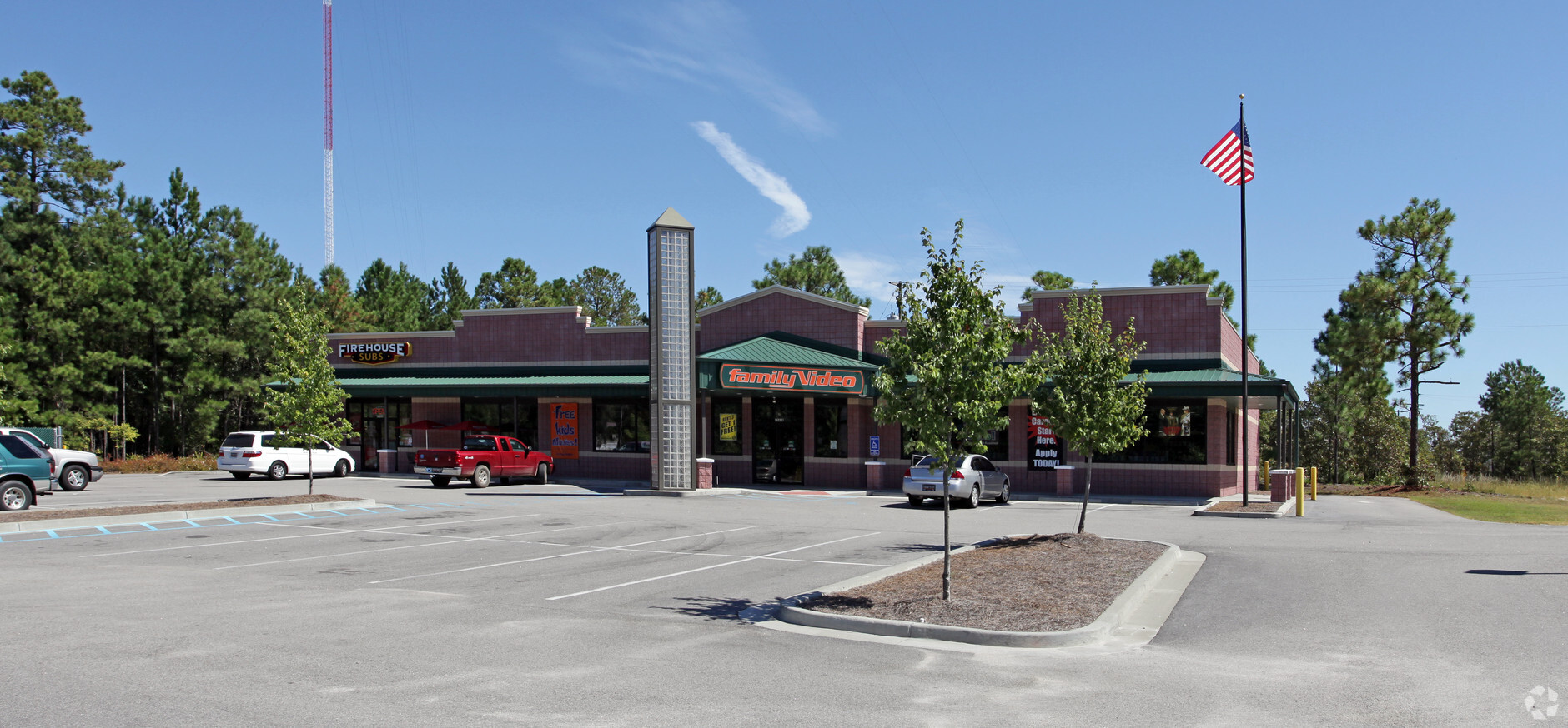
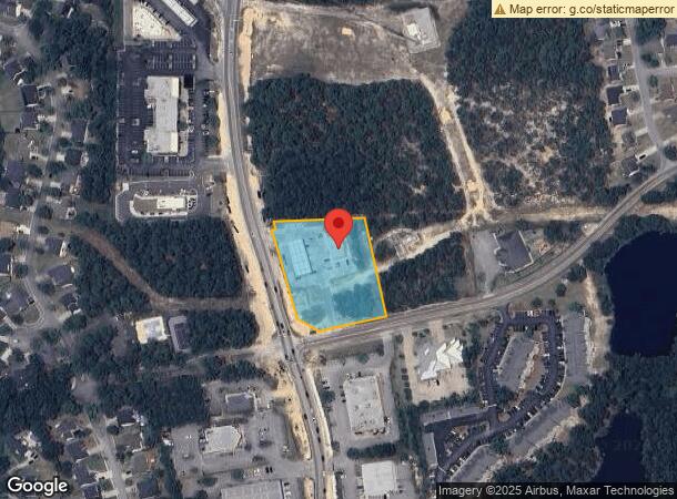
Property Record
4546 Hard Scrabble Rd, Columbia, SC 29229

NEARBY LISTINGS FOR SALE OR LEASE
Property Detail
4546 Hard Scrabble Rd
20309-09-01
LOT 6 241.6X34.8X321.8X295.9X293.5 #SU ELDERS COMMON #PR RB944-3541
Commercialnec
Richland
X
South Carolina
45079C0143L
6,241
2024
1.89 AC
2023
Northeast Columbia
011417
Columbia
7,734 SF
Columbia, SC
DEMOGRAPHICS near 4546 Hard Scrabble Rd
1 Mile
3 Mile
5 Mile
2024 Total Population
10,575
64,548
113,227
2029 Population
10,741
65,392
115,111
Pop Growth 2024-2029
+ 1.57%
+ 1.31%
+ 1.66%
Average Age
37
37
38
2024 Total Households
4,111
23,994
43,509
HH Growth 2024-2029
+ 1.36%
+ 1.36%
+ 1.72%
Median Household Inc
$67,919
$73,055
$70,520
Avg Household Size
2.50
2.60
2.60
2024 Avg HH Vehicles
2.00
2.00
2.00
Median Home Value
$175,391
$204,675
$216,302
Median Year Built
2002
2002
2002
Nearby Places
- Restaurants
- Banks
- Shops
- Fitness
- Groceries
PUBLIC TRANSPORTATION
AIRPORT
Columbia Metro
DRIVE
WALK
Distance
Columbia Metro
44 min
26.2 mi
Freight Ports
North Charleston Terminal
DRIVE
WALK
Distance
North Charleston Terminal
143 min
123.3 mi
SALE & LEASE HISTORY
LISTING DATE
SALE/LEASE

Apr 10, 2018
For Lease
Nearby Properties
Address
Land Use
TOTAL SIZE
Lot Size
Zoning
Address
Land Use
TOTAL SIZE
Lot Size
Zoning
83,808 SF
95.58 AC
PDD
Address
Land Use
TOTAL SIZE
Lot Size
Zoning
244,269 SF
9.54 AC
GC
Address
Land Use
TOTAL SIZE
Lot Size
Zoning
563.44 AC
OI
Address
Land Use
TOTAL SIZE
Lot Size
Zoning
309,478 SF
8.87 AC
PDD
Address
Land Use
TOTAL SIZE
Lot Size
Zoning
301,627 SF
25.08 AC
PDD
Address
Land Use
TOTAL SIZE
Lot Size
Zoning
333,002 SF
8.39 AC
GC
Address
Land Use
TOTAL SIZE
Lot Size
Zoning
140,567 SF
16.98 AC
M-1
Address
Land Use
TOTAL SIZE
Lot Size
Zoning
325,344 SF
71.41 AC
HI
Address
Land Use
TOTAL SIZE
Lot Size
Zoning
306,612 SF
20.94 AC
GC
Address
Land Use
TOTAL SIZE
Lot Size
Zoning
147,916 SF
4.69 AC
OI
Address
Land Use
TOTAL SIZE
Lot Size
Zoning
91,672 SF
12.18 AC
GC
Address
Land Use
TOTAL SIZE
Lot Size
Zoning
31,625 SF
3.30 AC
GC
Address
Land Use
TOTAL SIZE
Lot Size
Zoning
66,821 SF
6.32 AC
OI
Address
Land Use
TOTAL SIZE
Lot Size
Zoning
73,192 SF
6.12 AC
GC
Address
Land Use
TOTAL SIZE
Lot Size
Zoning
138,480 SF
23.02 AC
GC
Address
Land Use
TOTAL SIZE
Lot Size
Zoning
87,363 SF
10.61 AC
M-1
Address
Land Use
TOTAL SIZE
Lot Size
Zoning
81,951 SF
11.81 AC
M-1
Address
Land Use
TOTAL SIZE
Lot Size
Zoning
275,753 SF
26.21 AC
HI
Address
Land Use
TOTAL SIZE
Lot Size
Zoning
148,809 SF
17.52 AC
M-1
Address
Land Use
TOTAL SIZE
Lot Size
Zoning
78,282 SF
8.52 AC
M-1
Address
Land Use
TOTAL SIZE
Lot Size
Zoning
161,727 SF
13.25 AC
GC
Address
Land Use
TOTAL SIZE
Lot Size
Zoning
143,072 SF
12.61 AC
PDD
Address
Land Use
TOTAL SIZE
Lot Size
Zoning
93,560 SF
9.39 AC
M-1
Address
Land Use
TOTAL SIZE
Lot Size
Zoning
118,547 SF
10.64 AC
GC
Address
Land Use
TOTAL SIZE
Lot Size
Zoning
126,352 SF
10.43 AC
M-1
Address
Land Use
TOTAL SIZE
Lot Size
Zoning
73,901 SF
8.83 AC
PUD
Address
Land Use
TOTAL SIZE
Lot Size
Zoning
75,893 SF
10 AC
PDD
Address
Land Use
TOTAL SIZE
Lot Size
Zoning
68,091 SF
4.35 AC
OI
Address
Land Use
TOTAL SIZE
Lot Size
Zoning
45,284 SF
4.70 AC
GC
Address
Land Use
TOTAL SIZE
Lot Size
Zoning
125,894 SF
7.77 AC
PDD
The World's #1 Commercial Real Estate Marketplace
Connect with us
© 2025 CoStar Group
The information above has been obtained from sources believed reliable. While we do not doubt its accuracy we have not verified it and make no guarantee, warranty or representation about it. It is your responsibility to independently confirm its accuracy and completeness. Any projections, opinions, assumptions, or estimates used are for example only and do not represent the current or future performance of the property. The value of this transaction to you depends on tax and other factors which should be evaluated by your tax, financial, and legal advisors. You and your advisors should conduct a careful, independent investigation of the property to determine to your satisfaction the suitability of the property for your needs.