Property Record
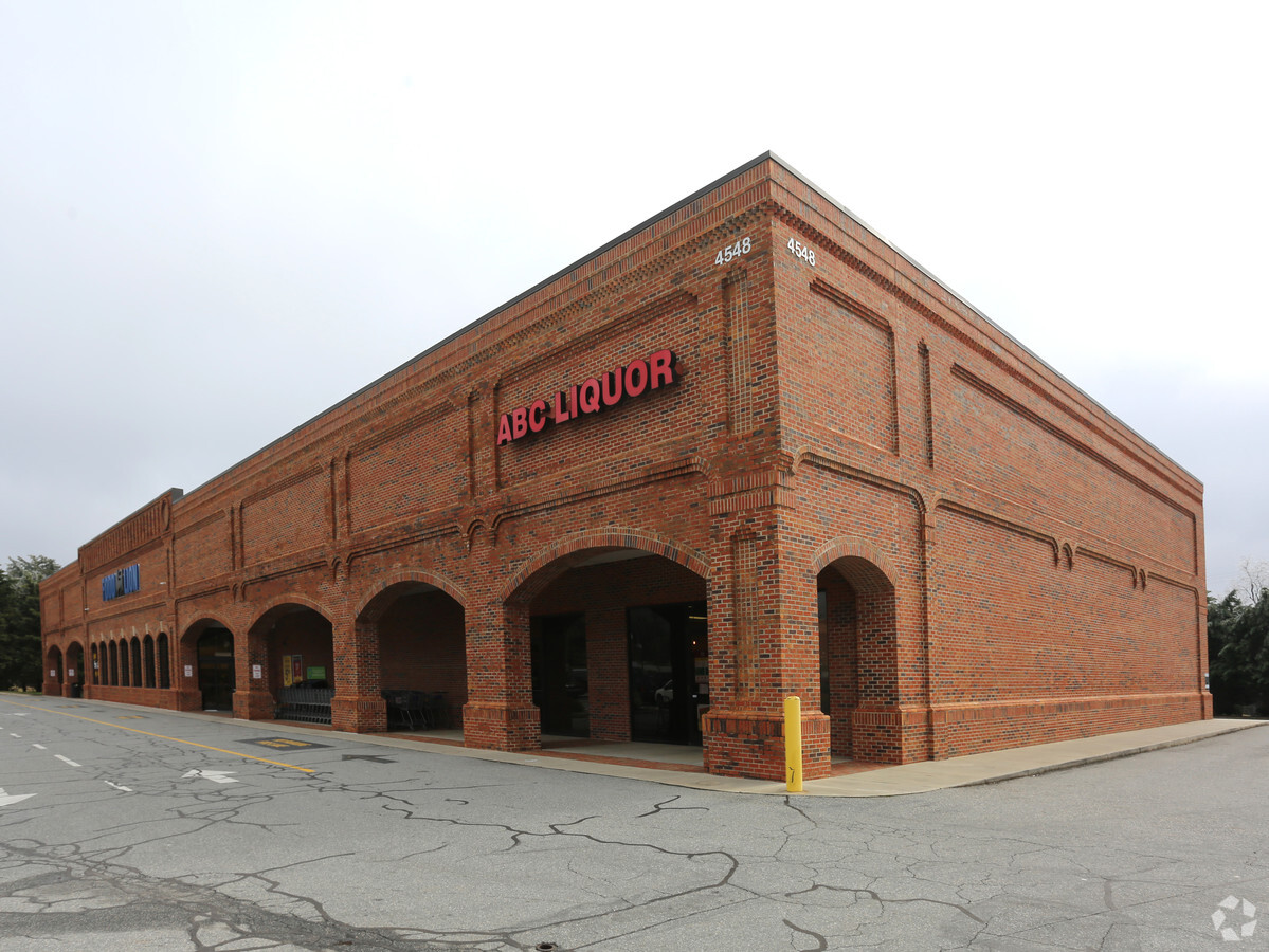
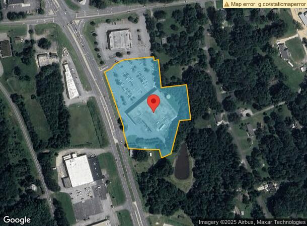
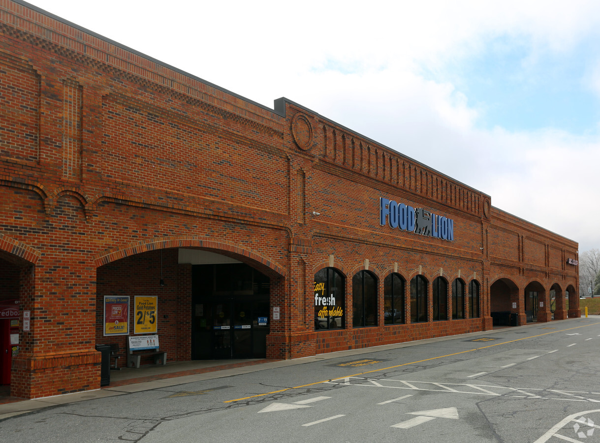
4548 Us Highway 220 N, Summerfield, NC 27358
NEARBY LISTINGS FOR SALE OR LEASE
Property Detail
4548 Us Highway 220 N
Greensboro-High Point, NC
Unified Development Summerfiel
0146006
SUMMERFIELD SHOP CNT/HWY 220
Commercialnec
Guilford
X
North Carolina
3710783900J
2
2023
4.94 AC
2023
NW Guilford County
015800
Greensboro/Winston-Salem
42,298 SF
DEMOGRAPHICS near 4548 Us Highway 220 N
1 Mile
3 Mile
5 Mile
2024 Total Population
1,631
10,159
49,914
2029 Population
1,620
10,095
49,566
Pop Growth 2024-2029
(0.67%)
(0.63%)
(0.70%)
Average Age
42
41
41
2024 Total Households
594
3,653
20,096
HH Growth 2024-2029
(0.67%)
(0.63%)
(0.75%)
Median Household Inc
$104,000
$125,861
$95,088
Avg Household Size
2.70
2.80
2.50
2024 Avg HH Vehicles
2.00
2.00
2.00
Median Home Value
$411,017
$422,429
$305,887
Median Year Built
1992
1997
1993
Nearby Places
- Restaurants
- Banks
- Shops
- Fitness
- Groceries
PUBLIC TRANSPORTATION
AIRPORT
Piedmont Triad International
DRIVE
WALK
Distance
Piedmont Triad International
21 min
11.4 mi
Freight Ports
Virginia Port Authority - Richmond
DRIVE
WALK
Distance
Virginia Port Authority - Richmond
243 min
209.7 mi
Nearby Properties
Address
Land Use
TOTAL SIZE
Lot Size
Zoning
Address
Land Use
TOTAL SIZE
Lot Size
Zoning
134,391 SF
19 AC
O
Address
Land Use
TOTAL SIZE
Lot Size
Zoning
66,187 SF
8.80 AC
CU-PDM
Address
Land Use
TOTAL SIZE
Lot Size
Zoning
54,260 SF
18.91 AC
RS-30
Address
Land Use
TOTAL SIZE
Lot Size
Zoning
24,910 SF
96.01 AC
PI
Address
Land Use
TOTAL SIZE
Lot Size
Zoning
52,167 SF
27.97 AC
RS-30
Address
Land Use
TOTAL SIZE
Lot Size
Zoning
38,926 SF
25.65 AC
CU-GB
Address
Land Use
TOTAL SIZE
Lot Size
Zoning
4,511 SF
463.69 AC
AG
Address
Land Use
TOTAL SIZE
Lot Size
Zoning
2,191 SF
43.13 AC
CU-GB
Address
Land Use
TOTAL SIZE
Lot Size
Zoning
56,095 SF
26.64 AC
PI
Address
Land Use
TOTAL SIZE
Lot Size
Zoning
3,644 SF
348.36 AC
AG
Address
Land Use
TOTAL SIZE
Lot Size
Zoning
14,676 SF
2.31 AC
HB
Address
Land Use
TOTAL SIZE
Lot Size
Zoning
17,640 SF
16.59 AC
AG-SP
Address
Land Use
TOTAL SIZE
Lot Size
Zoning
280.47 AC
R-3
Address
Land Use
TOTAL SIZE
Lot Size
Zoning
20,939 SF
4.61 AC
CU-PI
Address
Land Use
TOTAL SIZE
Lot Size
Zoning
5,913 SF
5.61 AC
RS-30
Address
Land Use
TOTAL SIZE
Lot Size
Zoning
13,547 SF
11.95 AC
CU-HB
Address
Land Use
TOTAL SIZE
Lot Size
Zoning
2,097 SF
145.27 AC
AG
Address
Land Use
TOTAL SIZE
Lot Size
Zoning
14,442 SF
7.96 AC
R-3
Address
Land Use
TOTAL SIZE
Lot Size
Zoning
10,502 SF
1.44 AC
CU-LB
Address
Land Use
TOTAL SIZE
Lot Size
Zoning
34,903 SF
11.17 AC
PI
Address
Land Use
TOTAL SIZE
Lot Size
Zoning
45,131 SF
8.37 AC
AG
Address
Land Use
TOTAL SIZE
Lot Size
Zoning
116.65 AC
AG
Address
Land Use
TOTAL SIZE
Lot Size
Zoning
2,512 SF
177.63 AC
CU-OSR
Address
Land Use
TOTAL SIZE
Lot Size
Zoning
90,000 SF
5.46 AC
CD-C-M
Address
Land Use
TOTAL SIZE
Lot Size
Zoning
9,831 SF
5 AC
LO
Address
Land Use
TOTAL SIZE
Lot Size
Zoning
850 SF
140.07 AC
CU-RS-40
Address
Land Use
TOTAL SIZE
Lot Size
Zoning
21.17 AC
CU-GB
Address
Land Use
TOTAL SIZE
Lot Size
Zoning
3,881 SF
94.81 AC
AG
Address
Land Use
TOTAL SIZE
Lot Size
Zoning
5,317 SF
40.33 AC
RS-40
The World's #1 Commercial Real Estate Marketplace
Connect with us
© 2025 CoStar Group
The information above has been obtained from sources believed reliable. While we do not doubt its accuracy we have not verified it and make no guarantee, warranty or representation about it. It is your responsibility to independently confirm its accuracy and completeness. Any projections, opinions, assumptions, or estimates used are for example only and do not represent the current or future performance of the property. The value of this transaction to you depends on tax and other factors which should be evaluated by your tax, financial, and legal advisors. You and your advisors should conduct a careful, independent investigation of the property to determine to your satisfaction the suitability of the property for your needs.