Property Record
4551 State Highway 30, Amsterdam, NY 12010
NEARBY LISTINGS FOR SALE OR LEASE
-
-
View all Amsterdam listings for sale on LoopNet.com
Property Detail
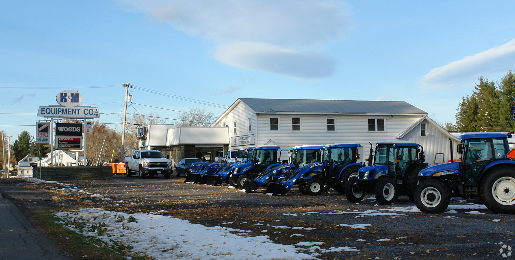
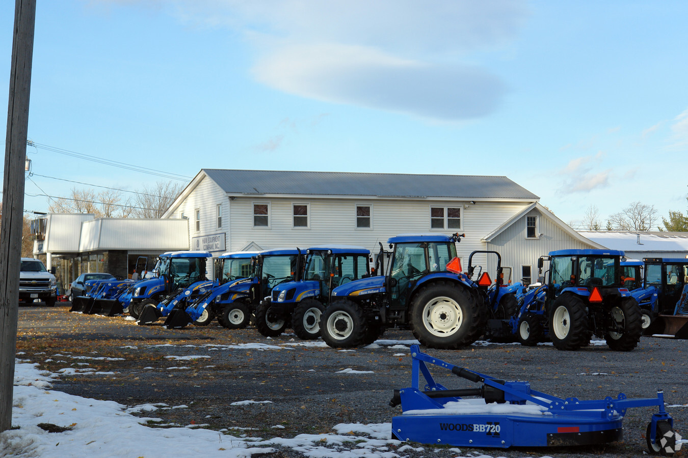
4551 State Highway 30
Gloversville, NY
OLD PARCEL =02-01- 216.00
173600-178-004-0001-019-000-0000
Fulton
Vehiclerentalsvehiclesales
New York
2023
19.000
2023
1.60 AC
971400
Fulton County
9,970 SF
Albany/Schenectady/Troy
DEMOGRAPHICS near 4551 State Highway 30
1 Mile
3 Mile
5 Mile
2024 Total Population
425
9,968
30,020
2029 Population
418
9,938
29,877
Pop Growth 2024-2029
(1.65%)
(0.30%)
(0.48%)
Average Age
44
44
41
2024 Total Households
172
4,176
12,455
HH Growth 2024-2029
(1.16%)
(0.24%)
(0.45%)
Median Household Inc
$71,249
$57,764
$51,404
Avg Household Size
2.40
2.30
2.30
2024 Avg HH Vehicles
2.00
2.00
2.00
Median Home Value
$241,666
$159,046
$144,649
Median Year Built
1984
1964
1949
Nearby Places
- Restaurants
- Banks
- Shops
- Fitness
- Groceries
PUBLIC TRANSPORTATION
COMMUTER RAIL
Amsterdam (Toronto - New York - VIA Rail)
DRIVE
WALK
Distance
Amsterdam (Toronto - New York - VIA Rail)
9 min
4.4 mi
Amsterdam Amtrak Station (Empire Service - Amtrak, Maple Leaf - Amtrak)
DRIVE
WALK
Distance
Amsterdam Amtrak Station (Empire Service - Amtrak, Maple Leaf - Amtrak)
10 min
4.4 mi
AIRPORT
Albany International
DRIVE
WALK
Distance
Albany International
53 min
33.1 mi
Freight Ports
Albany, NY Port
DRIVE
WALK
Distance
Albany, NY Port
54 min
39.8 mi
Nearby Properties
Address
Land Use
TOTAL SIZE
Lot Size
Zoning
Address
Land Use
TOTAL SIZE
Lot Size
Zoning
226,614 SF
4.80 AC
05 - COMME
Address
Land Use
TOTAL SIZE
Lot Size
Zoning
113,040 SF
5.70 AC
01 - NOT Z
Address
Land Use
TOTAL SIZE
Lot Size
Zoning
27,576 SF
42.80 AC
07 - MIXED
Address
Land Use
TOTAL SIZE
Lot Size
Zoning
26.20 AC
Address
Land Use
TOTAL SIZE
Lot Size
Zoning
226,614 SF
1 AC
07 - MIXED
Address
Land Use
TOTAL SIZE
Lot Size
Zoning
2,688 SF
49.10 AC
05 - COMME
Address
Land Use
TOTAL SIZE
Lot Size
Zoning
99.30 AC
B1
Address
Land Use
TOTAL SIZE
Lot Size
Zoning
5,800 SF
28 AC
B1
Address
Land Use
TOTAL SIZE
Lot Size
Zoning
9.30 AC
B1
Address
Land Use
TOTAL SIZE
Lot Size
Zoning
21,485 SF
64.22 AC
05 - COMME
Address
Land Use
TOTAL SIZE
Lot Size
Zoning
15.80 AC
B1
Address
Land Use
TOTAL SIZE
Lot Size
Zoning
9,390 SF
21.89 AC
08 - GOVER
Address
Land Use
TOTAL SIZE
Lot Size
Zoning
134,563 SF
12.90 AC
Address
Land Use
TOTAL SIZE
Lot Size
Zoning
Address
Land Use
TOTAL SIZE
Lot Size
Zoning
2,982 SF
26.80 AC
05 - COMME
Address
Land Use
TOTAL SIZE
Lot Size
Zoning
135,223 SF
5.30 AC
05 - COMME
Address
Land Use
TOTAL SIZE
Lot Size
Zoning
126,842 SF
11.50 AC
B1
Address
Land Use
TOTAL SIZE
Lot Size
Zoning
16.50 AC
Address
Land Use
TOTAL SIZE
Lot Size
Zoning
Address
Land Use
TOTAL SIZE
Lot Size
Zoning
9 AC
01 - NOT Z
Address
Land Use
TOTAL SIZE
Lot Size
Zoning
980 SF
18.10 AC
05 - COMME
Address
Land Use
TOTAL SIZE
Lot Size
Zoning
13,449 SF
4.60 AC
05 - COMME
Address
Land Use
TOTAL SIZE
Lot Size
Zoning
18,158 SF
7.60 AC
05 - COMME
Address
Land Use
TOTAL SIZE
Lot Size
Zoning
11.60 AC
Address
Land Use
TOTAL SIZE
Lot Size
Zoning
2,088 SF
36 AC
01 - NOT Z
Address
Land Use
TOTAL SIZE
Lot Size
Zoning
2,250 SF
39.50 AC
01 - NOT Z
Address
Land Use
TOTAL SIZE
Lot Size
Zoning
9.50 AC
R2
Address
Land Use
TOTAL SIZE
Lot Size
Zoning
336 SF
12.10 AC
05 - COMME
Address
Land Use
TOTAL SIZE
Lot Size
Zoning
9.40 AC
Address
Land Use
TOTAL SIZE
Lot Size
Zoning
14 AC
R1
The World's #1 Commercial Real Estate Marketplace
Connect with us
© 2025 CoStar Group
The information above has been obtained from sources believed reliable. While we do not doubt its accuracy we have not verified it and make no guarantee, warranty or representation about it. It is your responsibility to independently confirm its accuracy and completeness. Any projections, opinions, assumptions, or estimates used are for example only and do not represent the current or future performance of the property. The value of this transaction to you depends on tax and other factors which should be evaluated by your tax, financial, and legal advisors. You and your advisors should conduct a careful, independent investigation of the property to determine to your satisfaction the suitability of the property for your needs.