Property Record
4555 Airport Way, Denver, CO 80239
Current Lease Availabilities
NEARBY LISTINGS FOR SALE OR LEASE
Property Detail
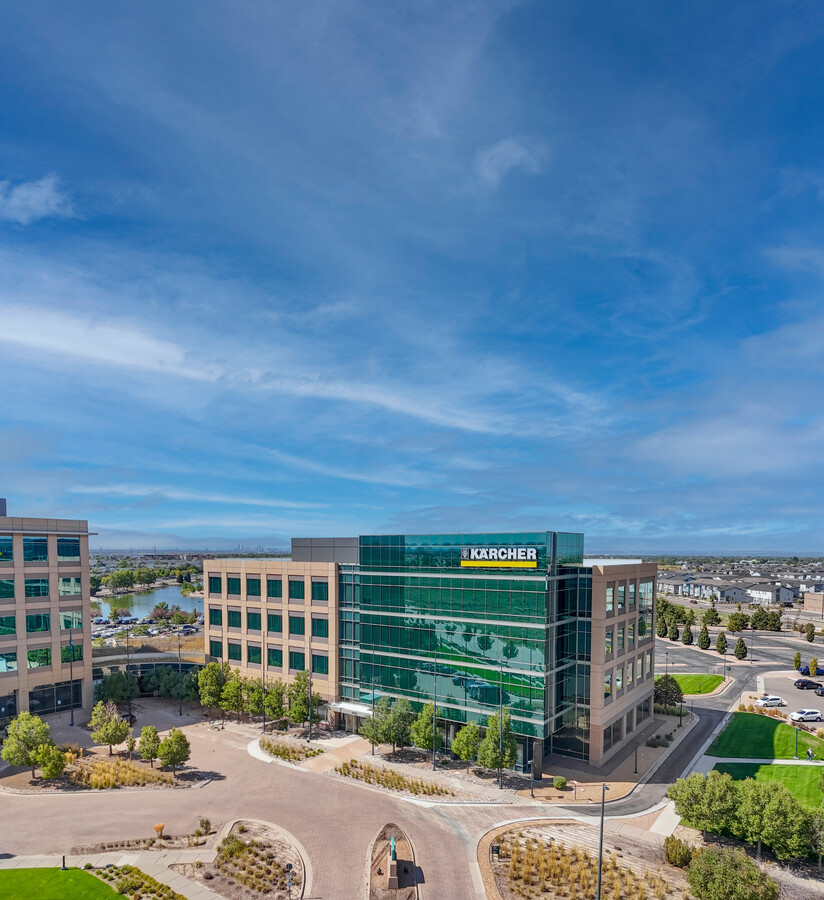
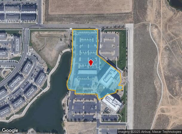
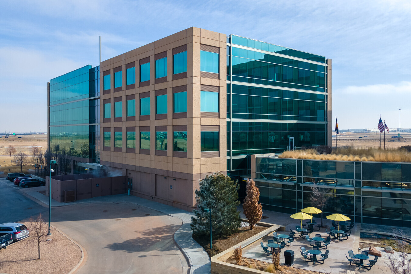
4555 Airport Way
Denver-Aurora-Lakewood, CO
Gateway Park Iv Flg #5
0201-01-013
GATEWAY PARK IV FLG #5 B1 PT L1 COM SE COR N/2 SE/4 S20/3/66 N41.3123W 1640.31FT N 138.08FT W 648.26FT N03.1137W 26.62FT N18.54E 56.41FT N 52.09FT N14.5947W 90.89FT N14.2225E 29.03
Officebuilding
Denver
X
Colorado
08005C0043K
1
2023
5.67 AC
2023
East I-70/Montbello
0083882006
Denver
92,105 SF
DEMOGRAPHICS near 4555 Airport Way
1 Mile
3 Mile
5 Mile
2024 Total Population
12,605
103,709
193,633
2029 Population
12,895
105,738
197,368
Pop Growth 2024-2029
+ 2.30%
+ 1.96%
+ 1.93%
Average Age
33
34
34
2024 Total Households
4,581
31,393
62,359
HH Growth 2024-2029
+ 2.16%
+ 2.25%
+ 2.10%
Median Household Inc
$80,976
$76,349
$71,380
Avg Household Size
2.60
3.10
2.90
2024 Avg HH Vehicles
2.00
2.00
2.00
Median Home Value
$335,388
$359,672
$378,827
Median Year Built
2008
1998
1993
Nearby Places
- Restaurants
- Banks
- Shops
- Fitness
- Groceries
PUBLIC TRANSPORTATION
COMMUTER RAIL
40Th Ave & Airport Blvd - Gateway Park Station Track 2 (Union Station to Denver Airport Station - Regional Transportation District)
DRIVE
WALK
Distance
40Th Ave & Airport Blvd - Gateway Park Station Track 2 (Union Station to Denver Airport Station - Regional Transportation District)
5 min
1.7 mi
61St & Pena Station Track 2 (Union Station to Denver Airport Station - Regional Transportation District)
DRIVE
WALK
Distance
61St & Pena Station Track 2 (Union Station to Denver Airport Station - Regional Transportation District)
8 min
3.9 mi
AIRPORT
Denver International
DRIVE
WALK
Distance
Denver International
15 min
11.4 mi
Freight Ports
Tulsa Port Of Catoosa
DRIVE
WALK
Distance
Tulsa Port Of Catoosa
715 min
698.5 mi
Nearby Properties
Address
Land Use
TOTAL SIZE
Lot Size
Zoning
Address
Land Use
TOTAL SIZE
Lot Size
Zoning
868,780 SF
105.02 AC
Address
Land Use
TOTAL SIZE
Lot Size
Zoning
461,580 SF
23.56 AC
Address
Land Use
TOTAL SIZE
Lot Size
Zoning
335,757 SF
36.88 AC
CMP-EI2
Address
Land Use
TOTAL SIZE
Lot Size
Zoning
876,549 SF
46.65 AC
Address
Land Use
TOTAL SIZE
Lot Size
Zoning
691,200 SF
38.09 AC
Address
Land Use
TOTAL SIZE
Lot Size
Zoning
704,978 SF
36.17 AC
Address
Land Use
TOTAL SIZE
Lot Size
Zoning
550,031 SF
37.73 AC
Address
Land Use
TOTAL SIZE
Lot Size
Zoning
200,105 SF
34.54 AC
C-MU-20
Address
Land Use
TOTAL SIZE
Lot Size
Zoning
185,812 SF
20.93 AC
C-MU-20
Address
Land Use
TOTAL SIZE
Lot Size
Zoning
545,010 SF
35.35 AC
Address
Land Use
TOTAL SIZE
Lot Size
Zoning
46,125 SF
87.83 AC
PUD
Address
Land Use
TOTAL SIZE
Lot Size
Zoning
548,510 SF
27.26 AC
Address
Land Use
TOTAL SIZE
Lot Size
Zoning
287,550 SF
18.66 AC
Address
Land Use
TOTAL SIZE
Lot Size
Zoning
522,120 SF
27.70 AC
Address
Land Use
TOTAL SIZE
Lot Size
Zoning
500,358 SF
23.59 AC
Address
Land Use
TOTAL SIZE
Lot Size
Zoning
244,920 SF
12.87 AC
Address
Land Use
TOTAL SIZE
Lot Size
Zoning
419,630 SF
24.34 AC
Address
Land Use
TOTAL SIZE
Lot Size
Zoning
217,995 SF
12.30 AC
S-SU-D
Address
Land Use
TOTAL SIZE
Lot Size
Zoning
290,147 SF
22.02 AC
Address
Land Use
TOTAL SIZE
Lot Size
Zoning
452,400 SF
20.99 AC
Address
Land Use
TOTAL SIZE
Lot Size
Zoning
355,740 SF
18.20 AC
Address
Land Use
TOTAL SIZE
Lot Size
Zoning
410,000 SF
31.97 AC
Address
Land Use
TOTAL SIZE
Lot Size
Zoning
347,840 SF
19.95 AC
Address
Land Use
TOTAL SIZE
Lot Size
Zoning
400,000 SF
22.91 AC
I-0
Address
Land Use
TOTAL SIZE
Lot Size
Zoning
458,020 SF
18.65 AC
I-B
Address
Land Use
TOTAL SIZE
Lot Size
Zoning
424,700 SF
31.64 AC
PUD
Address
Land Use
TOTAL SIZE
Lot Size
Zoning
426,510 SF
32.17 AC
GTWY
Address
Land Use
TOTAL SIZE
Lot Size
Zoning
385,187 SF
26.62 AC
Address
Land Use
TOTAL SIZE
Lot Size
Zoning
121,970 SF
12.12 AC
C-MU-20
Address
Land Use
TOTAL SIZE
Lot Size
Zoning
354,425 SF
18.44 AC
I-1
The World's #1 Commercial Real Estate Marketplace
Connect with us
© 2025 CoStar Group
The information above has been obtained from sources believed reliable. While we do not doubt its accuracy we have not verified it and make no guarantee, warranty or representation about it. It is your responsibility to independently confirm its accuracy and completeness. Any projections, opinions, assumptions, or estimates used are for example only and do not represent the current or future performance of the property. The value of this transaction to you depends on tax and other factors which should be evaluated by your tax, financial, and legal advisors. You and your advisors should conduct a careful, independent investigation of the property to determine to your satisfaction the suitability of the property for your needs.