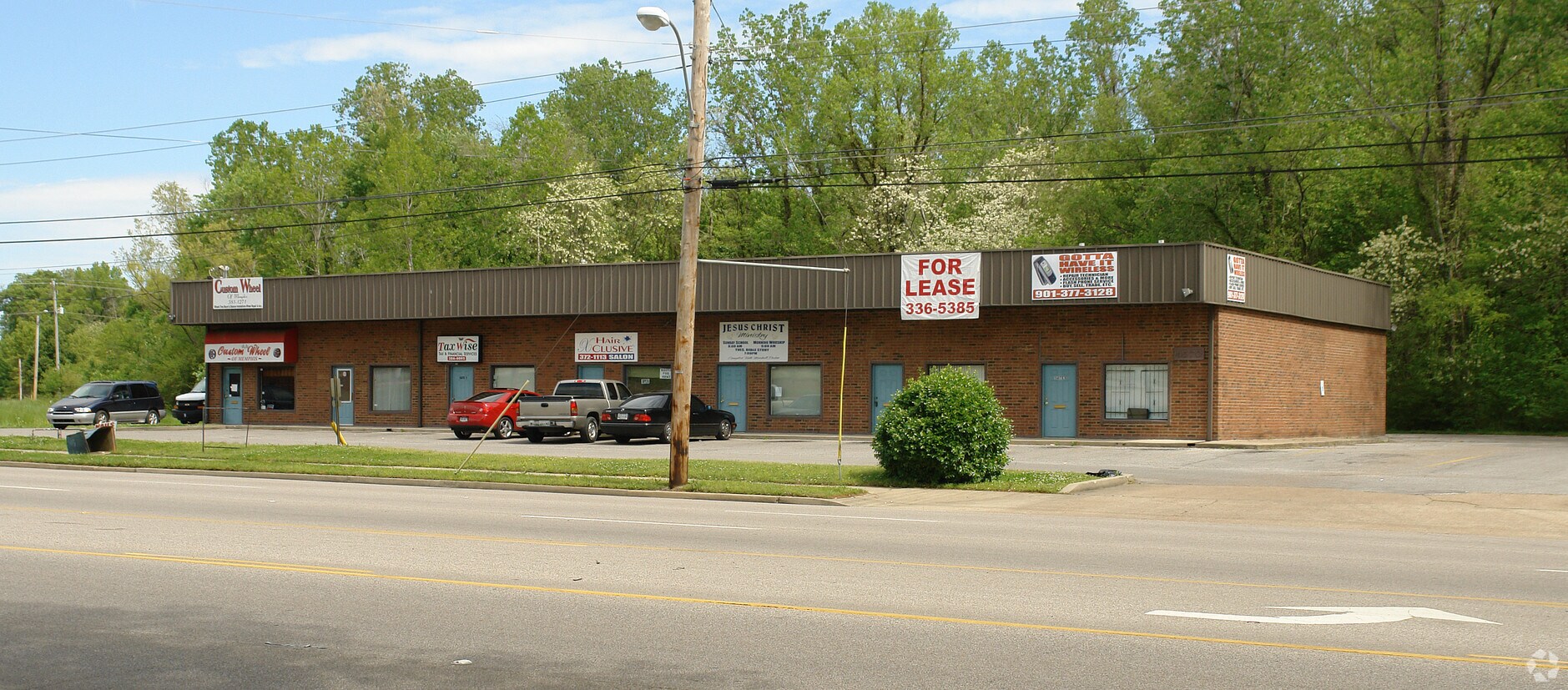
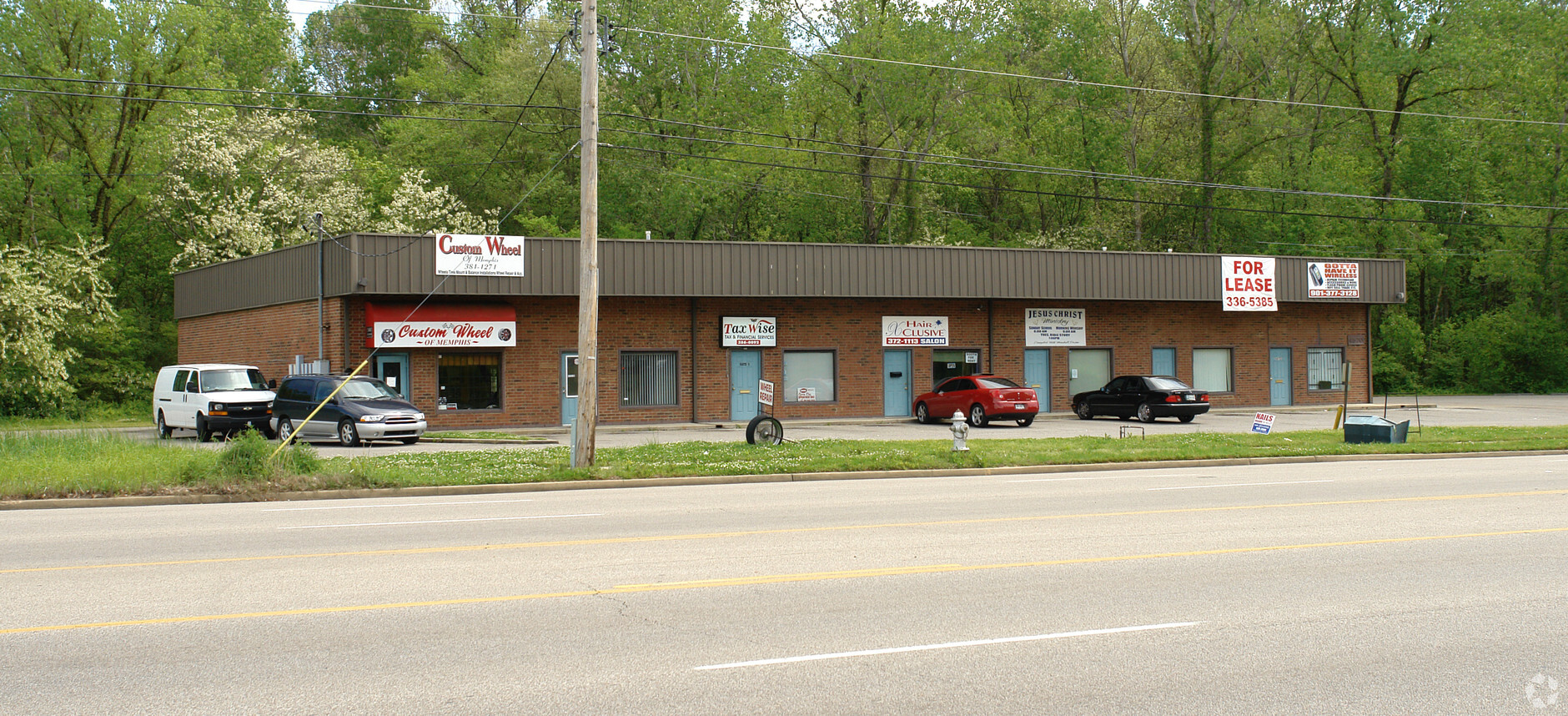
Property Record
4570 Raleigh Lagrange Rd, Memphis, TN 38128

Current Lease Availabilities
NEARBY LISTINGS FOR SALE OR LEASE
Property Detail
4570 Raleigh Lagrange Rd
Memphis, TN-MS-AR
Kennedy Park Shopping Center
08-8008-0-0217C
SEE MAP GRID 107F NS RALEIGH LAGRANGE RD
Loftbuilding
Shelby
AE
Tennessee
47157C0285F
1
2023
1.64 AC
2024
North
020542
Memphis
7,500 SF
DEMOGRAPHICS near 4570 Raleigh Lagrange Rd
1 Mile
3 Mile
5 Mile
2024 Total Population
7,392
71,696
182,929
2029 Population
7,267
70,436
180,046
Pop Growth 2024-2029
(1.69%)
(1.76%)
(1.58%)
Average Age
33
36
37
2024 Total Households
2,934
26,549
69,430
HH Growth 2024-2029
(1.77%)
(1.85%)
(1.68%)
Median Household Inc
$43,012
$45,887
$49,146
Avg Household Size
2.40
2.60
2.60
2024 Avg HH Vehicles
2.00
2.00
2.00
Median Home Value
$133,577
$131,400
$161,877
Median Year Built
1975
1971
1971
Nearby Places
- Restaurants
- Banks
- Shops
- Fitness
- Groceries
PUBLIC TRANSPORTATION
AIRPORT
Memphis International
DRIVE
WALK
Distance
Memphis International
23 min
14.5 mi
Freight Ports
Port of Shreveport
DRIVE
WALK
Distance
Port of Shreveport
411 min
379.2 mi
Nearby Properties
Address
Land Use
TOTAL SIZE
Lot Size
Zoning
Address
Land Use
TOTAL SIZE
Lot Size
Zoning
11,446 SF
29.76 AC
RU-3
Address
Land Use
TOTAL SIZE
Lot Size
Zoning
198,103 SF
17.75 AC
CG-MS
Address
Land Use
TOTAL SIZE
Lot Size
Zoning
38,200 SF
22.60 AC
RU-3
Address
Land Use
TOTAL SIZE
Lot Size
Zoning
31,305 SF
17.89 AC
RU-3
Address
Land Use
TOTAL SIZE
Lot Size
Zoning
62,400 SF
38.29 AC
RU-3
Address
Land Use
TOTAL SIZE
Lot Size
Zoning
78,603 SF
23.30 AC
R-6
Address
Land Use
TOTAL SIZE
Lot Size
Zoning
39,018 SF
22.21 AC
RU-2
Address
Land Use
TOTAL SIZE
Lot Size
Zoning
78,948 SF
33.77 AC
RU-3
Address
Land Use
TOTAL SIZE
Lot Size
Zoning
37,490 SF
4.42 AC
CMU-2
Address
Land Use
TOTAL SIZE
Lot Size
Zoning
399,662 SF
27.28 AC
EMP
Address
Land Use
TOTAL SIZE
Lot Size
Zoning
50,818 SF
13.30 AC
RU-3
Address
Land Use
TOTAL SIZE
Lot Size
Zoning
181,319 SF
14.82 AC
CMU-2
Address
Land Use
TOTAL SIZE
Lot Size
Zoning
45,939 SF
5.70 AC
R-10
Address
Land Use
TOTAL SIZE
Lot Size
Zoning
33,442 SF
22.50 AC
RU-3
Address
Land Use
TOTAL SIZE
Lot Size
Zoning
58,484 SF
19.95 AC
RU-3
Address
Land Use
TOTAL SIZE
Lot Size
Zoning
30,158 SF
18.83 AC
R-6
Address
Land Use
TOTAL SIZE
Lot Size
Zoning
69,158 SF
7.75 AC
RU-3
Address
Land Use
TOTAL SIZE
Lot Size
Zoning
50,447 SF
6.28 AC
R-10
Address
Land Use
TOTAL SIZE
Lot Size
Zoning
26,716 SF
11.37 AC
RU-2
Address
Land Use
TOTAL SIZE
Lot Size
Zoning
36,388 SF
13.09 AC
RU-3
Address
Land Use
TOTAL SIZE
Lot Size
Zoning
127,456 SF
15.05 AC
EMP
Address
Land Use
TOTAL SIZE
Lot Size
Zoning
180,630 SF
21.89 AC
CMU-2
Address
Land Use
TOTAL SIZE
Lot Size
Zoning
50,538 SF
5 AC
R-10
Address
Land Use
TOTAL SIZE
Lot Size
Zoning
26,544 SF
17.63 AC
RU-3
Address
Land Use
TOTAL SIZE
Lot Size
Zoning
93,514 SF
12.47 AC
R-8
Address
Land Use
TOTAL SIZE
Lot Size
Zoning
101,800 SF
15.97 AC
CMU-2
Address
Land Use
TOTAL SIZE
Lot Size
Zoning
54,845 SF
9.31 AC
RU-3
Address
Land Use
TOTAL SIZE
Lot Size
Zoning
66.90 AC
CMU-2
Address
Land Use
TOTAL SIZE
Lot Size
Zoning
28,512 SF
7 AC
CMU-3
Address
Land Use
TOTAL SIZE
Lot Size
Zoning
136,505 SF
6.76 AC
RU-3
The World's #1 Commercial Real Estate Marketplace
Connect with us
© 2025 CoStar Group
The information above has been obtained from sources believed reliable. While we do not doubt its accuracy we have not verified it and make no guarantee, warranty or representation about it. It is your responsibility to independently confirm its accuracy and completeness. Any projections, opinions, assumptions, or estimates used are for example only and do not represent the current or future performance of the property. The value of this transaction to you depends on tax and other factors which should be evaluated by your tax, financial, and legal advisors. You and your advisors should conduct a careful, independent investigation of the property to determine to your satisfaction the suitability of the property for your needs.