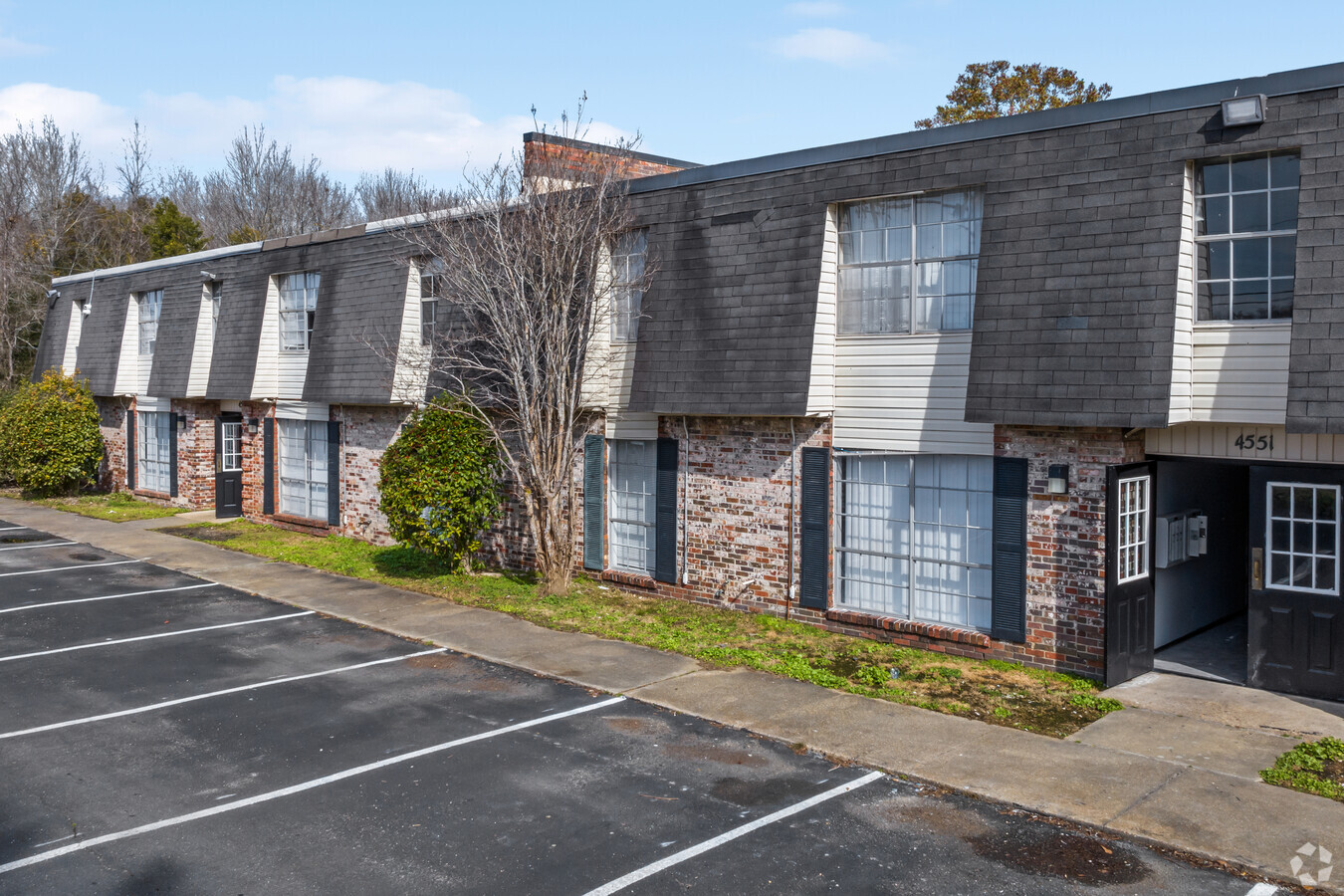
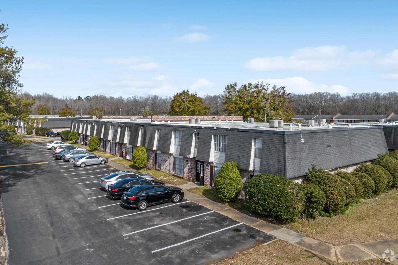
Property Record
4601 Narrow Lane Rd, Montgomery, AL 36116
NEARBY LISTINGS FOR SALE OR LEASE
Property Detail
4601 Narrow Lane Rd
Montgomery, AL
James D Tatum Plat
15-03-05-1-000-003.000
BEING THE SOUTH 330 FEET OF THE WEST 500 FEET OF LOT A 1503051000003000
Apartment
Montgomery
AE
Alabama
01101C0209H
a
2024
3.79 AC
2024
Outer South/Airport
003200
Montgomery
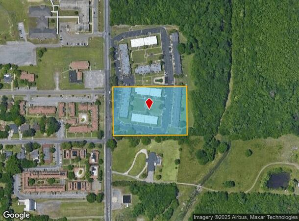
DEMOGRAPHICS near 4601 Narrow Lane Rd
1 Mile
3 Mile
5 Mile
2024 Total Population
5,242
45,323
110,606
2029 Population
5,089
44,361
108,919
Pop Growth 2024-2029
(2.92%)
(2.12%)
(1.53%)
Average Age
39
39
38
2024 Total Households
2,142
18,497
46,016
HH Growth 2024-2029
(2.94%)
(2.14%)
(1.46%)
Median Household Inc
$42,472
$42,090
$38,435
Avg Household Size
2.30
2.30
2.20
2024 Avg HH Vehicles
2.00
2.00
2.00
Median Home Value
$65,457
$116,843
$121,275
Median Year Built
1967
1970
1972
Nearby Places
- Restaurants
- Banks
- Shops
- Fitness
- Groceries
PUBLIC TRANSPORTATION
AIRPORT
Montgomery Regional (Dannelly Field)
DRIVE
WALK
Distance
Montgomery Regional (Dannelly Field)
13 min
8.8 mi
Freight Ports
Port of Panama City
DRIVE
WALK
Distance
Port of Panama City
234 min
185.3 mi
SALE & LEASE HISTORY
LISTING DATE
SALE/LEASE

Oct 07, 2021
For Sale
Nearby Properties
Address
Land Use
TOTAL SIZE
Lot Size
Zoning
Address
Land Use
TOTAL SIZE
Lot Size
Zoning
260,402 SF
17 AC
O-2
Address
Land Use
TOTAL SIZE
Lot Size
Zoning
1,343 SF
31.75 AC
R-65-M
Address
Land Use
TOTAL SIZE
Lot Size
Zoning
36,543 SF
0.62 AC
SD-M
Address
Land Use
TOTAL SIZE
Lot Size
Zoning
40,829 SF
50.49 AC
SD
Address
Land Use
TOTAL SIZE
Lot Size
Zoning
9,060 SF
524.11 AC
Address
Land Use
TOTAL SIZE
Lot Size
Zoning
164,528 SF
5.28 AC
B-3
Address
Land Use
TOTAL SIZE
Lot Size
Zoning
32,902 SF
14 AC
R-75-M
Address
Land Use
TOTAL SIZE
Lot Size
Zoning
8,519 SF
15.60 AC
B-2
Address
Land Use
TOTAL SIZE
Lot Size
Zoning
341,170 SF
O-2
Address
Land Use
TOTAL SIZE
Lot Size
Zoning
208,584 SF
21.10 AC
B-3
Address
Land Use
TOTAL SIZE
Lot Size
Zoning
3,312 SF
15.73 AC
R-65-M
Address
Land Use
TOTAL SIZE
Lot Size
Zoning
154,711 SF
31 AC
Address
Land Use
TOTAL SIZE
Lot Size
Zoning
14,733 SF
19 AC
O-2
Address
Land Use
TOTAL SIZE
Lot Size
Zoning
135,573 SF
35 AC
O-2
Address
Land Use
TOTAL SIZE
Lot Size
Zoning
249,231 SF
20 AC
INST
Address
Land Use
TOTAL SIZE
Lot Size
Zoning
61,137 SF
59 AC
INST
Address
Land Use
TOTAL SIZE
Lot Size
Zoning
113,108 SF
3.70 AC
B-3
Address
Land Use
TOTAL SIZE
Lot Size
Zoning
2,115 SF
11.90 AC
R-65-M
Address
Land Use
TOTAL SIZE
Lot Size
Zoning
918 SF
8.86 AC
R-65-M
Address
Land Use
TOTAL SIZE
Lot Size
Zoning
5,400 SF
12.61 AC
M-1
Address
Land Use
TOTAL SIZE
Lot Size
Zoning
8,028 SF
12.50 AC
R-65-M
Address
Land Use
TOTAL SIZE
Lot Size
Zoning
57,565 SF
1.50 AC
T4-R
Address
Land Use
TOTAL SIZE
Lot Size
Zoning
95,886 SF
3.19 AC
B-4
Address
Land Use
TOTAL SIZE
Lot Size
Zoning
8,652 SF
5.28 AC
R-75-D
Address
Land Use
TOTAL SIZE
Lot Size
Zoning
54,384 SF
0.65 AC
Address
Land Use
TOTAL SIZE
Lot Size
Zoning
154,202 SF
14.90 AC
B-4
Address
Land Use
TOTAL SIZE
Lot Size
Zoning
65,357 SF
4.29 AC
R-65-M
Address
Land Use
TOTAL SIZE
Lot Size
Zoning
91,241 SF
9.10 AC
R-65-S
Address
Land Use
TOTAL SIZE
Lot Size
Zoning
88,234 SF
O-1
Address
Land Use
TOTAL SIZE
Lot Size
Zoning
5,104 SF
11.07 AC
R-75-M
The World's #1 Commercial Real Estate Marketplace
Connect with us
© 2025 CoStar Group
The information above has been obtained from sources believed reliable. While we do not doubt its accuracy we have not verified it and make no guarantee, warranty or representation about it. It is your responsibility to independently confirm its accuracy and completeness. Any projections, opinions, assumptions, or estimates used are for example only and do not represent the current or future performance of the property. The value of this transaction to you depends on tax and other factors which should be evaluated by your tax, financial, and legal advisors. You and your advisors should conduct a careful, independent investigation of the property to determine to your satisfaction the suitability of the property for your needs.