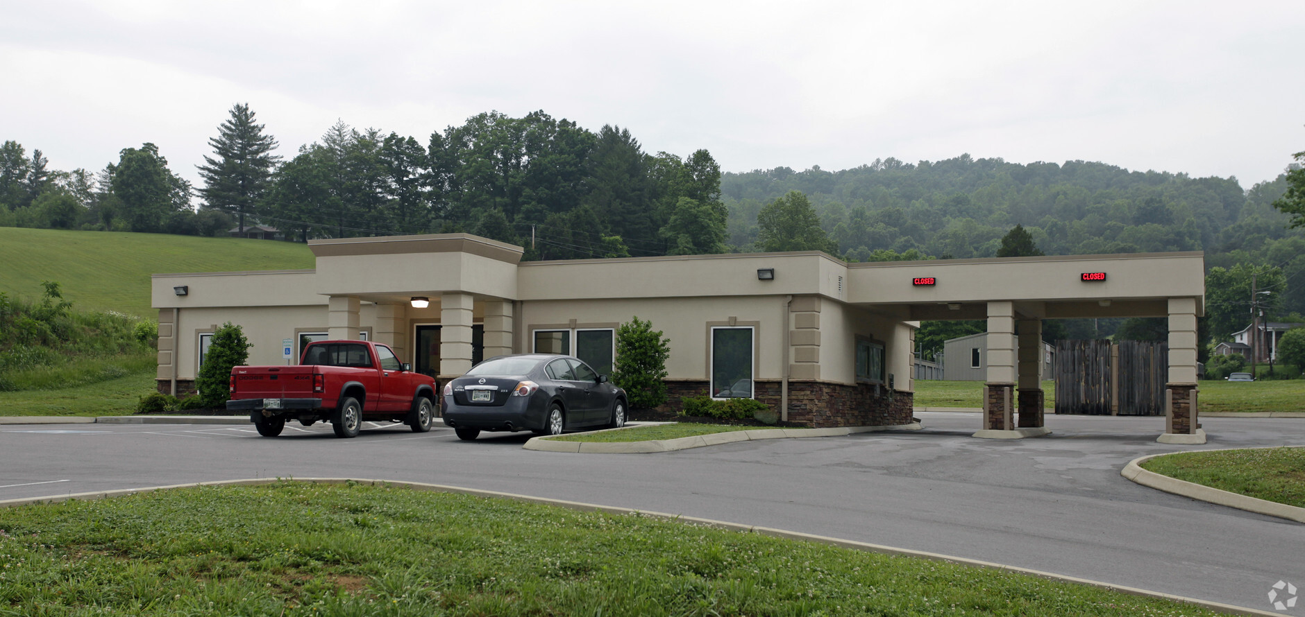
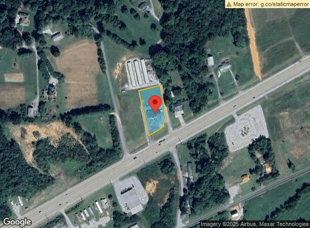
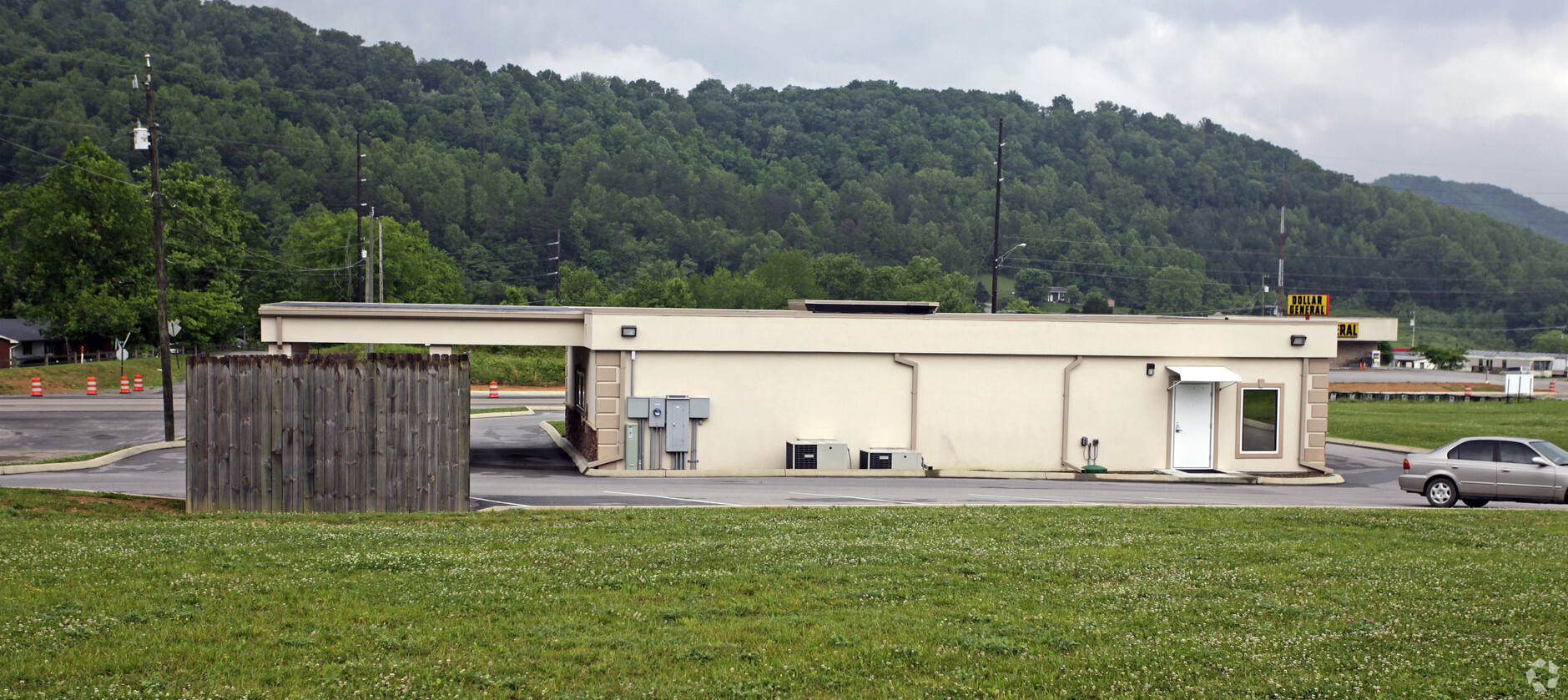
Property Record
4587 Maynardville Hwy, Maynardville, TN 37807
NEARBY LISTINGS FOR SALE OR LEASE
-
-
View all Maynardville listings for sale on LoopNet.com
Property Detail
4587 Maynardville Hwy
058C-A-006.00
Cab C Slide 45---D
Financialbuilding
DISTRICT: 01, COUNTY AREA: T01
X
Union
47173C0143C
Tennessee
2024
0.78 AC
2024
Union County
040201
Knoxville
2,304 SF
Knoxville, TN
DEMOGRAPHICS near 4587 Maynardville Hwy
1 Mile
3 Mile
5 Mile
2024 Total Population
1,155
5,121
10,270
2029 Population
1,238
5,506
11,047
Pop Growth 2024-2029
+ 7.19%
+ 7.52%
+ 7.57%
Average Age
39
39
40
2024 Total Households
439
1,967
3,965
HH Growth 2024-2029
+ 6.83%
+ 7.42%
+ 7.44%
Median Household Inc
$42,837
$47,474
$48,801
Avg Household Size
2.50
2.50
2.50
2024 Avg HH Vehicles
2.00
2.00
2.00
Median Home Value
$159,146
$159,277
$154,763
Median Year Built
1994
1992
1992
Nearby Places
- Restaurants
- Banks
- Shops
- Fitness
- Groceries
Nearby Properties
Address
Land Use
TOTAL SIZE
Lot Size
Zoning
Address
Land Use
TOTAL SIZE
Lot Size
Zoning
17,781 SF
4.32 AC
Address
Land Use
TOTAL SIZE
Lot Size
Zoning
54,914 SF
4.75 AC
Address
Land Use
TOTAL SIZE
Lot Size
Zoning
126,796 SF
10.98 AC
M1
Address
Land Use
TOTAL SIZE
Lot Size
Zoning
22,216 SF
4.81 AC
M1
Address
Land Use
TOTAL SIZE
Lot Size
Zoning
59,388 SF
6 AC
M1
Address
Land Use
TOTAL SIZE
Lot Size
Zoning
50.23 AC
Address
Land Use
TOTAL SIZE
Lot Size
Zoning
9.77 AC
Address
Land Use
TOTAL SIZE
Lot Size
Zoning
3,464 SF
6 AC
R2
Address
Land Use
TOTAL SIZE
Lot Size
Zoning
5,872 SF
3.26 AC
Address
Land Use
TOTAL SIZE
Lot Size
Zoning
10,192 SF
4.10 AC
B1
Address
Land Use
TOTAL SIZE
Lot Size
Zoning
10,968 SF
2.17 AC
Address
Land Use
TOTAL SIZE
Lot Size
Zoning
46.28 AC
Address
Land Use
TOTAL SIZE
Lot Size
Zoning
6,624 SF
1.19 AC
B2
Address
Land Use
TOTAL SIZE
Lot Size
Zoning
47,625 SF
5.92 AC
M1
Address
Land Use
TOTAL SIZE
Lot Size
Zoning
19,684 SF
3.51 AC
B2
Address
Land Use
TOTAL SIZE
Lot Size
Zoning
9,960 SF
1.40 AC
Address
Land Use
TOTAL SIZE
Lot Size
Zoning
Address
Land Use
TOTAL SIZE
Lot Size
Zoning
5,440 SF
1.60 AC
M1
Address
Land Use
TOTAL SIZE
Lot Size
Zoning
3.75 AC
Address
Land Use
TOTAL SIZE
Lot Size
Zoning
7,000 SF
1.17 AC
Address
Land Use
TOTAL SIZE
Lot Size
Zoning
7,752 SF
1.99 AC
Address
Land Use
TOTAL SIZE
Lot Size
Zoning
40,000 SF
5 AC
M1
Address
Land Use
TOTAL SIZE
Lot Size
Zoning
3,584 SF
3 AC
R2
Address
Land Use
TOTAL SIZE
Lot Size
Zoning
7,169 SF
1 AC
Address
Land Use
TOTAL SIZE
Lot Size
Zoning
13.60 AC
Address
Land Use
TOTAL SIZE
Lot Size
Zoning
5,068 SF
1.50 AC
B2
Address
Land Use
TOTAL SIZE
Lot Size
Zoning
22.22 AC
B2
Address
Land Use
TOTAL SIZE
Lot Size
Zoning
7,224 SF
0.91 AC
Address
Land Use
TOTAL SIZE
Lot Size
Zoning
2,254 SF
0.61 AC
Address
Land Use
TOTAL SIZE
Lot Size
Zoning
2,501 SF
0.23 AC
B1
The World's #1 Commercial Real Estate Marketplace
Connect with us
© 2025 CoStar Group
The information above has been obtained from sources believed reliable. While we do not doubt its accuracy we have not verified it and make no guarantee, warranty or representation about it. It is your responsibility to independently confirm its accuracy and completeness. Any projections, opinions, assumptions, or estimates used are for example only and do not represent the current or future performance of the property. The value of this transaction to you depends on tax and other factors which should be evaluated by your tax, financial, and legal advisors. You and your advisors should conduct a careful, independent investigation of the property to determine to your satisfaction the suitability of the property for your needs.