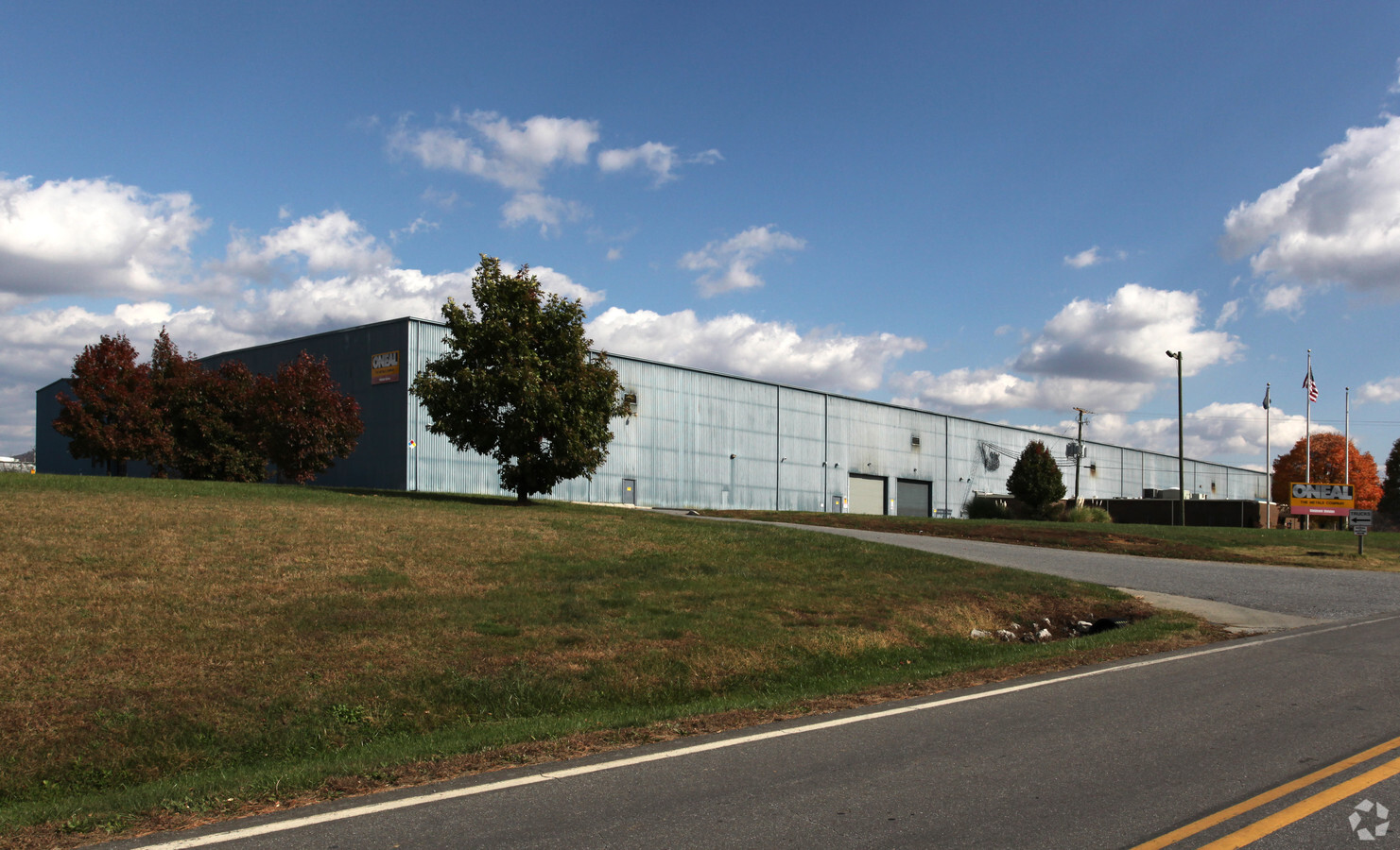
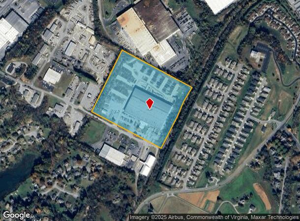
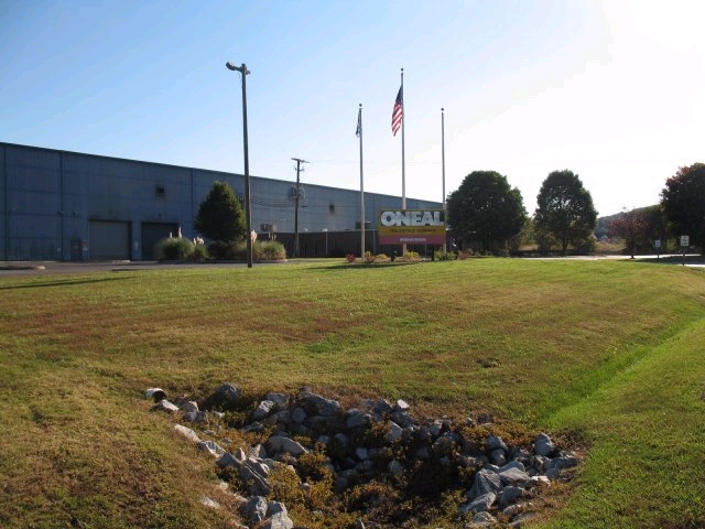
Property Record
459 Industrial Dr, Roanoke, VA 24019
NEARBY LISTINGS FOR SALE OR LEASE
-
-
View all Roanoke listings for sale on LoopNet.com
Property Detail
459 Industrial Dr
106-152
HOLLINS
Commercialnec
Botetourt
X
Virginia
51023C0460C
20 AC
2023
Botetourt County
2024
Roanoke
040402
Roanoke, VA
DEMOGRAPHICS near 459 Industrial Dr
1 Mile
3 Mile
5 Mile
2024 Total Population
3,950
27,787
65,010
2029 Population
4,016
27,923
64,989
Pop Growth 2024-2029
+ 1.67%
+ 0.49%
(0.03%)
Average Age
42
43
42
2024 Total Households
1,520
11,296
27,160
HH Growth 2024-2029
+ 1.71%
+ 0.46%
(0.10%)
Median Household Inc
$78,138
$68,281
$59,319
Avg Household Size
2.40
2.30
2.30
2024 Avg HH Vehicles
2.00
2.00
2.00
Median Home Value
$305,046
$229,118
$198,373
Median Year Built
1986
1977
1975
Nearby Places
- Restaurants
- Banks
- Shops
- Fitness
- Groceries
PUBLIC TRANSPORTATION
COMMUTER RAIL
Roanoke (Northeast Regional - Amtrak)
DRIVE
WALK
Distance
Roanoke (Northeast Regional - Amtrak)
14 min
8.3 mi
AIRPORT
Roanoke/Blacksburg Regional (Woodrum Field)
DRIVE
WALK
Distance
Roanoke/Blacksburg Regional (Woodrum Field)
12 min
5.3 mi
Freight Ports
Virginia Port Authority - Richmond
DRIVE
WALK
Distance
Virginia Port Authority - Richmond
210 min
185.3 mi
Nearby Properties
Address
Land Use
TOTAL SIZE
Lot Size
Zoning
Address
Land Use
TOTAL SIZE
Lot Size
Zoning
5,957.14 AC
FC
Address
Land Use
TOTAL SIZE
Lot Size
Zoning
4,284 SF
17.86 AC
R3
Address
Land Use
TOTAL SIZE
Lot Size
Zoning
24,126 SF
20.11 AC
R3
Address
Land Use
TOTAL SIZE
Lot Size
Zoning
40.12 AC
M-1
Address
Land Use
TOTAL SIZE
Lot Size
Zoning
609,211 SF
41.01 AC
I1C
Address
Land Use
TOTAL SIZE
Lot Size
Zoning
40.04 AC
M-2
Address
Land Use
TOTAL SIZE
Lot Size
Zoning
15,312 SF
182.27 AC
AG3
Address
Land Use
TOTAL SIZE
Lot Size
Zoning
22.52 AC
R-1
Address
Land Use
TOTAL SIZE
Lot Size
Zoning
124,725 SF
6.53 AC
I1
Address
Land Use
TOTAL SIZE
Lot Size
Zoning
48,935 SF
9.15 AC
RMF
Address
Land Use
TOTAL SIZE
Lot Size
Zoning
36.98 AC
M-1
Address
Land Use
TOTAL SIZE
Lot Size
Zoning
139,654 SF
4.77 AC
C2S
Address
Land Use
TOTAL SIZE
Lot Size
Zoning
22,950 SF
9.50 AC
R3
Address
Land Use
TOTAL SIZE
Lot Size
Zoning
69,212 SF
19.65 AC
R3S
Address
Land Use
TOTAL SIZE
Lot Size
Zoning
70,091 SF
11.82 AC
R1
Address
Land Use
TOTAL SIZE
Lot Size
Zoning
35,582 SF
16.36 AC
I2S
Address
Land Use
TOTAL SIZE
Lot Size
Zoning
70,770 SF
6 AC
R3
Address
Land Use
TOTAL SIZE
Lot Size
Zoning
24,512 SF
9.10 AC
C2S
Address
Land Use
TOTAL SIZE
Lot Size
Zoning
88,570 SF
10.02 AC
CLS
Address
Land Use
TOTAL SIZE
Lot Size
Zoning
35,004 SF
5.07 AC
SCD
Address
Land Use
TOTAL SIZE
Lot Size
Zoning
9.98 AC
A1
Address
Land Use
TOTAL SIZE
Lot Size
Zoning
35,796 SF
3.57 AC
C2CS
Address
Land Use
TOTAL SIZE
Lot Size
Zoning
20,086 SF
9.79 AC
R1S
Address
Land Use
TOTAL SIZE
Lot Size
Zoning
9.14 AC
M-2
Address
Land Use
TOTAL SIZE
Lot Size
Zoning
68,179 SF
10.18 AC
C2
Address
Land Use
TOTAL SIZE
Lot Size
Zoning
14.27 AC
SCD
Address
Land Use
TOTAL SIZE
Lot Size
Zoning
83,365 SF
9.67 AC
I-1
Address
Land Use
TOTAL SIZE
Lot Size
Zoning
110,347 SF
17.46 AC
I-1
Address
Land Use
TOTAL SIZE
Lot Size
Zoning
38,531 SF
5.99 AC
R1S
Address
Land Use
TOTAL SIZE
Lot Size
Zoning
12,252 SF
9.38 AC
R4
The World's #1 Commercial Real Estate Marketplace
Connect with us
© 2025 CoStar Group
The information above has been obtained from sources believed reliable. While we do not doubt its accuracy we have not verified it and make no guarantee, warranty or representation about it. It is your responsibility to independently confirm its accuracy and completeness. Any projections, opinions, assumptions, or estimates used are for example only and do not represent the current or future performance of the property. The value of this transaction to you depends on tax and other factors which should be evaluated by your tax, financial, and legal advisors. You and your advisors should conduct a careful, independent investigation of the property to determine to your satisfaction the suitability of the property for your needs.