Property Record
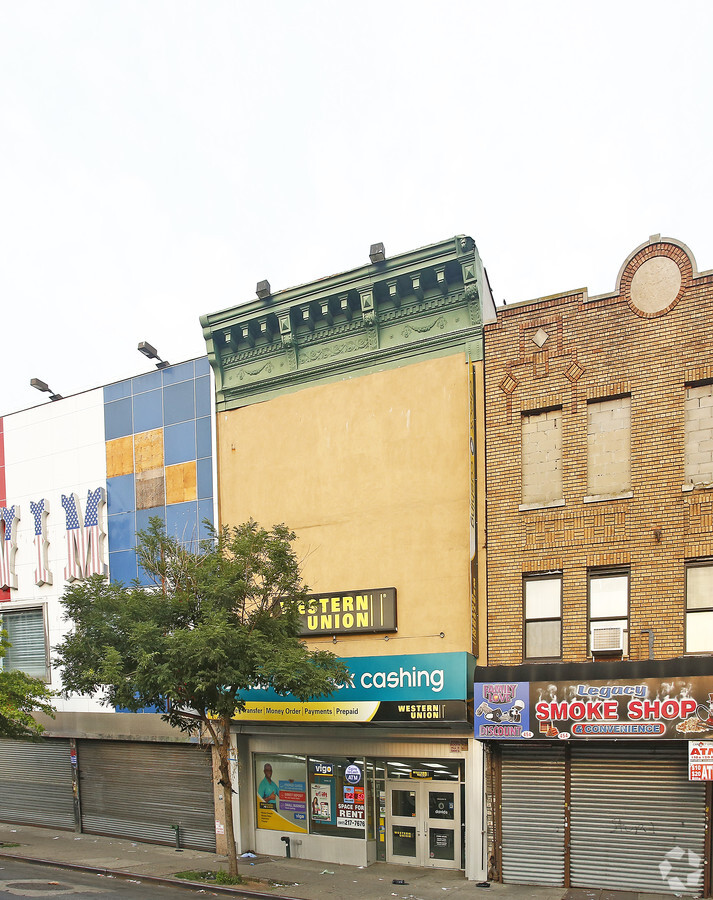
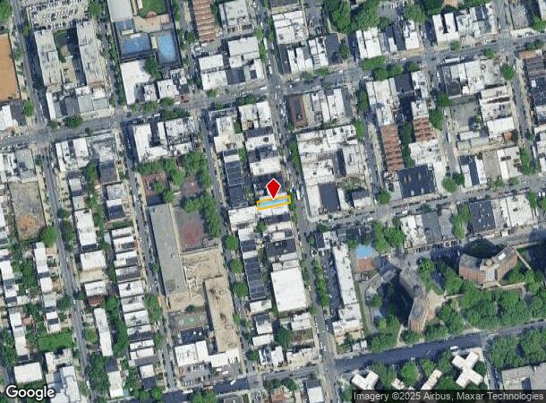
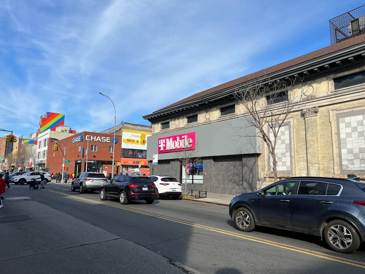
460 Rockaway Ave, Brooklyn, NY 11212

NEARBY LISTINGS FOR SALE OR LEASE
Property Detail
460 Rockaway Ave
03521-0054
DOCID-2023081600870001
Storebuilding
Kings
X
New York
3604970216F
54
2024
0.06 AC
2024
North Brooklyn
092400
Long Island (New York)
2,150 SF
New York-Jersey City-White Plains, NY-NJ
DEMOGRAPHICS near 460 Rockaway Ave
1 Mile
3 Mile
5 Mile
2024 Total Population
159,767
1,102,937
2,345,426
2029 Population
150,538
1,026,534
2,194,691
Pop Growth 2024-2029
(5.78%)
(6.93%)
(6.43%)
Average Age
38
39
39
2024 Total Households
56,930
400,593
862,794
HH Growth 2024-2029
(6.31%)
(7.31%)
(6.71%)
Median Household Inc
$36,765
$59,992
$73,106
Avg Household Size
2.60
2.60
2.60
2024 Avg HH Vehicles
.00
1.00
1.00
Median Home Value
$575,260
$742,847
$797,414
Median Year Built
1950
1948
1948
Nearby Places
- Restaurants
- Banks
- Shops
- Fitness
- Groceries
PUBLIC TRANSPORTATION
TRANSIT/SUBWAY
Rockaway Avenue (3,4 Line) (3 - New York MTA Subway (The Subway), 4 - New York MTA Subway (The Subway))
DRIVE
WALK
Distance
Rockaway Avenue (3,4 Line) (3 - New York MTA Subway (The Subway), 4 - New York MTA Subway (The Subway))
1 min
8 min
0.4 mi
Sutter Avenue (L - New York MTA Subway (The Subway))
DRIVE
WALK
Distance
Sutter Avenue (L - New York MTA Subway (The Subway))
1 min
10 min
0.6 mi
Junius Street (3 - New York MTA Subway (The Subway), 4 - New York MTA Subway (The Subway))
DRIVE
WALK
Distance
Junius Street (3 - New York MTA Subway (The Subway), 4 - New York MTA Subway (The Subway))
2 min
15 min
0.8 mi
Saratoga Avenue (3 - New York MTA Subway (The Subway), 4 - New York MTA Subway (The Subway))
DRIVE
WALK
Distance
Saratoga Avenue (3 - New York MTA Subway (The Subway), 4 - New York MTA Subway (The Subway))
3 min
15 min
0.8 mi
Livonia Avenue (L - New York MTA Subway (The Subway))
DRIVE
WALK
Distance
Livonia Avenue (L - New York MTA Subway (The Subway))
2 min
16 min
0.9 mi
COMMUTER RAIL
East New York Station (Far Rockaway Branch - Long Island Rail Road, Long Beach Branch - Long Island Rail Road, West Hempstead Branch - Long Island Rail Road)
DRIVE
WALK
Distance
East New York Station (Far Rockaway Branch - Long Island Rail Road, Long Beach Branch - Long Island Rail Road, West Hempstead Branch - Long Island Rail Road)
2 min
15 min
0.8 mi
Nostrand Avenue Station (Far Rockaway Branch - Long Island Rail Road, Hempstead Branch - Long Island Rail Road, Long Beach Branch - Long Island Rail Road, West Hempstead Branch - Long Island Rail Road)
DRIVE
WALK
Distance
Nostrand Avenue Station (Far Rockaway Branch - Long Island Rail Road, Hempstead Branch - Long Island Rail Road, Long Beach Branch - Long Island Rail Road, West Hempstead Branch - Long Island Rail Road)
9 min
2.9 mi
AIRPORT
Laguardia
DRIVE
WALK
Distance
Laguardia
21 min
9.2 mi
John F Kennedy International
DRIVE
WALK
Distance
John F Kennedy International
16 min
9.7 mi
Newark Liberty International
DRIVE
WALK
Distance
Newark Liberty International
36 min
18.6 mi
Freight Ports
NY - Red Hook Container Terminal
DRIVE
WALK
Distance
NY - Red Hook Container Terminal
16 min
7.8 mi
SALE & LEASE HISTORY
LISTING DATE
SALE/LEASE

Feb 15, 2023
For Sale
Nearby Properties
Address
Land Use
TOTAL SIZE
Lot Size
Zoning
Address
Land Use
TOTAL SIZE
Lot Size
Zoning
1,503,150 SF
20.47 AC
R5
Address
Land Use
TOTAL SIZE
Lot Size
Zoning
296,915 SF
0.31 AC
C5-3
Address
Land Use
TOTAL SIZE
Lot Size
Zoning
835,231 SF
11.32 AC
R6
Address
Land Use
TOTAL SIZE
Lot Size
Zoning
1,061,228 SF
8.86 AC
R5
Address
Land Use
TOTAL SIZE
Lot Size
Zoning
561,945 SF
11.58 AC
R6
Address
Land Use
TOTAL SIZE
Lot Size
Zoning
5,302 SF
366.15 AC
PARK
Address
Land Use
TOTAL SIZE
Lot Size
Zoning
1,688,760 SF
24.65 AC
R5
Address
Land Use
TOTAL SIZE
Lot Size
Zoning
1,526,800 SF
32.39 AC
R5
Address
Land Use
TOTAL SIZE
Lot Size
Zoning
61.60 AC
PARK
Address
Land Use
TOTAL SIZE
Lot Size
Zoning
566,000 SF
12.33 AC
R6
Address
Land Use
TOTAL SIZE
Lot Size
Zoning
600 SF
33.07 AC
PARK
Address
Land Use
TOTAL SIZE
Lot Size
Zoning
304,080 SF
5.17 AC
M1-2
Address
Land Use
TOTAL SIZE
Lot Size
Zoning
337,880 SF
0.71 AC
R7-2
Address
Land Use
TOTAL SIZE
Lot Size
Zoning
6,000 SF
110.42 AC
PARK
Address
Land Use
TOTAL SIZE
Lot Size
Zoning
1,420,000 SF
19.61 AC
R5
Address
Land Use
TOTAL SIZE
Lot Size
Zoning
511,776 SF
2.33 AC
R6
Address
Land Use
TOTAL SIZE
Lot Size
Zoning
1,493,793 SF
14.19 AC
R5
Address
Land Use
TOTAL SIZE
Lot Size
Zoning
1,485,000 SF
20.28 AC
R5
Address
Land Use
TOTAL SIZE
Lot Size
Zoning
33.98 AC
C4-2
Address
Land Use
TOTAL SIZE
Lot Size
Zoning
1,150,500 SF
15.17 AC
R6
Address
Land Use
TOTAL SIZE
Lot Size
Zoning
229,456 SF
4.15 AC
M1-1
Address
Land Use
TOTAL SIZE
Lot Size
Zoning
458,778 SF
2.09 AC
R6
Address
Land Use
TOTAL SIZE
Lot Size
Zoning
635,994 SF
17.90 AC
R5
Address
Land Use
TOTAL SIZE
Lot Size
Zoning
314,877 SF
1.94 AC
R7A
Address
Land Use
TOTAL SIZE
Lot Size
Zoning
997,720 SF
8.23 AC
R5
Address
Land Use
TOTAL SIZE
Lot Size
Zoning
540,672 SF
10.65 AC
PARK
Address
Land Use
TOTAL SIZE
Lot Size
Zoning
384,683 SF
1.99 AC
R6A
Address
Land Use
TOTAL SIZE
Lot Size
Zoning
780,000 SF
11.15 AC
R6
Address
Land Use
TOTAL SIZE
Lot Size
Zoning
1,136,208 SF
30.25 AC
R5
Address
Land Use
TOTAL SIZE
Lot Size
Zoning
142,931 SF
3.28 AC
C4-2
The World's #1 Commercial Real Estate Marketplace
Connect with us
© 2025 CoStar Group
The information above has been obtained from sources believed reliable. While we do not doubt its accuracy we have not verified it and make no guarantee, warranty or representation about it. It is your responsibility to independently confirm its accuracy and completeness. Any projections, opinions, assumptions, or estimates used are for example only and do not represent the current or future performance of the property. The value of this transaction to you depends on tax and other factors which should be evaluated by your tax, financial, and legal advisors. You and your advisors should conduct a careful, independent investigation of the property to determine to your satisfaction the suitability of the property for your needs.