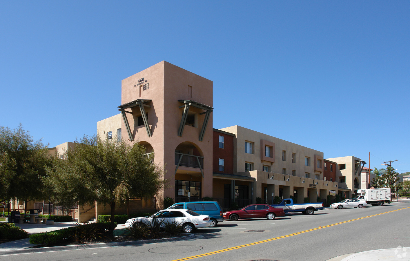
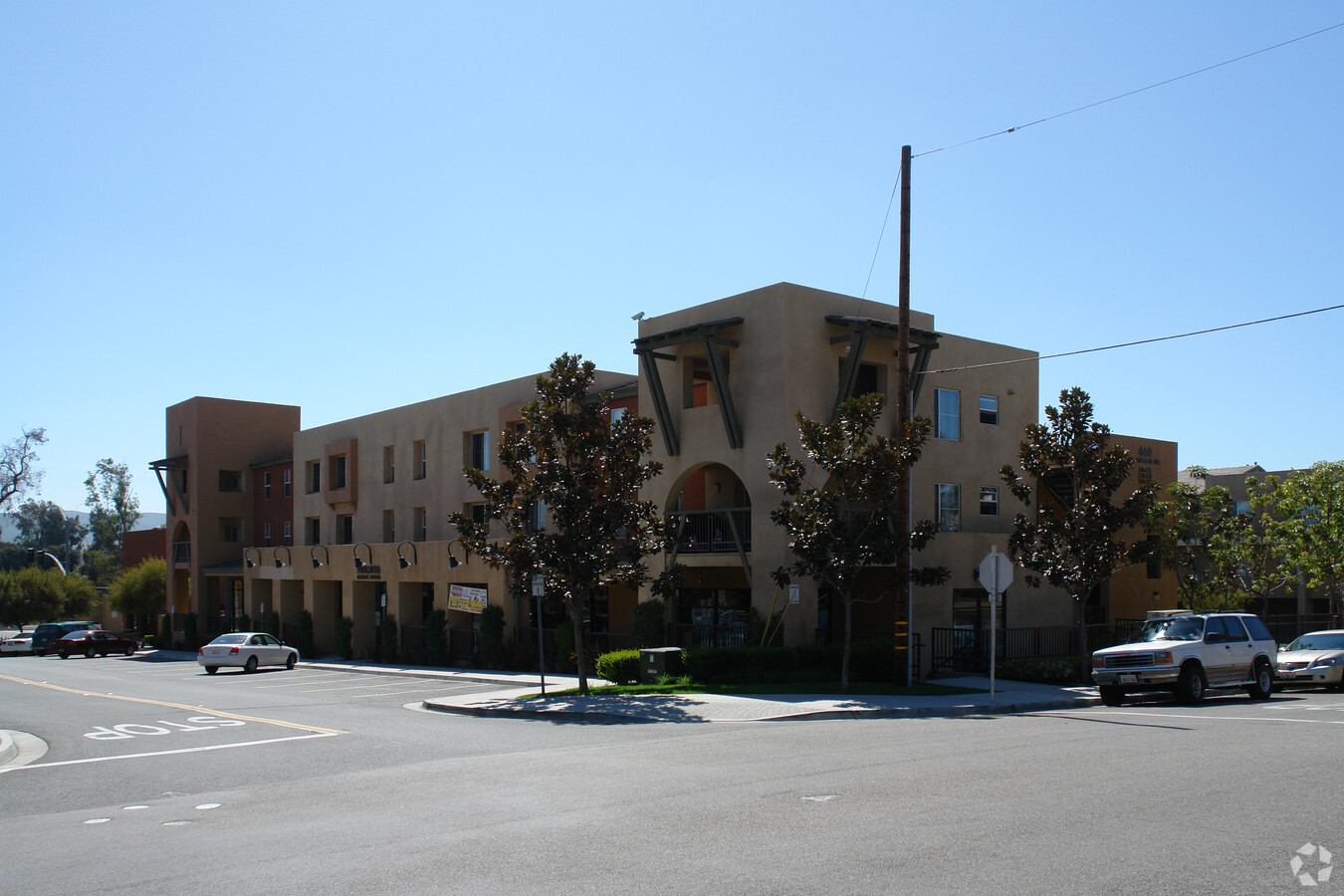
Property Record
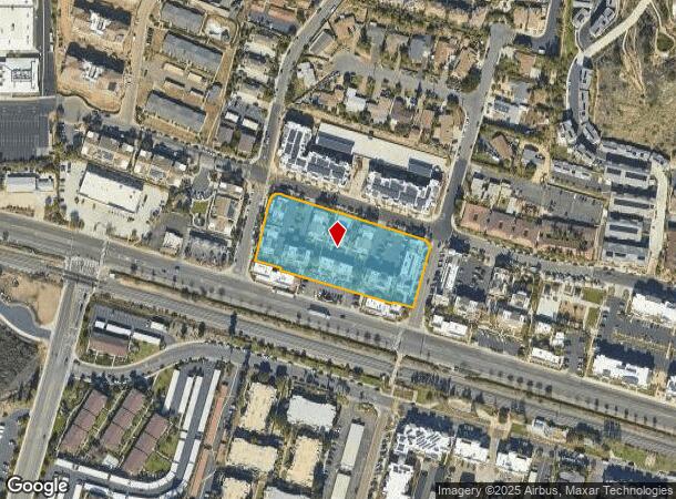
460 W Mission Rd, San Marcos, CA 92069
NEARBY LISTINGS FOR SALE OR LEASE
Property Detail
460 W Mission Rd
220-112-25
City San Marcos
Multifamilydwelling
PAR 1 TR PM18601
X
San Diego
06073C0793G
California
2024
2.37 AC
2024
San Marcos
020021
San Diego
68,636 SF
San Diego-Carlsbad, CA
DEMOGRAPHICS near 460 W Mission Rd
1 Mile
3 Mile
5 Mile
2024 Total Population
16,841
92,820
198,706
2029 Population
16,799
92,025
197,096
Pop Growth 2024-2029
(0.25%)
(0.86%)
(0.81%)
Average Age
33
39
39
2024 Total Households
5,140
30,503
67,580
HH Growth 2024-2029
(0.39%)
(0.93%)
(0.96%)
Median Household Inc
$71,438
$90,013
$94,745
Avg Household Size
3.20
2.90
2.80
2024 Avg HH Vehicles
2.00
2.00
2.00
Median Home Value
$670,161
$701,109
$736,023
Median Year Built
1989
1988
1986
Nearby Places
- Restaurants
- Banks
- Shops
- Fitness
- Groceries
PUBLIC TRANSPORTATION
TRANSIT/SUBWAY
San Marcos Civic Center (Sprinter - San Diego North County Transit District (Coaster/Sprinter/Breeze))
DRIVE
WALK
Distance
San Marcos Civic Center (Sprinter - San Diego North County Transit District (Coaster/Sprinter/Breeze))
1 min
13 min
0.7 mi
Palomar College (Sprinter - San Diego North County Transit District (Coaster/Sprinter/Breeze))
DRIVE
WALK
Distance
Palomar College (Sprinter - San Diego North County Transit District (Coaster/Sprinter/Breeze))
2 min
18 min
0.9 mi
AIRPORT
San Diego International
DRIVE
WALK
Distance
San Diego International
47 min
35.3 mi
Freight Ports
Port of San Diego
DRIVE
WALK
Distance
Port of San Diego
49 min
37.5 mi
SALE & LEASE HISTORY
LISTING DATE
SALE/LEASE

Jan 09, 2018
For Lease
Nearby Properties
Address
Land Use
TOTAL SIZE
Lot Size
Zoning
Address
Land Use
TOTAL SIZE
Lot Size
Zoning
27.98 AC
SPA
Address
Land Use
TOTAL SIZE
Lot Size
Zoning
15.37 AC
SPA
Address
Land Use
TOTAL SIZE
Lot Size
Zoning
5.25 AC
SPA
Address
Land Use
TOTAL SIZE
Lot Size
Zoning
5.37 AC
SPA
Address
Land Use
TOTAL SIZE
Lot Size
Zoning
10.82 AC
SPA
Address
Land Use
TOTAL SIZE
Lot Size
Zoning
11.87 AC
R-M
Address
Land Use
TOTAL SIZE
Lot Size
Zoning
16.91 AC
C
Address
Land Use
TOTAL SIZE
Lot Size
Zoning
11.08 AC
SPI
Address
Land Use
TOTAL SIZE
Lot Size
Zoning
9.88 AC
R-3-10
Address
Land Use
TOTAL SIZE
Lot Size
Zoning
Address
Land Use
TOTAL SIZE
Lot Size
Zoning
4.76 AC
C34
Address
Land Use
TOTAL SIZE
Lot Size
Zoning
9.80 AC
I
Address
Land Use
TOTAL SIZE
Lot Size
Zoning
99,461 SF
4.89 AC
SPA
Address
Land Use
TOTAL SIZE
Lot Size
Zoning
10.80 AC
SPA
Address
Land Use
TOTAL SIZE
Lot Size
Zoning
1.94 AC
C
Address
Land Use
TOTAL SIZE
Lot Size
Zoning
9.99 AC
MU-1
Address
Land Use
TOTAL SIZE
Lot Size
Zoning
1.49 AC
SPA
Address
Land Use
TOTAL SIZE
Lot Size
Zoning
9.75 AC
RU
Address
Land Use
TOTAL SIZE
Lot Size
Zoning
7.06 AC
SR
Address
Land Use
TOTAL SIZE
Lot Size
Zoning
5.85 AC
SPA
Address
Land Use
TOTAL SIZE
Lot Size
Zoning
95,713 SF
0.51 AC
C
Address
Land Use
TOTAL SIZE
Lot Size
Zoning
10.69 AC
R-3-10
Address
Land Use
TOTAL SIZE
Lot Size
Zoning
16.12 AC
SPA
Address
Land Use
TOTAL SIZE
Lot Size
Zoning
10.83 AC
SPA
Address
Land Use
TOTAL SIZE
Lot Size
Zoning
4.79 AC
SR
Address
Land Use
TOTAL SIZE
Lot Size
Zoning
96,747 SF
3.34 AC
SPA
Address
Land Use
TOTAL SIZE
Lot Size
Zoning
91,354 SF
2.66 AC
SPA
Address
Land Use
TOTAL SIZE
Lot Size
Zoning
99,500 SF
4.57 AC
SPA
Address
Land Use
TOTAL SIZE
Lot Size
Zoning
10 AC
MU-3
Address
Land Use
TOTAL SIZE
Lot Size
Zoning
6.16 AC
SPA
The World's #1 Commercial Real Estate Marketplace
Connect with us
© 2025 CoStar Group
The information above has been obtained from sources believed reliable. While we do not doubt its accuracy we have not verified it and make no guarantee, warranty or representation about it. It is your responsibility to independently confirm its accuracy and completeness. Any projections, opinions, assumptions, or estimates used are for example only and do not represent the current or future performance of the property. The value of this transaction to you depends on tax and other factors which should be evaluated by your tax, financial, and legal advisors. You and your advisors should conduct a careful, independent investigation of the property to determine to your satisfaction the suitability of the property for your needs.