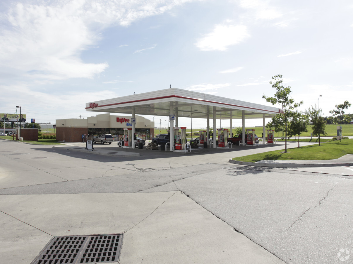
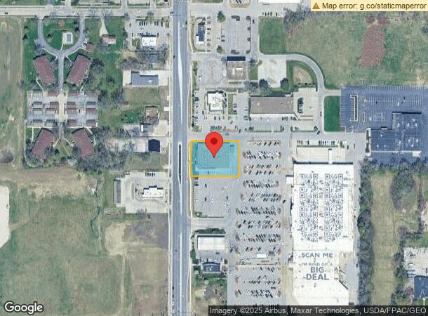
Property Record
4605 Fleur Dr, Des Moines, IA 50321

NEARBY LISTINGS FOR SALE OR LEASE
Property Detail
4605 Fleur Dr
120-07110001002
Sec 20-78-24
Storebuilding
HY-VEE BLDG ON LSD LND SEE 12-0/7110-1 -EX ST- & -EX E 125F W 175F N 146F S 183F & N 145F S 781.35F E 190F W 240F- S 817.35F MEAS ON W LN W 780F SW 1/4 SE 1/4 SEC 20-78-24
X
Polk
19153C0345F
Iowa
2024
South
2024
Des Moines
004502
Des Moines-West Des Moines, IA
91,166 SF
DEMOGRAPHICS near 4605 Fleur Dr
1 Mile
3 Mile
5 Mile
2024 Total Population
7,306
54,711
153,387
2029 Population
7,531
57,048
160,941
Pop Growth 2024-2029
+ 3.08%
+ 4.27%
+ 4.92%
Average Age
42
38
37
2024 Total Households
3,165
22,899
64,428
HH Growth 2024-2029
+ 3.32%
+ 4.57%
+ 5.13%
Median Household Inc
$69,101
$60,218
$59,142
Avg Household Size
2.20
2.30
2.30
2024 Avg HH Vehicles
2.00
2.00
2.00
Median Home Value
$184,426
$158,866
$180,595
Median Year Built
1962
1970
1970
Nearby Places
- Restaurants
- Banks
- Shops
- Fitness
- Groceries
PUBLIC TRANSPORTATION
AIRPORT
Des Moines International
DRIVE
WALK
Distance
Des Moines International
5 min
1.4 mi
Freight Ports
Port Milwaukee
DRIVE
WALK
Distance
Port Milwaukee
424 min
377.8 mi
Nearby Properties
Address
Land Use
TOTAL SIZE
Lot Size
Zoning
Address
Land Use
TOTAL SIZE
Lot Size
Zoning
594,010 SF
24.40 AC
R1-80
Address
Land Use
TOTAL SIZE
Lot Size
Zoning
162,578 SF
6.37 AC
Address
Land Use
TOTAL SIZE
Lot Size
Zoning
397,938 SF
27.97 AC
PUD
Address
Land Use
TOTAL SIZE
Lot Size
Zoning
371,920 SF
1.82 AC
C-3
Address
Land Use
TOTAL SIZE
Lot Size
Zoning
432,630 SF
0.82 AC
C-3
Address
Land Use
TOTAL SIZE
Lot Size
Zoning
302,800 SF
20.85 AC
Address
Land Use
TOTAL SIZE
Lot Size
Zoning
203,710 SF
26.88 AC
Address
Land Use
TOTAL SIZE
Lot Size
Zoning
298,716 SF
18.90 AC
PUD
Address
Land Use
TOTAL SIZE
Lot Size
Zoning
1,070,647 SF
2.96 AC
C-3
Address
Land Use
TOTAL SIZE
Lot Size
Zoning
526,295 SF
26.06 AC
M-1
Address
Land Use
TOTAL SIZE
Lot Size
Zoning
298,528 SF
3.79 AC
R-4
Address
Land Use
TOTAL SIZE
Lot Size
Zoning
231,168 SF
22.29 AC
PUD
Address
Land Use
TOTAL SIZE
Lot Size
Zoning
161,788 SF
9.41 AC
PBP
Address
Land Use
TOTAL SIZE
Lot Size
Zoning
72,036 SF
3.54 AC
Address
Land Use
TOTAL SIZE
Lot Size
Zoning
208,456 SF
14.42 AC
PUD
Address
Land Use
TOTAL SIZE
Lot Size
Zoning
538,460 SF
5.41 AC
C-3B
Address
Land Use
TOTAL SIZE
Lot Size
Zoning
74,880 SF
0.45 AC
Address
Land Use
TOTAL SIZE
Lot Size
Zoning
658,855 SF
47.73 AC
M-1
Address
Land Use
TOTAL SIZE
Lot Size
Zoning
74,760 SF
3.17 AC
Address
Land Use
TOTAL SIZE
Lot Size
Zoning
260,420 SF
18.17 AC
R-3
Address
Land Use
TOTAL SIZE
Lot Size
Zoning
237,306 SF
0.82 AC
Address
Land Use
TOTAL SIZE
Lot Size
Zoning
67,080 SF
1.29 AC
Address
Land Use
TOTAL SIZE
Lot Size
Zoning
60,498 SF
6.90 AC
C3B
Address
Land Use
TOTAL SIZE
Lot Size
Zoning
684,064 SF
2 AC
C-3
Address
Land Use
TOTAL SIZE
Lot Size
Zoning
150,398 SF
2.25 AC
C-3A
Address
Land Use
TOTAL SIZE
Lot Size
Zoning
149,564 SF
22.28 AC
PUD
Address
Land Use
TOTAL SIZE
Lot Size
Zoning
160,680 SF
19.54 AC
C-2
Address
Land Use
TOTAL SIZE
Lot Size
Zoning
120,497 SF
14.10 AC
Address
Land Use
TOTAL SIZE
Lot Size
Zoning
191,668 SF
8.26 AC
R-6
Address
Land Use
TOTAL SIZE
Lot Size
Zoning
97,979 SF
10.35 AC
The World's #1 Commercial Real Estate Marketplace
Connect with us
© 2025 CoStar Group
The information above has been obtained from sources believed reliable. While we do not doubt its accuracy we have not verified it and make no guarantee, warranty or representation about it. It is your responsibility to independently confirm its accuracy and completeness. Any projections, opinions, assumptions, or estimates used are for example only and do not represent the current or future performance of the property. The value of this transaction to you depends on tax and other factors which should be evaluated by your tax, financial, and legal advisors. You and your advisors should conduct a careful, independent investigation of the property to determine to your satisfaction the suitability of the property for your needs.