Property Record
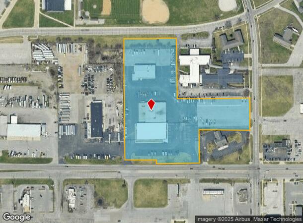
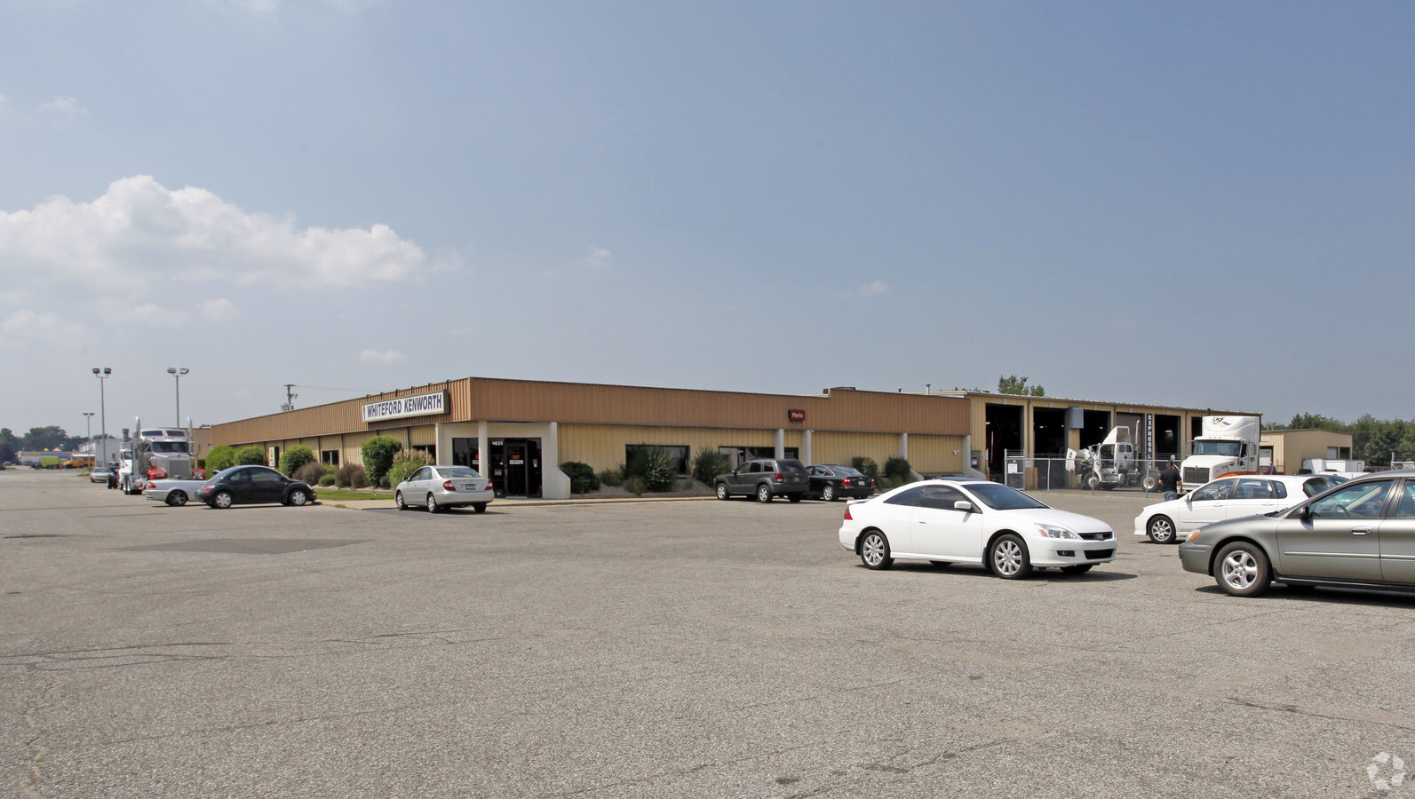
4625 W Western Ave, South Bend, IN 46619
NEARBY LISTINGS FOR SALE OR LEASE
Property Detail
4625 W Western Ave
71-08-08-276-006.000-026
Garden Village 3Rd Unit
Vehiclerentalsvehiclesales
BLOCK C GARDEN VILLAGE 3RD UNIT CONT 7.402 AC +-
X
St Joseph
18141C0187D
Indiana
2023
7.40 AC
2023
Greater South Bend
002500
South Bend/Mishawaka
31,220 SF
South Bend-Mishawaka, IN-MI
DEMOGRAPHICS near 4625 W Western Ave
1 Mile
3 Mile
5 Mile
2024 Total Population
9,900
46,798
108,107
2029 Population
9,840
47,195
108,789
Pop Growth 2024-2029
(0.61%)
+ 0.85%
+ 0.63%
Average Age
36
36
36
2024 Total Households
3,479
17,045
39,521
HH Growth 2024-2029
(0.63%)
+ 0.77%
+ 0.67%
Median Household Inc
$38,373
$39,678
$48,382
Avg Household Size
2.70
2.60
2.40
2024 Avg HH Vehicles
2.00
2.00
2.00
Median Home Value
$64,323
$78,530
$121,752
Median Year Built
1953
1952
1956
Nearby Places
- Restaurants
- Banks
- Shops
- Fitness
- Groceries
PUBLIC TRANSPORTATION
COMMUTER RAIL
South Bend Amtrak Station (Capitol Limited - Amtrak, Lake Shore Limited - Amtrak)
DRIVE
WALK
Distance
South Bend Amtrak Station (Capitol Limited - Amtrak, Lake Shore Limited - Amtrak)
4 min
2.0 mi
South Bend Airport Station (South Shore Line - Northern Indiana Commuter Transportation District (South Shore Line))
DRIVE
WALK
Distance
South Bend Airport Station (South Shore Line - Northern Indiana Commuter Transportation District (South Shore Line))
7 min
3.2 mi
AIRPORT
South Bend International
DRIVE
WALK
Distance
South Bend International
14 min
4.1 mi
Freight Ports
Port Milwaukee
DRIVE
WALK
Distance
Port Milwaukee
215 min
172.3 mi
Nearby Properties
Address
Land Use
TOTAL SIZE
Lot Size
Zoning
Address
Land Use
TOTAL SIZE
Lot Size
Zoning
553,872 SF
70.95 AC
Address
Land Use
TOTAL SIZE
Lot Size
Zoning
58,135 SF
40 AC
Address
Land Use
TOTAL SIZE
Lot Size
Zoning
176,431 SF
5.70 AC
Address
Land Use
TOTAL SIZE
Lot Size
Zoning
104,812 SF
9.45 AC
Address
Land Use
TOTAL SIZE
Lot Size
Zoning
165,725 SF
62.89 AC
Address
Land Use
TOTAL SIZE
Lot Size
Zoning
74,976 SF
6.91 AC
Address
Land Use
TOTAL SIZE
Lot Size
Zoning
85,928 SF
7.83 AC
Address
Land Use
TOTAL SIZE
Lot Size
Zoning
158,495 SF
6.23 AC
Address
Land Use
TOTAL SIZE
Lot Size
Zoning
164,141 SF
61.83 AC
Address
Land Use
TOTAL SIZE
Lot Size
Zoning
152,040 SF
21 AC
Address
Land Use
TOTAL SIZE
Lot Size
Zoning
1,234,159 SF
45.69 AC
Address
Land Use
TOTAL SIZE
Lot Size
Zoning
57,063 SF
6.30 AC
Address
Land Use
TOTAL SIZE
Lot Size
Zoning
128,825 SF
12.05 AC
Address
Land Use
TOTAL SIZE
Lot Size
Zoning
242,042 SF
5.20 AC
Address
Land Use
TOTAL SIZE
Lot Size
Zoning
581,506 SF
9.18 AC
Address
Land Use
TOTAL SIZE
Lot Size
Zoning
130,997 SF
8.44 AC
Address
Land Use
TOTAL SIZE
Lot Size
Zoning
95,436 SF
8.56 AC
Address
Land Use
TOTAL SIZE
Lot Size
Zoning
39,498 SF
5 AC
Address
Land Use
TOTAL SIZE
Lot Size
Zoning
169,260 SF
1.80 AC
Address
Land Use
TOTAL SIZE
Lot Size
Zoning
430,722 SF
8.77 AC
Address
Land Use
TOTAL SIZE
Lot Size
Zoning
149,184 SF
21.84 AC
Address
Land Use
TOTAL SIZE
Lot Size
Zoning
93,477 SF
15.53 AC
Address
Land Use
TOTAL SIZE
Lot Size
Zoning
278,376 SF
13.45 AC
Address
Land Use
TOTAL SIZE
Lot Size
Zoning
35,702 SF
44.52 AC
Address
Land Use
TOTAL SIZE
Lot Size
Zoning
34,712 SF
3.14 AC
Address
Land Use
TOTAL SIZE
Lot Size
Zoning
114,456 SF
9.13 AC
Address
Land Use
TOTAL SIZE
Lot Size
Zoning
127,145 SF
8.56 AC
Address
Land Use
TOTAL SIZE
Lot Size
Zoning
312,900 SF
17.28 AC
Address
Land Use
TOTAL SIZE
Lot Size
Zoning
81,497 SF
5.89 AC
Address
Land Use
TOTAL SIZE
Lot Size
Zoning
84,252 SF
8.95 AC
The World's #1 Commercial Real Estate Marketplace
Connect with us
© 2025 CoStar Group
The information above has been obtained from sources believed reliable. While we do not doubt its accuracy we have not verified it and make no guarantee, warranty or representation about it. It is your responsibility to independently confirm its accuracy and completeness. Any projections, opinions, assumptions, or estimates used are for example only and do not represent the current or future performance of the property. The value of this transaction to you depends on tax and other factors which should be evaluated by your tax, financial, and legal advisors. You and your advisors should conduct a careful, independent investigation of the property to determine to your satisfaction the suitability of the property for your needs.