Property Record
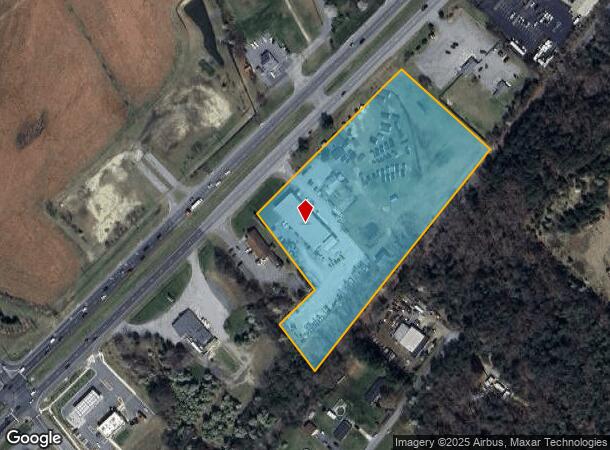
4630 Crain Hwy, White Plains, MD 20695


NEARBY LISTINGS FOR SALE OR LEASE
Property Detail
4630 Crain Hwy
06-040888
White Plains
Commercialnec
7.15 AC ON 301 NR WHITE PLAINS
X
Charles
24017C0180C
Maryland
2024
7.15 AC
2024
Charles County
851004
Washington, DC
13,561 SF
Washington-Arlington-Alexandria, DC-VA-MD-WV
DEMOGRAPHICS near 4630 Crain Hwy
1 Mile
3 Mile
5 Mile
2024 Total Population
1,822
45,303
101,836
2029 Population
1,935
47,403
106,505
Pop Growth 2024-2029
+ 6.20%
+ 4.64%
+ 4.58%
Average Age
42
38
38
2024 Total Households
680
16,226
35,957
HH Growth 2024-2029
+ 6.18%
+ 4.62%
+ 4.57%
Median Household Inc
$104,762
$103,583
$107,028
Avg Household Size
2.60
2.70
2.80
2024 Avg HH Vehicles
2.00
2.00
2.00
Median Home Value
$403,571
$356,235
$365,337
Median Year Built
1999
1996
1993
Nearby Places
- Restaurants
- Banks
- Shops
- Fitness
- Groceries
PUBLIC TRANSPORTATION
AIRPORT
Ronald Reagan Washington Ntl
DRIVE
WALK
Distance
Ronald Reagan Washington Ntl
49 min
30.6 mi
Freight Ports
Port of Baltimore
DRIVE
WALK
Distance
Port of Baltimore
84 min
57.4 mi
Nearby Properties
Address
Land Use
TOTAL SIZE
Lot Size
Zoning
Address
Land Use
TOTAL SIZE
Lot Size
Zoning
714,134 SF
29.53 AC
PUD
Address
Land Use
TOTAL SIZE
Lot Size
Zoning
289,883 SF
98.95 AC
PUD
Address
Land Use
TOTAL SIZE
Lot Size
Zoning
287,760 SF
16.27 AC
PUD
Address
Land Use
TOTAL SIZE
Lot Size
Zoning
312,478 SF
54.26 AC
PUD
Address
Land Use
TOTAL SIZE
Lot Size
Zoning
250,272 SF
12.37 AC
PUD
Address
Land Use
TOTAL SIZE
Lot Size
Zoning
267,264 SF
26.49 AC
PUD
Address
Land Use
TOTAL SIZE
Lot Size
Zoning
239,608 SF
11.28 AC
PUD
Address
Land Use
TOTAL SIZE
Lot Size
Zoning
392,124 SF
38.73 AC
PUD
Address
Land Use
TOTAL SIZE
Lot Size
Zoning
315,662 SF
134.30 AC
PL
Address
Land Use
TOTAL SIZE
Lot Size
Zoning
103,737 SF
43.94 AC
WCD
Address
Land Use
TOTAL SIZE
Lot Size
Zoning
136,192 SF
17.85 AC
PUD
Address
Land Use
TOTAL SIZE
Lot Size
Zoning
113,605 SF
20.59 AC
CH
Address
Land Use
TOTAL SIZE
Lot Size
Zoning
207,928 SF
15.50 AC
PUD
Address
Land Use
TOTAL SIZE
Lot Size
Zoning
141,578 SF
7.40 AC
PUD
Address
Land Use
TOTAL SIZE
Lot Size
Zoning
186,500 SF
52.67 AC
PUD
Address
Land Use
TOTAL SIZE
Lot Size
Zoning
42.74 AC
PUD
Address
Land Use
TOTAL SIZE
Lot Size
Zoning
112,736 SF
16.71 AC
PUD
Address
Land Use
TOTAL SIZE
Lot Size
Zoning
145,749 SF
20.15 AC
PUD
Address
Land Use
TOTAL SIZE
Lot Size
Zoning
86,880 SF
22.18 AC
PUD
Address
Land Use
TOTAL SIZE
Lot Size
Zoning
121,968 SF
2.22 AC
PUD
Address
Land Use
TOTAL SIZE
Lot Size
Zoning
109,304 SF
9.09 AC
PUD
Address
Land Use
TOTAL SIZE
Lot Size
Zoning
53,318 SF
20.01 AC
PUD
Address
Land Use
TOTAL SIZE
Lot Size
Zoning
147,800 SF
4.54 AC
RH
Address
Land Use
TOTAL SIZE
Lot Size
Zoning
83,328 SF
10.34 AC
PUD
Address
Land Use
TOTAL SIZE
Lot Size
Zoning
116,828 SF
10.78 AC
PUD
Address
Land Use
TOTAL SIZE
Lot Size
Zoning
126,240 SF
3.52 AC
RH
Address
Land Use
TOTAL SIZE
Lot Size
Zoning
123,290 SF
8.25 AC
PUD
Address
Land Use
TOTAL SIZE
Lot Size
Zoning
53,990 SF
6.20 AC
PUD
Address
Land Use
TOTAL SIZE
Lot Size
Zoning
191,746 SF
10.46 AC
PUD
Address
Land Use
TOTAL SIZE
Lot Size
Zoning
105,800 SF
73.87 AC
PUD
The World's #1 Commercial Real Estate Marketplace
Connect with us
© 2025 CoStar Group
The information above has been obtained from sources believed reliable. While we do not doubt its accuracy we have not verified it and make no guarantee, warranty or representation about it. It is your responsibility to independently confirm its accuracy and completeness. Any projections, opinions, assumptions, or estimates used are for example only and do not represent the current or future performance of the property. The value of this transaction to you depends on tax and other factors which should be evaluated by your tax, financial, and legal advisors. You and your advisors should conduct a careful, independent investigation of the property to determine to your satisfaction the suitability of the property for your needs.