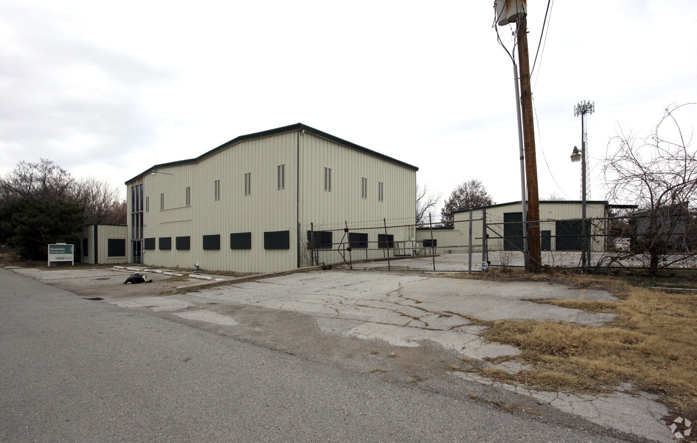
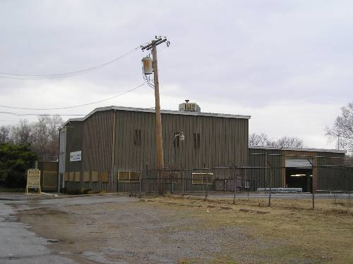
Property Record
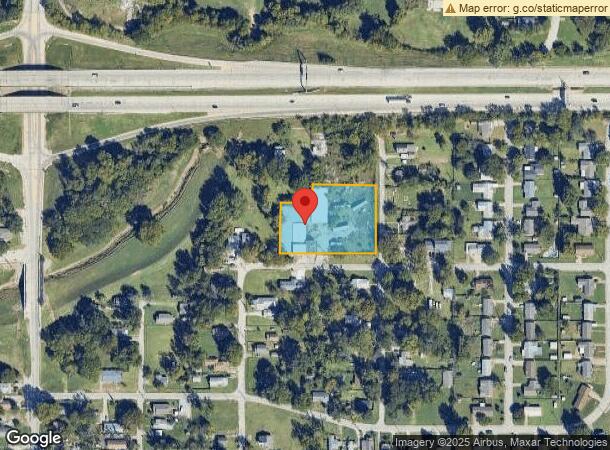
4631 W Reconciliation Way, Tulsa, OK 74127
NEARBY LISTINGS FOR SALE OR LEASE
Property Detail
4631 W Reconciliation Way
Tulsa, OK
Vern Hgts Sub
44650-92-04-12640
E102 LTS 39 & 40 & ALL LTS 43 THRU 45 BLK D
Lightindustrial
Tulsa
A
Oklahoma
40143C0220L
39
2023
1.42 AC
2024
West Tulsa
002900
Tulsa
22,310 SF
DEMOGRAPHICS near 4631 W Reconciliation Way
1 Mile
3 Mile
5 Mile
2024 Total Population
4,896
27,069
86,316
2029 Population
5,158
28,234
90,299
Pop Growth 2024-2029
+ 5.35%
+ 4.30%
+ 4.61%
Average Age
40
40
39
2024 Total Households
1,981
11,748
37,279
HH Growth 2024-2029
+ 5.40%
+ 4.48%
+ 4.86%
Median Household Inc
$37,540
$43,543
$46,880
Avg Household Size
2.30
2.10
2.20
2024 Avg HH Vehicles
2.00
2.00
2.00
Median Home Value
$64,431
$122,273
$145,311
Median Year Built
1954
1969
1959
Nearby Places
- Restaurants
- Banks
- Shops
- Fitness
- Groceries
PUBLIC TRANSPORTATION
AIRPORT
Tulsa International
DRIVE
WALK
Distance
Tulsa International
19 min
12.2 mi
Freight Ports
Tulsa Port Of Catoosa
DRIVE
WALK
Distance
Tulsa Port Of Catoosa
28 min
21.5 mi
SALE & LEASE HISTORY
LISTING DATE
SALE/LEASE

Sep 25, 2016
For Lease
Sep 23, 2016
For Sale
Nearby Properties
Address
Land Use
TOTAL SIZE
Lot Size
Zoning
Address
Land Use
TOTAL SIZE
Lot Size
Zoning
565,000 SF
10.62 AC
CBD
Address
Land Use
TOTAL SIZE
Lot Size
Zoning
249,092 SF
11.75 AC
CBD
Address
Land Use
TOTAL SIZE
Lot Size
Zoning
423,825 SF
23.97 AC
CBD
Address
Land Use
TOTAL SIZE
Lot Size
Zoning
483,697 SF
5.31 AC
CBD
Address
Land Use
TOTAL SIZE
Lot Size
Zoning
74,284 SF
3.60 AC
IM
Address
Land Use
TOTAL SIZE
Lot Size
Zoning
132,305 SF
2.07 AC
CBD
Address
Land Use
TOTAL SIZE
Lot Size
Zoning
124,033 SF
4.18 AC
CBD
Address
Land Use
TOTAL SIZE
Lot Size
Zoning
355,620 SF
4.78 AC
CBD
Address
Land Use
TOTAL SIZE
Lot Size
Zoning
315,434 SF
2.07 AC
CBD
Address
Land Use
TOTAL SIZE
Lot Size
Zoning
410,400 SF
1.76 AC
CBD
Address
Land Use
TOTAL SIZE
Lot Size
Zoning
236,413 SF
2.07 AC
CBD
Address
Land Use
TOTAL SIZE
Lot Size
Zoning
137,215 SF
5.08 AC
RM3
Address
Land Use
TOTAL SIZE
Lot Size
Zoning
84,560 SF
1.92 AC
CBD
Address
Land Use
TOTAL SIZE
Lot Size
Zoning
1,298,531 SF
2.49 AC
CBD
Address
Land Use
TOTAL SIZE
Lot Size
Zoning
157,736 SF
56.74 AC
RS3
Address
Land Use
TOTAL SIZE
Lot Size
Zoning
102,092 SF
0.96 AC
CBD
Address
Land Use
TOTAL SIZE
Lot Size
Zoning
86,881 SF
11.02 AC
IM
Address
Land Use
TOTAL SIZE
Lot Size
Zoning
54,684 SF
0.96 AC
CBD
Address
Land Use
TOTAL SIZE
Lot Size
Zoning
174,776 SF
9.46 AC
RM2
Address
Land Use
TOTAL SIZE
Lot Size
Zoning
342,608 SF
2.58 AC
CBD
Address
Land Use
TOTAL SIZE
Lot Size
Zoning
333,000 SF
1.28 AC
CBD
Address
Land Use
TOTAL SIZE
Lot Size
Zoning
66,355 SF
3.06 AC
CBD
Address
Land Use
TOTAL SIZE
Lot Size
Zoning
99,468 SF
1.10 AC
CBD
Address
Land Use
TOTAL SIZE
Lot Size
Zoning
497,385 SF
0.79 AC
CBD
Address
Land Use
TOTAL SIZE
Lot Size
Zoning
522,481 SF
2.07 AC
CBD
Address
Land Use
TOTAL SIZE
Lot Size
Zoning
1,096,890 SF
87.29 AC
IM
Address
Land Use
TOTAL SIZE
Lot Size
Zoning
32,827 SF
4.22 AC
CS
Address
Land Use
TOTAL SIZE
Lot Size
Zoning
84,400 SF
2.79 AC
CH
Address
Land Use
TOTAL SIZE
Lot Size
Zoning
21,715 SF
1.62 AC
CBD
The World's #1 Commercial Real Estate Marketplace
Connect with us
© 2025 CoStar Group
The information above has been obtained from sources believed reliable. While we do not doubt its accuracy we have not verified it and make no guarantee, warranty or representation about it. It is your responsibility to independently confirm its accuracy and completeness. Any projections, opinions, assumptions, or estimates used are for example only and do not represent the current or future performance of the property. The value of this transaction to you depends on tax and other factors which should be evaluated by your tax, financial, and legal advisors. You and your advisors should conduct a careful, independent investigation of the property to determine to your satisfaction the suitability of the property for your needs.