Property Record
4633 Main Ave, Ashtabula, OH 44004
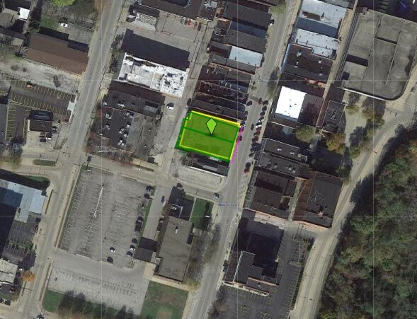
Property Detail
4633 Main Ave
052080000800
96 TOWNEXEMPT #1087
Commercialnec
ASHTABULA
B and X Area of moderate flood hazard, usually the area between the limits of the 100-year and 500-year floods.
Ohio
2024
0.15 AC
2024
Ashtabula County
000704
Cleveland
35,524 SF
Cleveland-Elyria, OH
NEARBY LISTINGS FOR SALE OR LEASE
DEMOGRAPHICS near 4633 Main Ave
1 mile
3 mile
5 mile
2025 Total Population
8,706
25,531
30,783
2030 Population
8,684
25,422
30,750
Pop Growth 2025-2030
(0.25%)
(0.43%)
(0.11%)
Average Age
39
41
42
2025 Total Households
3,700
10,882
13,150
HH Growth 2025-2030
(0.43%)
(0.56%)
(0.20%)
Median Household Inc
$42,301
$51,954
$54,224
Avg Household Size
2.20
2.20
2.20
2025 Avg HH Vehicles
1.00
2.00
2.00
Median Home Value
$77,299
$124,467
$138,914
Median Year Built
1951
1954
1956
Nearby Places
Map Layers
Map Styles
 Street
 Aerial
Transit
 Traffic
 Biking
Places
Listings with unknown addresses are not visible on the map
- Restaurants
- Banks
- Shops
- Fitness
- Groceries
PUBLIC TRANSPORTATION
AIRPORT
Erie International/Tom Ridge Field
Drive
Walk
Distance
Erie International/Tom Ridge Field
57 min
40.0 mi
Nearby Properties
Address
Land Use
TOTAL SIZE
Lot Size
Zoning
Address
Land Use
TOTAL SIZE
Lot Size
Zoning
311,348 SF
128.96 AC
Address
Land Use
TOTAL SIZE
Lot Size
Zoning
224,856 SF
79.47 AC
Address
Land Use
TOTAL SIZE
Lot Size
Zoning
297,379 SF
2.03 AC
Address
Land Use
TOTAL SIZE
Lot Size
Zoning
421,253 SF
260.15 AC
Address
Land Use
TOTAL SIZE
Lot Size
Zoning
98,137 SF
40.63 AC
Address
Land Use
TOTAL SIZE
Lot Size
Zoning
0.36 AC
Address
Land Use
TOTAL SIZE
Lot Size
Zoning
219,369 SF
21.87 AC
Address
Land Use
TOTAL SIZE
Lot Size
Zoning
417,667 SF
91.53 AC
Address
Land Use
TOTAL SIZE
Lot Size
Zoning
148,372 SF
18 AC
Address
Land Use
TOTAL SIZE
Lot Size
Zoning
302,473 SF
31.70 AC
Address
Land Use
TOTAL SIZE
Lot Size
Zoning
Address
Land Use
TOTAL SIZE
Lot Size
Zoning
116,000 SF
44.51 AC
Address
Land Use
TOTAL SIZE
Lot Size
Zoning
192,830 SF
9.09 AC
Address
Land Use
TOTAL SIZE
Lot Size
Zoning
7,882 SF
13.53 AC
Address
Land Use
TOTAL SIZE
Lot Size
Zoning
21,988 SF
4.49 AC
Address
Land Use
TOTAL SIZE
Lot Size
Zoning
683,606 SF
61.73 AC
Address
Land Use
TOTAL SIZE
Lot Size
Zoning
59,222 SF
6.76 AC
Address
Land Use
TOTAL SIZE
Lot Size
Zoning
252,612 SF
20.47 AC
Address
Land Use
TOTAL SIZE
Lot Size
Zoning
21,912 SF
1.47 AC
Address
Land Use
TOTAL SIZE
Lot Size
Zoning
30,530 SF
2.72 AC
Address
Land Use
TOTAL SIZE
Lot Size
Zoning
25,607 SF
1.56 AC
Address
Land Use
TOTAL SIZE
Lot Size
Zoning
2.13 AC
Address
Land Use
TOTAL SIZE
Lot Size
Zoning
30,642 SF
0.12 AC
Address
Land Use
TOTAL SIZE
Lot Size
Zoning
119,090 SF
8.49 AC
Address
Land Use
TOTAL SIZE
Lot Size
Zoning
116,093 SF
28.16 AC
Address
Land Use
TOTAL SIZE
Lot Size
Zoning
26,026 SF
2.08 AC
Address
Land Use
TOTAL SIZE
Lot Size
Zoning
60,687 SF
3.91 AC
Address
Land Use
TOTAL SIZE
Lot Size
Zoning
40,222 SF
3.03 AC
Address
Land Use
TOTAL SIZE
Lot Size
Zoning
50,596 SF
42.10 AC
Address
Land Use
TOTAL SIZE
Lot Size
Zoning
The World's #1 Commercial Real Estate Marketplace
Connect with us
© 2026 CoStar Group
The information above has been obtained from sources believed reliable. While we do not doubt its accuracy we have not verified it and make no guarantee, warranty or representation about it. It is your responsibility to independently confirm its accuracy and completeness. Any projections, opinions, assumptions, or estimates used are for example only and do not represent the current or future performance of the property. The value of this transaction to you depends on tax and other factors which should be evaluated by your tax, financial, and legal advisors. You and your advisors should conduct a careful, independent investigation of the property to determine to your satisfaction the suitability of the property for your needs.