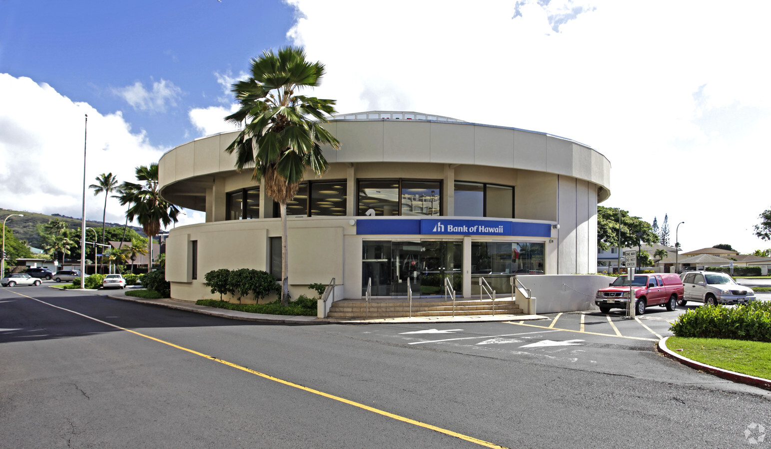
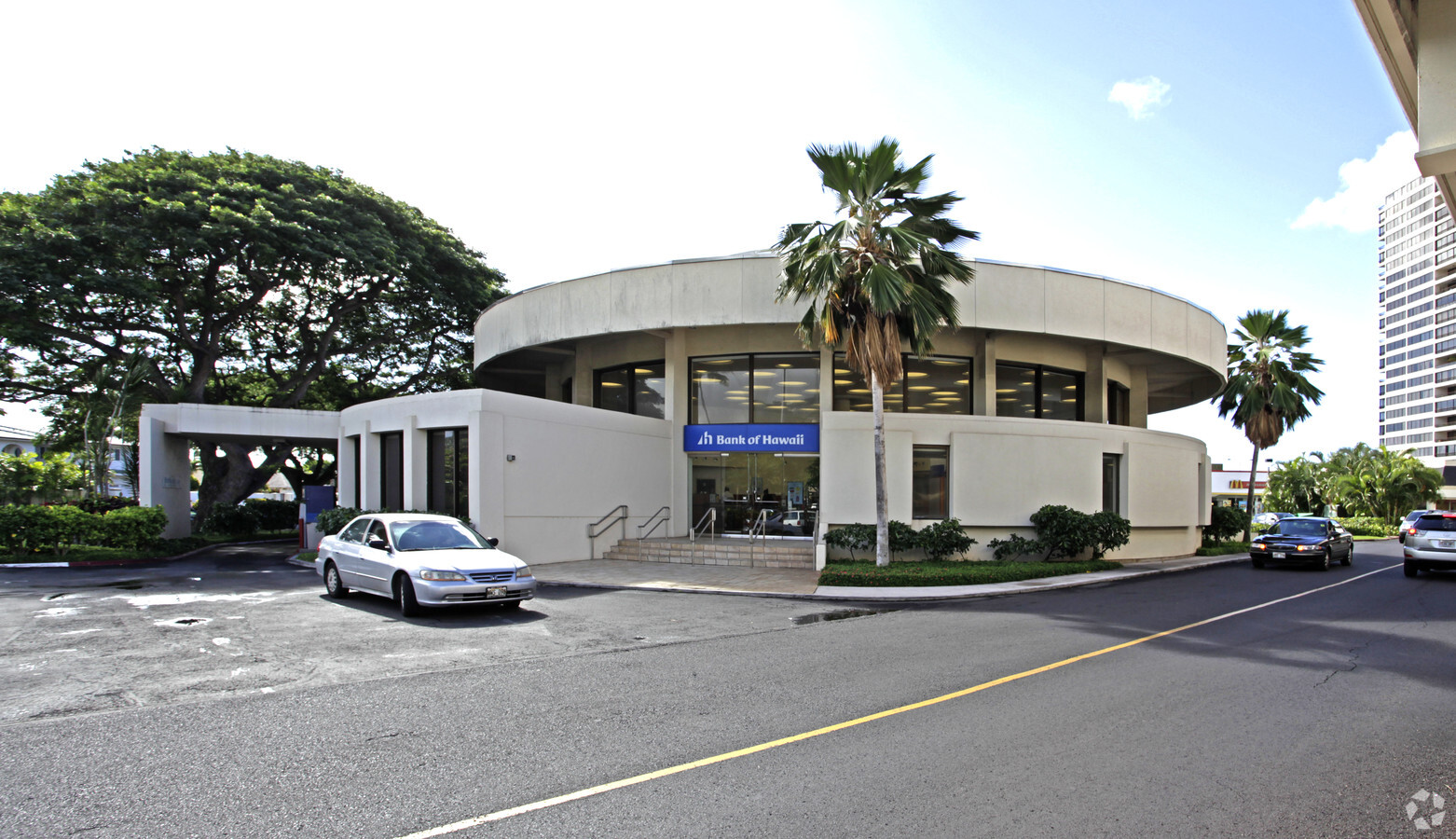
Property Record
4634 Kilauea Ave, Honolulu, HI 96816
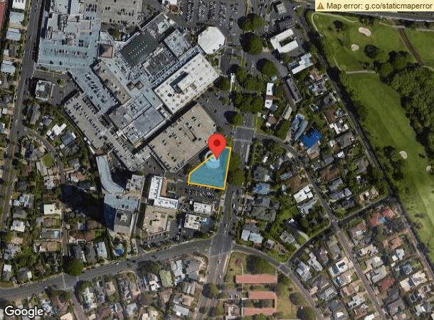
NEARBY LISTINGS FOR SALE OR LEASE
Property Detail
4634 Kilauea Ave
Urban Honolulu, HI
Waialae Beach Lts
1-3-5-016-013-0000
LOT 4 POR LCAW 7713:50 BLK 17 TRACT B WAIALAE NEIGHBORHOOD 27,725 SF DES
Commercialnec
Honolulu
X
Hawaii
15003C0369H
4
2024
0.64 AC
2024
East Oahu
000500
Hawaii
7,547 SF
DEMOGRAPHICS near 4634 Kilauea Ave
1 Mile
3 Mile
5 Mile
2024 Total Population
19,583
122,368
244,241
2029 Population
19,202
121,274
243,266
Pop Growth 2024-2029
(1.95%)
(0.89%)
(0.40%)
Average Age
47
45
45
2024 Total Households
6,777
48,829
106,313
HH Growth 2024-2029
(2.73%)
(0.93%)
(0.54%)
Median Household Inc
$127,259
$84,751
$79,013
Avg Household Size
2.70
2.30
2.20
2024 Avg HH Vehicles
2.00
2.00
1.00
Median Home Value
$1,084,680
$963,442
$837,641
Median Year Built
1963
1969
1972
Nearby Places
- Restaurants
- Banks
- Shops
- Fitness
- Groceries
PUBLIC TRANSPORTATION
AIRPORT
Daniel K Inouye International
DRIVE
WALK
Distance
Daniel K Inouye International
20 min
11.2 mi
Freight Ports
Honolulu Harbor, Oahu
DRIVE
WALK
Distance
Honolulu Harbor, Oahu
22 min
11.1 mi
Nearby Properties
Address
Land Use
TOTAL SIZE
Lot Size
Zoning
Address
Land Use
TOTAL SIZE
Lot Size
Zoning
264,870 SF
3.47 AC
U/X6/20
Address
Land Use
TOTAL SIZE
Lot Size
Zoning
193,478 SF
10.34 AC
U/X6/20
Address
Land Use
TOTAL SIZE
Lot Size
Zoning
292,691 SF
1.09 AC
U/X6/20
Address
Land Use
TOTAL SIZE
Lot Size
Zoning
164,234 SF
2.56 AC
U/X6/20
Address
Land Use
TOTAL SIZE
Lot Size
Zoning
471,798 SF
6.31 AC
U/X5/30
Address
Land Use
TOTAL SIZE
Lot Size
Zoning
107,721 SF
2.76 AC
U/X6/20
Address
Land Use
TOTAL SIZE
Lot Size
Zoning
103,284 SF
1.84 AC
U/X6/20
Address
Land Use
TOTAL SIZE
Lot Size
Zoning
242,241 SF
2.40 AC
U/X6/20
Address
Land Use
TOTAL SIZE
Lot Size
Zoning
64,300 SF
0.77 AC
U/X6/20
Address
Land Use
TOTAL SIZE
Lot Size
Zoning
206,214 SF
6.48 AC
U/21/20
Address
Land Use
TOTAL SIZE
Lot Size
Zoning
144,855 SF
1.74 AC
U/X6/20
Address
Land Use
TOTAL SIZE
Lot Size
Zoning
139,740 SF
2.82 AC
U/X6/20
Address
Land Use
TOTAL SIZE
Lot Size
Zoning
92,885 SF
1.18 AC
U/X6/20
Address
Land Use
TOTAL SIZE
Lot Size
Zoning
79,613 SF
1.33 AC
U/X6/20
Address
Land Use
TOTAL SIZE
Lot Size
Zoning
240,702 SF
2.60 AC
U/X6/20
Address
Land Use
TOTAL SIZE
Lot Size
Zoning
22.36 AC
U/X7/70
Address
Land Use
TOTAL SIZE
Lot Size
Zoning
113,864 SF
1.47 AC
U/X5/30
Address
Land Use
TOTAL SIZE
Lot Size
Zoning
1.50 AC
U/X7/90
Address
Land Use
TOTAL SIZE
Lot Size
Zoning
251,612 SF
1.27 AC
U/X2/12
Address
Land Use
TOTAL SIZE
Lot Size
Zoning
134,796 SF
0.94 AC
U/X1/12
Address
Land Use
TOTAL SIZE
Lot Size
Zoning
169,300 SF
2.87 AC
U/X5/30
Address
Land Use
TOTAL SIZE
Lot Size
Zoning
825,841 SF
20.25 AC
U/32/30
Address
Land Use
TOTAL SIZE
Lot Size
Zoning
83,189 SF
1.33 AC
U/X6/20
Address
Land Use
TOTAL SIZE
Lot Size
Zoning
168,546 SF
1.17 AC
U/X6/20
Address
Land Use
TOTAL SIZE
Lot Size
Zoning
1.04 AC
U/X7/90
Address
Land Use
TOTAL SIZE
Lot Size
Zoning
83,709 SF
0.68 AC
U/X5/30
Address
Land Use
TOTAL SIZE
Lot Size
Zoning
97,054 SF
0.93 AC
U/X6/20
Address
Land Use
TOTAL SIZE
Lot Size
Zoning
72,783 SF
0.58 AC
U/X6/20
Address
Land Use
TOTAL SIZE
Lot Size
Zoning
70,128 SF
0.83 AC
U/X6/20
Address
Land Use
TOTAL SIZE
Lot Size
Zoning
7.27 AC
U/62/90
The World's #1 Commercial Real Estate Marketplace
Connect with us
© 2025 CoStar Group
The information above has been obtained from sources believed reliable. While we do not doubt its accuracy we have not verified it and make no guarantee, warranty or representation about it. It is your responsibility to independently confirm its accuracy and completeness. Any projections, opinions, assumptions, or estimates used are for example only and do not represent the current or future performance of the property. The value of this transaction to you depends on tax and other factors which should be evaluated by your tax, financial, and legal advisors. You and your advisors should conduct a careful, independent investigation of the property to determine to your satisfaction the suitability of the property for your needs.