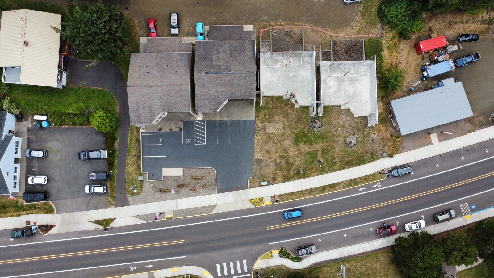
Property Record
470 Highway 101 N, Yachats, OR 97498
NEARBY LISTINGS FOR SALE OR LEASE
-
-
View all Yachats listings for sale on LoopNet.com
Property Detail
470 Highway 101 N
Newport, OR
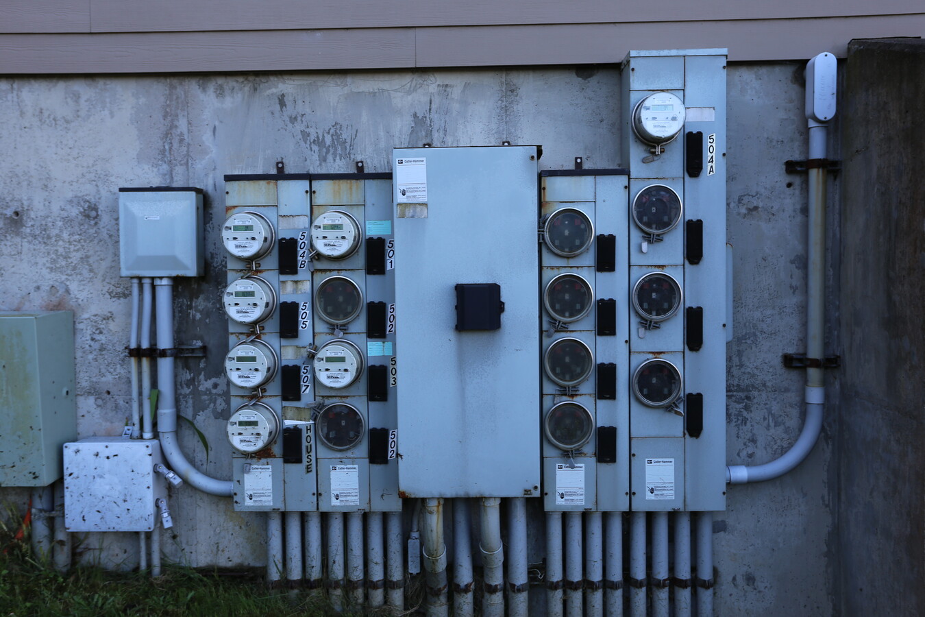
Overlook Addn. To Yachats
R27823
SEA CREST BLOCKS (ORIG 14), BLOCK 1, LOT 12, DOC202013454
Commercialnec
Lincoln
X
Oregon
41039C0025G
12
2024
0.20 AC
2024
Oregon West Area
951000
Other Market Areas
2,656 SF
DEMOGRAPHICS near 470 Highway 101 N
1 Mile
3 Mile
5 Mile
2024 Total Population
1,383
2,271
2,588
2029 Population
1,464
2,400
2,737
Pop Growth 2024-2029
+ 5.86%
+ 5.68%
+ 5.76%
Average Age
50
51
50
2024 Total Households
640
1,062
1,196
HH Growth 2024-2029
+ 5.94%
+ 5.74%
+ 5.77%
Median Household Inc
$61,012
$60,560
$61,282
Avg Household Size
1.90
1.90
1.90
2024 Avg HH Vehicles
2.00
2.00
2.00
Median Home Value
$525,974
$514,706
$521,612
Median Year Built
1976
1976
1976
Nearby Places
- Restaurants
- Banks
- Shops
- Fitness
- Groceries
SALE & LEASE HISTORY
LISTING DATE
SALE/LEASE

Sep 22, 2020
For Sale
Mar 01, 2018
For Sale
Dec 15, 2021
For Sale
Nearby Properties
Address
Land Use
TOTAL SIZE
Lot Size
Zoning
Address
Land Use
TOTAL SIZE
Lot Size
Zoning
107,084 SF
8.91 AC
R-4
Address
Land Use
TOTAL SIZE
Lot Size
Zoning
50,252 SF
3.55 AC
R-4
Address
Land Use
TOTAL SIZE
Lot Size
Zoning
12,023 SF
1.60 AC
R-3
Address
Land Use
TOTAL SIZE
Lot Size
Zoning
4,780 SF
1.26 AC
PF
Address
Land Use
TOTAL SIZE
Lot Size
Zoning
19,870 SF
3.47 AC
R-4
Address
Land Use
TOTAL SIZE
Lot Size
Zoning
18.94 AC
R-1,SR
Address
Land Use
TOTAL SIZE
Lot Size
Zoning
1,800 SF
3,556.28 AC
T-C
Address
Land Use
TOTAL SIZE
Lot Size
Zoning
14,478 SF
3.04 AC
RR-2,DR
Address
Land Use
TOTAL SIZE
Lot Size
Zoning
0.92 AC
R-2
Address
Land Use
TOTAL SIZE
Lot Size
Zoning
28,902 SF
1.35 AC
R-3
Address
Land Use
TOTAL SIZE
Lot Size
Zoning
9,939 SF
0.65 AC
R-4
Address
Land Use
TOTAL SIZE
Lot Size
Zoning
14,604 SF
1.86 AC
PF
Address
Land Use
TOTAL SIZE
Lot Size
Zoning
28,902 SF
0.89 AC
R-3
Address
Land Use
TOTAL SIZE
Lot Size
Zoning
7,556 SF
0.55 AC
C-1
Address
Land Use
TOTAL SIZE
Lot Size
Zoning
6,400 SF
T-C
Address
Land Use
TOTAL SIZE
Lot Size
Zoning
4,255 SF
0.23 AC
C-1
Address
Land Use
TOTAL SIZE
Lot Size
Zoning
5,154 SF
0.39 AC
C-1
Address
Land Use
TOTAL SIZE
Lot Size
Zoning
3.45 AC
RR-2,DR
Address
Land Use
TOTAL SIZE
Lot Size
Zoning
3,784 SF
6.16 AC
R-4
Address
Land Use
TOTAL SIZE
Lot Size
Zoning
1,508 SF
4.20 AC
RR-2,DR
Address
Land Use
TOTAL SIZE
Lot Size
Zoning
7,360 SF
0.23 AC
C-1
Address
Land Use
TOTAL SIZE
Lot Size
Zoning
3,312 SF
0.30 AC
C-1
Address
Land Use
TOTAL SIZE
Lot Size
Zoning
1,792 SF
0.11 AC
R-1
Address
Land Use
TOTAL SIZE
Lot Size
Zoning
8,722 SF
0.76 AC
C-1
Address
Land Use
TOTAL SIZE
Lot Size
Zoning
4,235 SF
0.46 AC
C-1
Address
Land Use
TOTAL SIZE
Lot Size
Zoning
6,868 SF
1.53 AC
R-1,SR
Address
Land Use
TOTAL SIZE
Lot Size
Zoning
2,006 SF
0.16 AC
C-1
Address
Land Use
TOTAL SIZE
Lot Size
Zoning
2,864 SF
0.27 AC
C-1
Address
Land Use
TOTAL SIZE
Lot Size
Zoning
27.91 AC
RR-2,DR
Address
Land Use
TOTAL SIZE
Lot Size
Zoning
4,622 SF
1.99 AC
C-T
The World's #1 Commercial Real Estate Marketplace
Connect with us
© 2025 CoStar Group
The information above has been obtained from sources believed reliable. While we do not doubt its accuracy we have not verified it and make no guarantee, warranty or representation about it. It is your responsibility to independently confirm its accuracy and completeness. Any projections, opinions, assumptions, or estimates used are for example only and do not represent the current or future performance of the property. The value of this transaction to you depends on tax and other factors which should be evaluated by your tax, financial, and legal advisors. You and your advisors should conduct a careful, independent investigation of the property to determine to your satisfaction the suitability of the property for your needs.