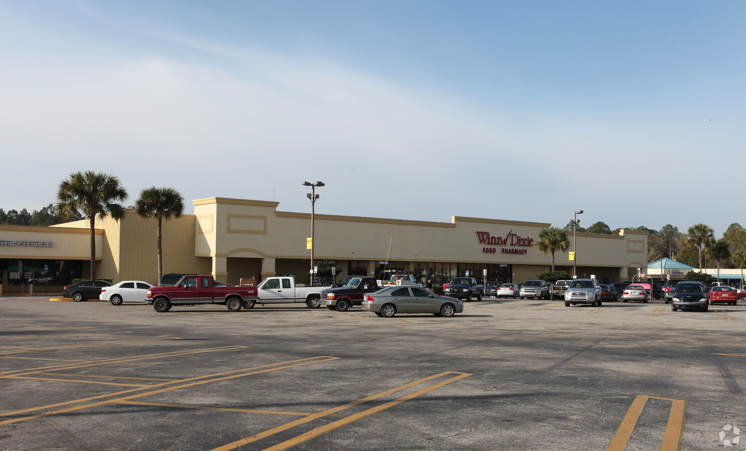
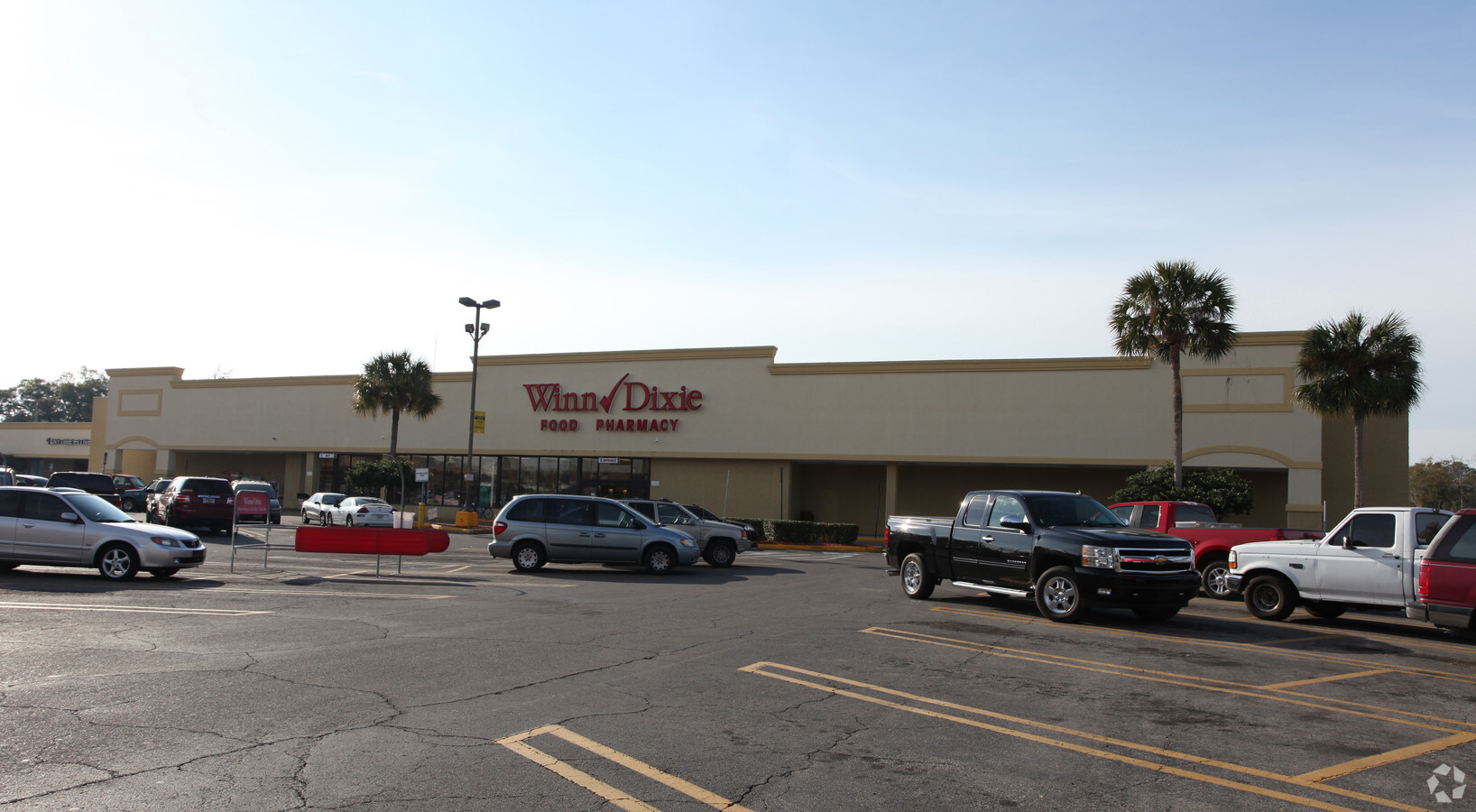
Property Record
470 W Madison St, Starke, FL 32091

NEARBY LISTINGS FOR SALE OR LEASE
Property Detail
470 W Madison St
Supermarket
28 6S 22 COM INT S R/W MADISON ST & W R/W BAY ST. S25*W 462.53 TO N R/W LAFAYETTE ST. W152.34 TO POB. W242.81 TO E R/W ORANGE ST. N1*W 333.45, N285.18, N52*E 6.18 TO S R/W MADISON ST. E35.06, S71*E 162.36, S23*E 6.67, N24*E 5, S71*E 40.25, S24*W 10,
X
Bradford
12007C0203F
Florida
2024
4.07 AC
2024
Florida Central North Area
000201
Other Market Areas
64,054 SF
03185-0-00000
DEMOGRAPHICS near 470 W Madison St
1 Mile
3 Mile
5 Mile
2024 Total Population
3,924
9,750
13,070
2029 Population
4,097
10,190
13,631
Pop Growth 2024-2029
+ 4.41%
+ 4.51%
+ 4.29%
Average Age
41
41
41
2024 Total Households
1,520
3,707
4,932
HH Growth 2024-2029
+ 3.62%
+ 3.75%
+ 3.63%
Median Household Inc
$41,933
$45,109
$46,014
Avg Household Size
2.50
2.50
2.50
2024 Avg HH Vehicles
2.00
2.00
2.00
Median Home Value
$118,328
$124,499
$125,942
Median Year Built
1977
1981
1983
Nearby Places
- Restaurants
- Banks
- Shops
- Fitness
- Groceries
PUBLIC TRANSPORTATION
AIRPORT
Gainesville Regional
DRIVE
WALK
Distance
Gainesville Regional
37 min
23.7 mi
Freight Ports
Jacksonville Port
DRIVE
WALK
Distance
Jacksonville Port
66 min
49.1 mi
Nearby Properties
Address
Land Use
TOTAL SIZE
Lot Size
Zoning
Address
Land Use
TOTAL SIZE
Lot Size
Zoning
168,336 SF
23.97 AC
Address
Land Use
TOTAL SIZE
Lot Size
Zoning
96,617 SF
11 AC
Address
Land Use
TOTAL SIZE
Lot Size
Zoning
63,568 SF
8.54 AC
Address
Land Use
TOTAL SIZE
Lot Size
Zoning
117,119 SF
30.15 AC
Address
Land Use
TOTAL SIZE
Lot Size
Zoning
74,461 SF
7.92 AC
Address
Land Use
TOTAL SIZE
Lot Size
Zoning
119,949 SF
5.50 AC
Address
Land Use
TOTAL SIZE
Lot Size
Zoning
69,258 SF
10 AC
Address
Land Use
TOTAL SIZE
Lot Size
Zoning
111,635 SF
44.63 AC
Address
Land Use
TOTAL SIZE
Lot Size
Zoning
35,032 SF
8.75 AC
Address
Land Use
TOTAL SIZE
Lot Size
Zoning
30,963 SF
7.47 AC
Address
Land Use
TOTAL SIZE
Lot Size
Zoning
42,534 SF
1.86 AC
Address
Land Use
TOTAL SIZE
Lot Size
Zoning
47,283 SF
5.70 AC
Address
Land Use
TOTAL SIZE
Lot Size
Zoning
24,370 SF
1.27 AC
Address
Land Use
TOTAL SIZE
Lot Size
Zoning
38,431 SF
13.76 AC
Address
Land Use
TOTAL SIZE
Lot Size
Zoning
51,918 SF
7.97 AC
Address
Land Use
TOTAL SIZE
Lot Size
Zoning
65,461 SF
8 AC
Address
Land Use
TOTAL SIZE
Lot Size
Zoning
23,225 SF
4.81 AC
Address
Land Use
TOTAL SIZE
Lot Size
Zoning
29,120 SF
3.26 AC
Address
Land Use
TOTAL SIZE
Lot Size
Zoning
104,030 SF
24.65 AC
Address
Land Use
TOTAL SIZE
Lot Size
Zoning
7,572 SF
1.32 AC
Address
Land Use
TOTAL SIZE
Lot Size
Zoning
15,287 SF
1.54 AC
Address
Land Use
TOTAL SIZE
Lot Size
Zoning
16,274 SF
1.51 AC
Address
Land Use
TOTAL SIZE
Lot Size
Zoning
63.28 AC
Address
Land Use
TOTAL SIZE
Lot Size
Zoning
22,052 SF
2.67 AC
Address
Land Use
TOTAL SIZE
Lot Size
Zoning
35,950 SF
2.76 AC
Address
Land Use
TOTAL SIZE
Lot Size
Zoning
7,490 SF
18.84 AC
Address
Land Use
TOTAL SIZE
Lot Size
Zoning
14,806 SF
6.80 AC
Address
Land Use
TOTAL SIZE
Lot Size
Zoning
45,056 SF
5.30 AC
Address
Land Use
TOTAL SIZE
Lot Size
Zoning
23,899 SF
6.05 AC
The World's #1 Commercial Real Estate Marketplace
Connect with us
© 2025 CoStar Group
The information above has been obtained from sources believed reliable. While we do not doubt its accuracy we have not verified it and make no guarantee, warranty or representation about it. It is your responsibility to independently confirm its accuracy and completeness. Any projections, opinions, assumptions, or estimates used are for example only and do not represent the current or future performance of the property. The value of this transaction to you depends on tax and other factors which should be evaluated by your tax, financial, and legal advisors. You and your advisors should conduct a careful, independent investigation of the property to determine to your satisfaction the suitability of the property for your needs.