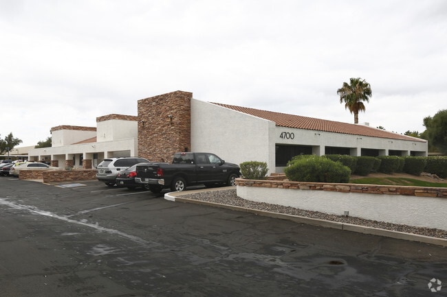
Property Record
4700 S Mill Ave, Tempe, AZ 85282


NEARBY LISTINGS FOR SALE OR LEASE
Property Detail
4700 S Mill Ave
Phoenix-Mesa-Scottsdale, AZ
Superstition Business Park
133-41-630D
SUPERSTITION BUSINESS PARK MCR 224-30
Officebuilding
Maricopa
X
Arizona
04013C2240M
22
2025
1.22 AC
2025
Tempe
319801
Phoenix
12,400 SF
DEMOGRAPHICS near 4700 S Mill Ave
1 Mile
3 Mile
5 Mile
2024 Total Population
21,728
149,599
327,619
2029 Population
23,407
160,833
353,442
Pop Growth 2024-2029
+ 7.73%
+ 7.51%
+ 7.88%
Average Age
34
35
36
2024 Total Households
9,286
59,896
134,724
HH Growth 2024-2029
+ 7.86%
+ 7.87%
+ 8.17%
Median Household Inc
$59,979
$65,055
$68,804
Avg Household Size
2.20
2.30
2.30
2024 Avg HH Vehicles
2.00
2.00
2.00
Median Home Value
$324,139
$365,547
$365,641
Median Year Built
1979
1980
1983
Nearby Places
Map Layers
Map Styles
 Street
 Aerial
- Restaurants
- Banks
- Shops
- Fitness
- Groceries
PUBLIC TRANSPORTATION
AIRPORT
Phoenix Sky Harbor International
DRIVE
WALK
Distance
Phoenix Sky Harbor International
14 min
7.8 mi
Phoenix-Mesa Gateway
DRIVE
WALK
Distance
Phoenix-Mesa Gateway
32 min
21.7 mi
SALE & LEASE HISTORY
LISTING DATE
SALE/LEASE

Nov 12, 2019
For Lease
Nov 06, 2018
For Lease
Jan 11, 2017
For Lease
Apr 27, 2017
For Lease
Nearby Properties
Address
Land Use
TOTAL SIZE
Lot Size
Zoning
Address
Land Use
TOTAL SIZE
Lot Size
Zoning
12.93 AC
I-P
Address
Land Use
TOTAL SIZE
Lot Size
Zoning
2,089,643 SF
33.80 AC
MU-ED
Address
Land Use
TOTAL SIZE
Lot Size
Zoning
1,227,029 SF
7.39 AC
R-6
Address
Land Use
TOTAL SIZE
Lot Size
Zoning
1,056,321 SF
35.93 AC
R1-6
Address
Land Use
TOTAL SIZE
Lot Size
Zoning
5.13 AC
Address
Land Use
TOTAL SIZE
Lot Size
Zoning
1,102,629 SF
12.33 AC
R-3
Address
Land Use
TOTAL SIZE
Lot Size
Zoning
1,479,006 SF
84.96 AC
C-R
Address
Land Use
TOTAL SIZE
Lot Size
Zoning
2.54 AC
Address
Land Use
TOTAL SIZE
Lot Size
Zoning
571,804 SF
0.98 AC
CSS
Address
Land Use
TOTAL SIZE
Lot Size
Zoning
1,020,776 SF
11.33 AC
I-1
Address
Land Use
TOTAL SIZE
Lot Size
Zoning
331,050 SF
39 AC
I-1
Address
Land Use
TOTAL SIZE
Lot Size
Zoning
32,968 SF
2.10 AC
I-P
Address
Land Use
TOTAL SIZE
Lot Size
Zoning
548,227 SF
1.62 AC
C-G
Address
Land Use
TOTAL SIZE
Lot Size
Zoning
746,457 SF
20.95 AC
I-1
Address
Land Use
TOTAL SIZE
Lot Size
Zoning
352,244 SF
5.55 AC
R-6
Address
Land Use
TOTAL SIZE
Lot Size
Zoning
368,727 SF
12.77 AC
R1-6
Address
Land Use
TOTAL SIZE
Lot Size
Zoning
654,960 SF
19.48 AC
R-6
Address
Land Use
TOTAL SIZE
Lot Size
Zoning
474,335 SF
9.54 AC
R-3
Address
Land Use
TOTAL SIZE
Lot Size
Zoning
683,623 SF
1.80 AC
PAD
Address
Land Use
TOTAL SIZE
Lot Size
Zoning
235,587 SF
0.59 AC
C-C
Address
Land Use
TOTAL SIZE
Lot Size
Zoning
17,700 SF
0.69 AC
CC
Address
Land Use
TOTAL SIZE
Lot Size
Zoning
570,209 SF
1.86 AC
C-C
Address
Land Use
TOTAL SIZE
Lot Size
Zoning
694,867 SF
4.32 AC
C-C
Address
Land Use
TOTAL SIZE
Lot Size
Zoning
1,107,057 SF
2.38 AC
PAD
Address
Land Use
TOTAL SIZE
Lot Size
Zoning
586,083 SF
69.82 AC
Address
Land Use
TOTAL SIZE
Lot Size
Zoning
378,731 SF
8.68 AC
I-1
Address
Land Use
TOTAL SIZE
Lot Size
Zoning
573,715 SF
3.37 AC
MU4
Address
Land Use
TOTAL SIZE
Lot Size
Zoning
459,103 SF
13.27 AC
MU4
Address
Land Use
TOTAL SIZE
Lot Size
Zoning
562,356 SF
6.70 AC
MU4
Address
Land Use
TOTAL SIZE
Lot Size
Zoning
256,185 SF
1.89 AC
CSS
The World's #1 Commercial Real Estate Marketplace
Connect with us
© 2025 CoStar Group
The information above has been obtained from sources believed reliable. While we do not doubt its accuracy we have not verified it and make no guarantee, warranty or representation about it. It is your responsibility to independently confirm its accuracy and completeness. Any projections, opinions, assumptions, or estimates used are for example only and do not represent the current or future performance of the property. The value of this transaction to you depends on tax and other factors which should be evaluated by your tax, financial, and legal advisors. You and your advisors should conduct a careful, independent investigation of the property to determine to your satisfaction the suitability of the property for your needs.