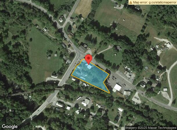
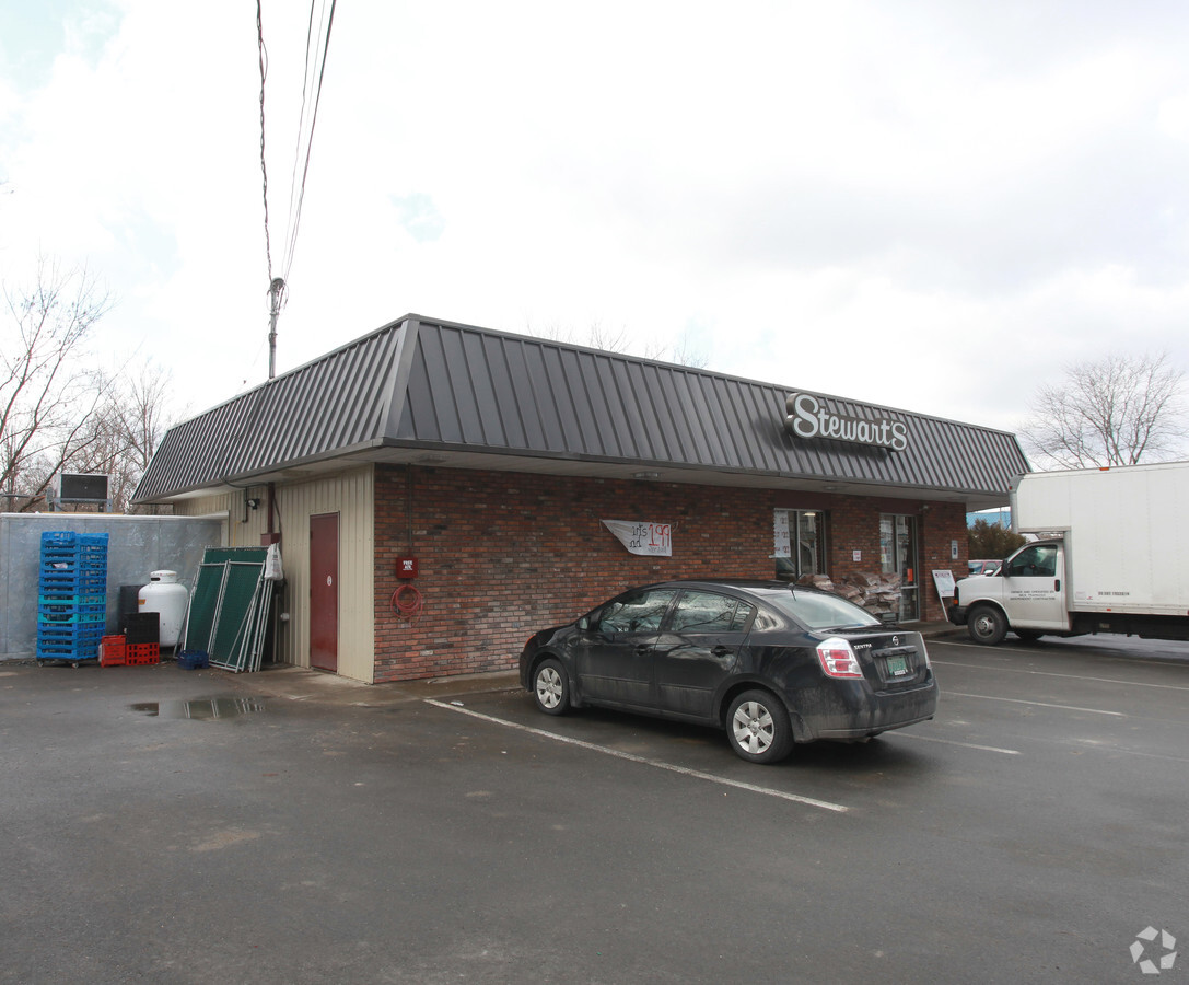
Property Record
4702 State Route 67, Hoosick Falls, NY 12090

NEARBY LISTINGS FOR SALE OR LEASE
Property Detail
4702 State Route 67
2889-017.2-5-1
25%OF 23000
Servicestationmarket
Rensselaer
X
New York
36083C0087D
1.000
2023
1.41 AC
2023
Outer Rensselaer County
051702
Albany/Schenectady/Troy
3,500 SF
Albany-Schenectady-Troy, NY
DEMOGRAPHICS near 4702 State Route 67
1 Mile
3 Mile
5 Mile
2024 Total Population
363
4,861
8,133
2029 Population
354
4,803
8,018
Pop Growth 2024-2029
(2.48%)
(1.19%)
(1.41%)
Average Age
45
43
43
2024 Total Households
145
2,008
3,188
HH Growth 2024-2029
(2.76%)
(1.29%)
(1.57%)
Median Household Inc
$58,181
$53,862
$58,153
Avg Household Size
2.50
2.30
2.40
2024 Avg HH Vehicles
2.00
2.00
2.00
Median Home Value
$252,941
$165,728
$186,941
Median Year Built
1969
1949
1954
Nearby Places
- Restaurants
- Banks
- Shops
- Fitness
- Groceries
PUBLIC TRANSPORTATION
AIRPORT
Albany International
DRIVE
WALK
Distance
Albany International
56 min
34.8 mi
Freight Ports
Albany, NY Port
DRIVE
WALK
Distance
Albany, NY Port
61 min
37.5 mi
Nearby Properties
Address
Land Use
TOTAL SIZE
Lot Size
Zoning
Address
Land Use
TOTAL SIZE
Lot Size
Zoning
32,656 SF
2.35 AC
Address
Land Use
TOTAL SIZE
Lot Size
Zoning
3,850 SF
3.28 AC
Address
Land Use
TOTAL SIZE
Lot Size
Zoning
29,112 SF
2.49 AC
Address
Land Use
TOTAL SIZE
Lot Size
Zoning
91,154 SF
11.40 AC
Address
Land Use
TOTAL SIZE
Lot Size
Zoning
22,036 SF
2.71 AC
Address
Land Use
TOTAL SIZE
Lot Size
Zoning
50,928 SF
6.44 AC
Address
Land Use
TOTAL SIZE
Lot Size
Zoning
21,500 SF
12.03 AC
Address
Land Use
TOTAL SIZE
Lot Size
Zoning
Address
Land Use
TOTAL SIZE
Lot Size
Zoning
989.50 AC
Address
Land Use
TOTAL SIZE
Lot Size
Zoning
9,360 SF
1.59 AC
Address
Land Use
TOTAL SIZE
Lot Size
Zoning
25,600 SF
3.23 AC
Address
Land Use
TOTAL SIZE
Lot Size
Zoning
11,832 SF
0.90 AC
Address
Land Use
TOTAL SIZE
Lot Size
Zoning
22,780 SF
20.11 AC
Address
Land Use
TOTAL SIZE
Lot Size
Zoning
19,064 SF
2.13 AC
Address
Land Use
TOTAL SIZE
Lot Size
Zoning
85,712 SF
10.40 AC
Address
Land Use
TOTAL SIZE
Lot Size
Zoning
11,000 SF
0.90 AC
Address
Land Use
TOTAL SIZE
Lot Size
Zoning
23,726 SF
7.95 AC
Address
Land Use
TOTAL SIZE
Lot Size
Zoning
Address
Land Use
TOTAL SIZE
Lot Size
Zoning
Address
Land Use
TOTAL SIZE
Lot Size
Zoning
5,674 SF
3.55 AC
Address
Land Use
TOTAL SIZE
Lot Size
Zoning
8,112 SF
3.41 AC
Address
Land Use
TOTAL SIZE
Lot Size
Zoning
9,012 SF
0.80 AC
Address
Land Use
TOTAL SIZE
Lot Size
Zoning
7,707 SF
3.19 AC
Address
Land Use
TOTAL SIZE
Lot Size
Zoning
118,563 SF
27.76 AC
Address
Land Use
TOTAL SIZE
Lot Size
Zoning
4,474 SF
288.92 AC
Address
Land Use
TOTAL SIZE
Lot Size
Zoning
3,119 SF
42.20 AC
Address
Land Use
TOTAL SIZE
Lot Size
Zoning
8,059 SF
167.30 AC
Address
Land Use
TOTAL SIZE
Lot Size
Zoning
8,770 SF
1.19 AC
Address
Land Use
TOTAL SIZE
Lot Size
Zoning
11,468 SF
2.13 AC
The World's #1 Commercial Real Estate Marketplace
Connect with us
© 2025 CoStar Group
The information above has been obtained from sources believed reliable. While we do not doubt its accuracy we have not verified it and make no guarantee, warranty or representation about it. It is your responsibility to independently confirm its accuracy and completeness. Any projections, opinions, assumptions, or estimates used are for example only and do not represent the current or future performance of the property. The value of this transaction to you depends on tax and other factors which should be evaluated by your tax, financial, and legal advisors. You and your advisors should conduct a careful, independent investigation of the property to determine to your satisfaction the suitability of the property for your needs.