Property Record
4739 E Lewis Ave, Phoenix, AZ 85008
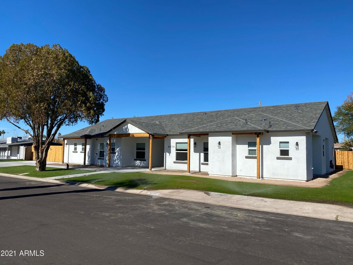

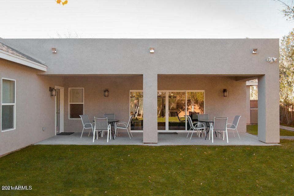
This Property Is For Sale
NEARBY LISTINGS FOR SALE OR LEASE
Property Detail
4739 E Lewis Ave
Phoenix-Mesa-Scottsdale, AZ
Rancho Ventura Tr 24
126-12-046
Maricopa
Sfr
Arizona
X
0.26 AC
04013C2230M
44th Street Corridor
2,440 SF
Phoenix
DEMOGRAPHICS near 4739 E Lewis Ave
1 Mile
3 Mile
5 Mile
2024 Total Population
20,239
129,932
314,005
2029 Population
22,050
141,631
343,719
Pop Growth 2024-2029
+ 8.95%
+ 9.00%
+ 9.46%
Average Age
36
37
38
2024 Total Households
8,829
55,286
141,631
HH Growth 2024-2029
+ 9.14%
+ 9.19%
+ 9.84%
Median Household Inc
$60,217
$66,150
$69,238
Avg Household Size
2.30
2.30
2.10
2024 Avg HH Vehicles
2.00
2.00
2.00
Median Home Value
$474,643
$496,831
$472,604
Median Year Built
1976
1973
1976
Nearby Places
- Restaurants
- Banks
- Shops
- Fitness
- Groceries
PUBLIC TRANSPORTATION
AIRPORT
Phoenix Sky Harbor International
DRIVE
WALK
Distance
Phoenix Sky Harbor International
9 min
4.7 mi
Phoenix-Mesa Gateway
DRIVE
WALK
Distance
Phoenix-Mesa Gateway
43 min
29.8 mi
Freight Ports
Port of San Diego
DRIVE
WALK
Distance
Port of San Diego
403 min
361.3 mi
Nearby Properties
Address
Land Use
TOTAL SIZE
Lot Size
Zoning
Address
Land Use
TOTAL SIZE
Lot Size
Zoning
2,901,193 SF
20.73 AC
A-1
Address
Land Use
TOTAL SIZE
Lot Size
Zoning
1,748,324 SF
29.35 AC
M-H
Address
Land Use
TOTAL SIZE
Lot Size
Zoning
1,457,213 SF
41.78 AC
PUD
Address
Land Use
TOTAL SIZE
Lot Size
Zoning
462,201 SF
6.74 AC
I-1
Address
Land Use
TOTAL SIZE
Lot Size
Zoning
697,894 SF
8.43 AC
PAD
Address
Land Use
TOTAL SIZE
Lot Size
Zoning
3,010 SF
35.44 AC
R110
Address
Land Use
TOTAL SIZE
Lot Size
Zoning
498,595 SF
9.01 AC
C-C
Address
Land Use
TOTAL SIZE
Lot Size
Zoning
9,344 SF
134.45 AC
R3
Address
Land Use
TOTAL SIZE
Lot Size
Zoning
688,550 SF
149.95 AC
R-6
Address
Land Use
TOTAL SIZE
Lot Size
Zoning
1,524,499 SF
159.88 AC
I-1
Address
Land Use
TOTAL SIZE
Lot Size
Zoning
285,883 SF
12.62 AC
I-1
Address
Land Use
TOTAL SIZE
Lot Size
Zoning
533,404 SF
18.78 AC
A1
Address
Land Use
TOTAL SIZE
Lot Size
Zoning
831,861 SF
4.25 AC
MU4
Address
Land Use
TOTAL SIZE
Lot Size
Zoning
344,504 SF
14.97 AC
WU
Address
Land Use
TOTAL SIZE
Lot Size
Zoning
303,171 SF
12.52 AC
I-1
Address
Land Use
TOTAL SIZE
Lot Size
Zoning
252,306 SF
112.57 AC
A-2
Address
Land Use
TOTAL SIZE
Lot Size
Zoning
62,497 SF
130.73 AC
R-6
Address
Land Use
TOTAL SIZE
Lot Size
Zoning
282,287 SF
38.68 AC
R-10
Address
Land Use
TOTAL SIZE
Lot Size
Zoning
234,200 SF
8.38 AC
I-1
Address
Land Use
TOTAL SIZE
Lot Size
Zoning
438,373 SF
11.35 AC
Address
Land Use
TOTAL SIZE
Lot Size
Zoning
540,981 SF
30.40 AC
CPGCP
Address
Land Use
TOTAL SIZE
Lot Size
Zoning
153,890 SF
8.54 AC
C-R
Address
Land Use
TOTAL SIZE
Lot Size
Zoning
487,752 SF
6.01 AC
MU4
Address
Land Use
TOTAL SIZE
Lot Size
Zoning
469,104 SF
3.22 AC
C-C
Address
Land Use
TOTAL SIZE
Lot Size
Zoning
508,796 SF
4.71 AC
PAD
Address
Land Use
TOTAL SIZE
Lot Size
Zoning
72,708 SF
37.24 AC
A-2
Address
Land Use
TOTAL SIZE
Lot Size
Zoning
167,639 SF
1.59 AC
I-1
Address
Land Use
TOTAL SIZE
Lot Size
Zoning
745,394 SF
14.34 AC
PUD
Address
Land Use
TOTAL SIZE
Lot Size
Zoning
251,592 SF
3.81 AC
PUD
Address
Land Use
TOTAL SIZE
Lot Size
Zoning
511,856 SF
3.76 AC
MU4
The World's #1 Commercial Real Estate Marketplace
Connect with us
© 2025 CoStar Group
The information above has been obtained from sources believed reliable. While we do not doubt its accuracy we have not verified it and make no guarantee, warranty or representation about it. It is your responsibility to independently confirm its accuracy and completeness. Any projections, opinions, assumptions, or estimates used are for example only and do not represent the current or future performance of the property. The value of this transaction to you depends on tax and other factors which should be evaluated by your tax, financial, and legal advisors. You and your advisors should conduct a careful, independent investigation of the property to determine to your satisfaction the suitability of the property for your needs.