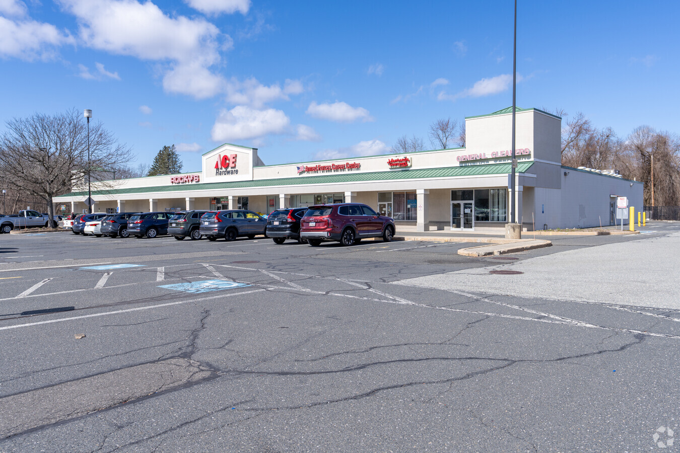
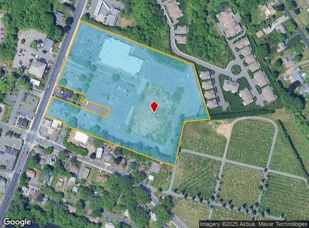
Property Record
501 Newton St, South Hadley, MA 01075

NEARBY LISTINGS FOR SALE OR LEASE
Property Detail
501 Newton St
Springfield, MA
Hampshire
SHAD-000028-000200
Massachusetts
Commercialnec
10 AC
2024
Hampshire County
2024
Hartford
821000
DEMOGRAPHICS near 501 Newton St
1 Mile
3 Mile
5 Mile
2024 Total Population
4,694
44,394
94,220
2029 Population
3,733
40,566
87,444
Pop Growth 2024-2029
(20.47%)
(8.62%)
(7.19%)
Average Age
45
41
41
2024 Total Households
2,044
17,947
39,179
HH Growth 2024-2029
(20.99%)
(9.49%)
(7.76%)
Median Household Inc
$86,532
$58,361
$58,616
Avg Household Size
2.20
2.30
2.30
2024 Avg HH Vehicles
2.00
1.00
2.00
Median Home Value
$314,405
$278,122
$261,754
Median Year Built
1961
1956
1956
Nearby Places
- Restaurants
- Banks
- Shops
- Fitness
- Groceries
PUBLIC TRANSPORTATION
COMMUTER RAIL
Holyoke Amtrak (Valley Flyer - Amtrak, Vermonter - Amtrak)
DRIVE
WALK
Distance
Holyoke Amtrak (Valley Flyer - Amtrak, Vermonter - Amtrak)
7 min
2.7 mi
AIRPORT
Bradley International
DRIVE
WALK
Distance
Bradley International
48 min
24.0 mi
Freight Ports
Albany, NY Port
DRIVE
WALK
Distance
Albany, NY Port
108 min
86.4 mi
SALE & LEASE HISTORY
LISTING DATE
SALE/LEASE

Dec 30, 2016
For Lease
Nearby Properties
Address
Land Use
TOTAL SIZE
Lot Size
Zoning
Address
Land Use
TOTAL SIZE
Lot Size
Zoning
16.30 AC
RA2
Address
Land Use
TOTAL SIZE
Lot Size
Zoning
4.50 AC
RA2
Address
Land Use
TOTAL SIZE
Lot Size
Zoning
26.68 AC
110
Address
Land Use
TOTAL SIZE
Lot Size
Zoning
52 AC
RA1
Address
Land Use
TOTAL SIZE
Lot Size
Zoning
4.04 AC
107
Address
Land Use
TOTAL SIZE
Lot Size
Zoning
9 AC
RA2
Address
Land Use
TOTAL SIZE
Lot Size
Zoning
23,111 SF
1.43 AC
IA
Address
Land Use
TOTAL SIZE
Lot Size
Zoning
26.35 AC
RA2
Address
Land Use
TOTAL SIZE
Lot Size
Zoning
14.47 AC
110
Address
Land Use
TOTAL SIZE
Lot Size
Zoning
194,875 SF
2.75 AC
IG
Address
Land Use
TOTAL SIZE
Lot Size
Zoning
64,638 SF
9.26 AC
RA2
Address
Land Use
TOTAL SIZE
Lot Size
Zoning
6.28 AC
IG
Address
Land Use
TOTAL SIZE
Lot Size
Zoning
10.62 AC
111A
Address
Land Use
TOTAL SIZE
Lot Size
Zoning
152,380 SF
11.36 AC
110
Address
Land Use
TOTAL SIZE
Lot Size
Zoning
3.30 AC
RA2
Address
Land Use
TOTAL SIZE
Lot Size
Zoning
291,714 SF
35.75 AC
110
Address
Land Use
TOTAL SIZE
Lot Size
Zoning
61,808 SF
8.53 AC
RA2
Address
Land Use
TOTAL SIZE
Lot Size
Zoning
62,808 SF
7.60 AC
R-1
Address
Land Use
TOTAL SIZE
Lot Size
Zoning
2.61 AC
107
Address
Land Use
TOTAL SIZE
Lot Size
Zoning
2.44 AC
RA2
Address
Land Use
TOTAL SIZE
Lot Size
Zoning
17.68 AC
IGD
Address
Land Use
TOTAL SIZE
Lot Size
Zoning
16.36 AC
RA1
Address
Land Use
TOTAL SIZE
Lot Size
Zoning
7.60 AC
BG
Address
Land Use
TOTAL SIZE
Lot Size
Zoning
3 AC
107
Address
Land Use
TOTAL SIZE
Lot Size
Zoning
15,248 SF
15.40 AC
AGR
Address
Land Use
TOTAL SIZE
Lot Size
Zoning
43,289 SF
2.63 AC
DR
Address
Land Use
TOTAL SIZE
Lot Size
Zoning
144,384 SF
35.87 AC
RA2
Address
Land Use
TOTAL SIZE
Lot Size
Zoning
1.95 AC
107
Address
Land Use
TOTAL SIZE
Lot Size
Zoning
47,890 SF
5.97 AC
BA1
Address
Land Use
TOTAL SIZE
Lot Size
Zoning
5,496 SF
3.59 AC
IG
The World's #1 Commercial Real Estate Marketplace
Connect with us
© 2025 CoStar Group
The information above has been obtained from sources believed reliable. While we do not doubt its accuracy we have not verified it and make no guarantee, warranty or representation about it. It is your responsibility to independently confirm its accuracy and completeness. Any projections, opinions, assumptions, or estimates used are for example only and do not represent the current or future performance of the property. The value of this transaction to you depends on tax and other factors which should be evaluated by your tax, financial, and legal advisors. You and your advisors should conduct a careful, independent investigation of the property to determine to your satisfaction the suitability of the property for your needs.