Property Record
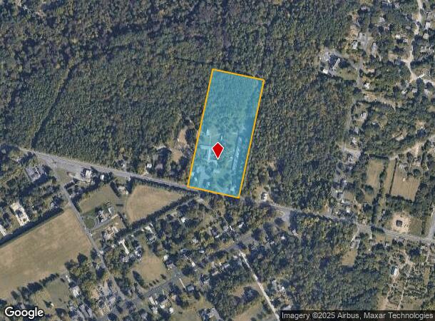
480 Jackson Rd, Atco, NJ 08004
NEARBY LISTINGS FOR SALE OR LEASE
Property Detail
480 Jackson Rd
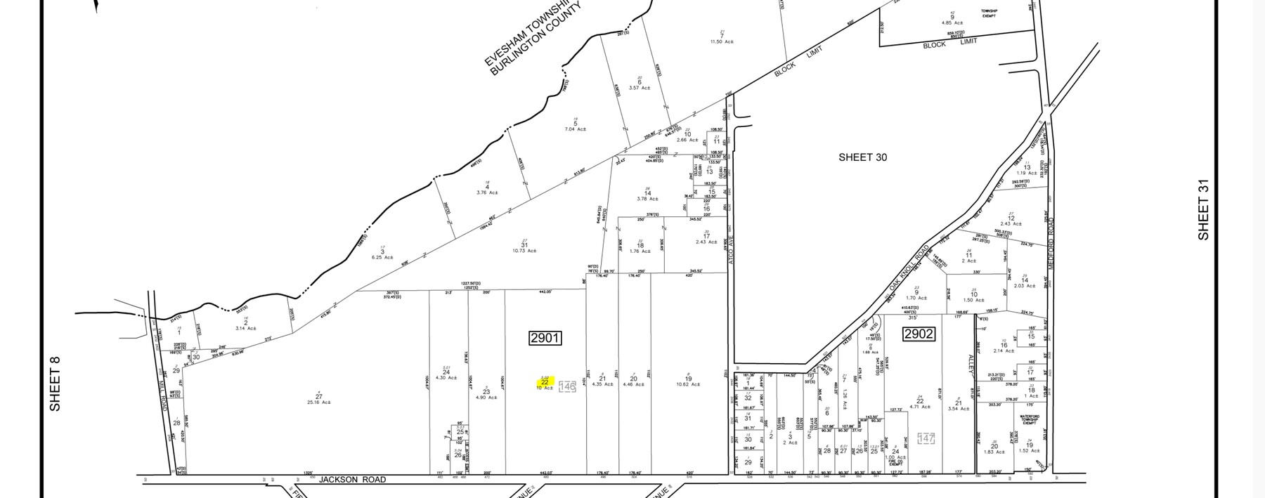
35-02901-0000-00022
ADDITIONAL LOTS: PARKVIEW CARE/FACILITY NAME: HOUSING
Commercialnec
Camden
X
New Jersey
34007C0165E
22
2023
10 AC
2024
South Camden County
608901
Philadelphia
4,246 SF
Philadelphia-Camden-Wilmington, PA-NJ-DE-MD
DEMOGRAPHICS near 480 Jackson Rd
1 Mile
3 Mile
5 Mile
2024 Total Population
2,832
20,990
50,889
2029 Population
2,833
21,246
51,213
Pop Growth 2024-2029
+ 0.04%
+ 1.22%
+ 0.64%
Average Age
42
42
42
2024 Total Households
931
7,874
19,093
HH Growth 2024-2029
(0.11%)
+ 1.36%
+ 0.72%
Median Household Inc
$114,955
$99,050
$106,667
Avg Household Size
2.70
2.60
2.60
2024 Avg HH Vehicles
2.00
2.00
2.00
Median Home Value
$254,030
$262,669
$287,350
Median Year Built
1975
1978
1979
Nearby Places
- Restaurants
- Banks
- Shops
- Fitness
- Groceries
PUBLIC TRANSPORTATION
COMMUTER RAIL
Atco (Atlantic City Line - NJ Transit Commuter Rail (NJ Transit))
DRIVE
WALK
Distance
Atco (Atlantic City Line - NJ Transit Commuter Rail (NJ Transit))
6 min
3.3 mi
Lindenwold (Njt) (Atlantic City Line - NJ Transit Commuter Rail (NJ Transit))
DRIVE
WALK
Distance
Lindenwold (Njt) (Atlantic City Line - NJ Transit Commuter Rail (NJ Transit))
13 min
8.5 mi
AIRPORT
Philadelphia International
DRIVE
WALK
Distance
Philadelphia International
43 min
27.2 mi
Atlantic City International
DRIVE
WALK
Distance
Atlantic City International
62 min
32.9 mi
Freight Ports
Broadway Terminal - Pier 5
DRIVE
WALK
Distance
Broadway Terminal - Pier 5
27 min
18.7 mi
Nearby Properties
Address
Land Use
TOTAL SIZE
Lot Size
Zoning
Address
Land Use
TOTAL SIZE
Lot Size
Zoning
5,417.17 AC
PD
Address
Land Use
TOTAL SIZE
Lot Size
Zoning
6,208 SF
30.73 AC
PARC
Address
Land Use
TOTAL SIZE
Lot Size
Zoning
137.33 AC
PR3
Address
Land Use
TOTAL SIZE
Lot Size
Zoning
27.18 AC
PR4
Address
Land Use
TOTAL SIZE
Lot Size
Zoning
69,324 SF
20.26 AC
Address
Land Use
TOTAL SIZE
Lot Size
Zoning
59,361 SF
19.21 AC
INST
Address
Land Use
TOTAL SIZE
Lot Size
Zoning
22.93 AC
PC-2
Address
Land Use
TOTAL SIZE
Lot Size
Zoning
14.10 AC
RD-1
Address
Land Use
TOTAL SIZE
Lot Size
Zoning
8.16 AC
I1
Address
Land Use
TOTAL SIZE
Lot Size
Zoning
8.56 AC
PARC
Address
Land Use
TOTAL SIZE
Lot Size
Zoning
5.06 AC
PF
Address
Land Use
TOTAL SIZE
Lot Size
Zoning
15.84 AC
RPF
Address
Land Use
TOTAL SIZE
Lot Size
Zoning
23.77 AC
RPF
Address
Land Use
TOTAL SIZE
Lot Size
Zoning
7.07 AC
PF
Address
Land Use
TOTAL SIZE
Lot Size
Zoning
20.99 AC
C-2
Address
Land Use
TOTAL SIZE
Lot Size
Zoning
5,702 SF
3.28 AC
C-3
Address
Land Use
TOTAL SIZE
Lot Size
Zoning
218.30 AC
RD-2
Address
Land Use
TOTAL SIZE
Lot Size
Zoning
1,341 SF
1.98 AC
PHB
Address
Land Use
TOTAL SIZE
Lot Size
Zoning
Address
Land Use
TOTAL SIZE
Lot Size
Zoning
38.85 AC
PHB
Address
Land Use
TOTAL SIZE
Lot Size
Zoning
4.67 AC
PC2
Address
Land Use
TOTAL SIZE
Lot Size
Zoning
2.23 AC
Address
Land Use
TOTAL SIZE
Lot Size
Zoning
9,900 SF
154 AC
RPF
Address
Land Use
TOTAL SIZE
Lot Size
Zoning
2.66 AC
R-3
Address
Land Use
TOTAL SIZE
Lot Size
Zoning
3,885 SF
5.73 AC
I1
Address
Land Use
TOTAL SIZE
Lot Size
Zoning
2.09 AC
I1
Address
Land Use
TOTAL SIZE
Lot Size
Zoning
14,594 SF
1.67 AC
PHB
Address
Land Use
TOTAL SIZE
Lot Size
Zoning
5.76 AC
PHB
Address
Land Use
TOTAL SIZE
Lot Size
Zoning
1.80 AC
I1
Address
Land Use
TOTAL SIZE
Lot Size
Zoning
73.98 AC
RGD2
The World's #1 Commercial Real Estate Marketplace
Connect with us
© 2025 CoStar Group
The information above has been obtained from sources believed reliable. While we do not doubt its accuracy we have not verified it and make no guarantee, warranty or representation about it. It is your responsibility to independently confirm its accuracy and completeness. Any projections, opinions, assumptions, or estimates used are for example only and do not represent the current or future performance of the property. The value of this transaction to you depends on tax and other factors which should be evaluated by your tax, financial, and legal advisors. You and your advisors should conduct a careful, independent investigation of the property to determine to your satisfaction the suitability of the property for your needs.