Property Record
4800 Noland Rd, Kansas City, MO 64133
NEARBY LISTINGS FOR SALE OR LEASE
Property Detail
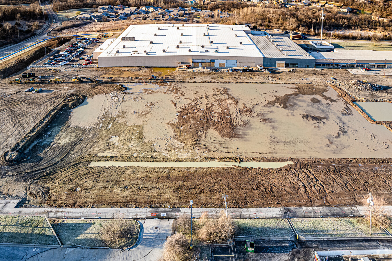
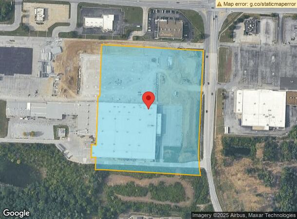
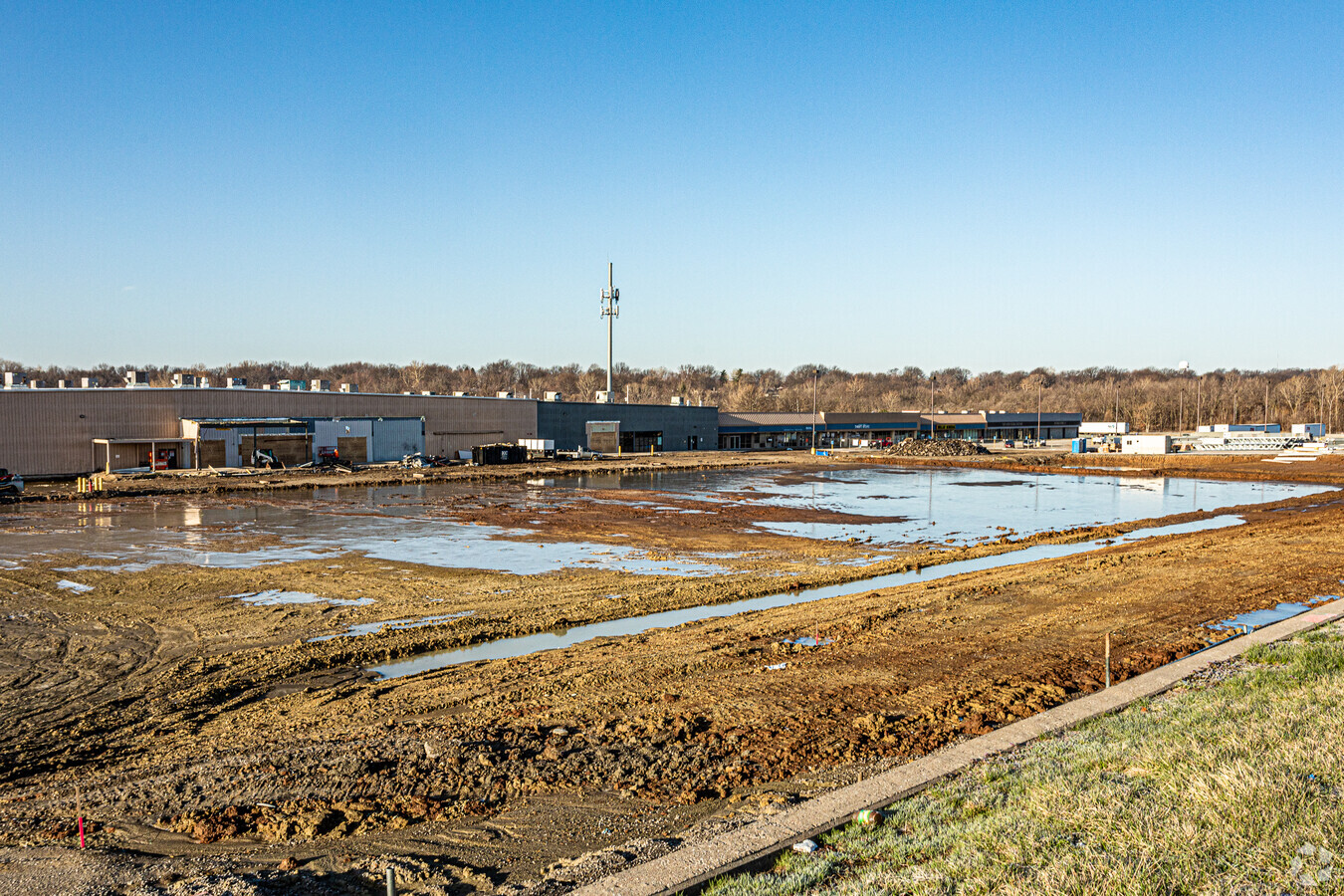
4800 Noland Rd
Kansas City, MO-KS
Plaza 40 Shopping Center Phase I
33-530-01-86-00-0-00-000
BENNETT PACKING---PT LOT 1 DAF: BEG NE COR LOT 1 TH S 02 DEG 07 MIN 36 SEC W 383.40 TO POB TH S 0 795.37 TH N 02 DEG 06 MIN 06 SEC E 430.24 TH S 88 DEG 09 MIN 10 SEC E 779.15 TO POB
Commercialnec
Jackson
X
Missouri
29095C0291G
1
2022
11.54 AC
2024
Raytown/Lakewood
0124002009
Kansas City
333,682 SF
DEMOGRAPHICS near 4800 Noland Rd
1 Mile
3 Mile
5 Mile
2024 Total Population
7,487
61,372
152,070
2029 Population
7,432
60,472
150,914
Pop Growth 2024-2029
(0.73%)
(1.47%)
(0.76%)
Average Age
43
42
42
2024 Total Households
3,201
25,915
63,587
HH Growth 2024-2029
(0.87%)
(1.64%)
(0.89%)
Median Household Inc
$64,343
$64,255
$60,787
Avg Household Size
2.20
2.30
2.30
2024 Avg HH Vehicles
2.00
2.00
2.00
Median Home Value
$177,133
$167,927
$167,447
Median Year Built
1968
1969
1969
Nearby Places
- Restaurants
- Banks
- Shops
- Fitness
- Groceries
PUBLIC TRANSPORTATION
COMMUTER RAIL
Independence Amtrak Station (Lincoln Service Missouri River Runner - Amtrak, Missouri River Runner - Amtrak)
DRIVE
WALK
Distance
Independence Amtrak Station (Lincoln Service Missouri River Runner - Amtrak, Missouri River Runner - Amtrak)
10 min
4.6 mi
AIRPORT
Kansas City International
DRIVE
WALK
Distance
Kansas City International
44 min
32.1 mi
Freight Ports
Tulsa Port Of Catoosa
DRIVE
WALK
Distance
Tulsa Port Of Catoosa
274 min
247.3 mi
Nearby Properties
Address
Land Use
TOTAL SIZE
Lot Size
Zoning
Address
Land Use
TOTAL SIZE
Lot Size
Zoning
519,504 SF
28.46 AC
Address
Land Use
TOTAL SIZE
Lot Size
Zoning
455,100 SF
42.02 AC
Address
Land Use
TOTAL SIZE
Lot Size
Zoning
171,513 SF
18.37 AC
Address
Land Use
TOTAL SIZE
Lot Size
Zoning
48,781 SF
32.40 AC
Address
Land Use
TOTAL SIZE
Lot Size
Zoning
74,801 SF
8.93 AC
Address
Land Use
TOTAL SIZE
Lot Size
Zoning
210,008 SF
16.89 AC
Address
Land Use
TOTAL SIZE
Lot Size
Zoning
20.97 AC
Address
Land Use
TOTAL SIZE
Lot Size
Zoning
67,820 SF
11.94 AC
Address
Land Use
TOTAL SIZE
Lot Size
Zoning
179,128 SF
15.07 AC
Address
Land Use
TOTAL SIZE
Lot Size
Zoning
389,178 SF
33.30 AC
Address
Land Use
TOTAL SIZE
Lot Size
Zoning
Address
Land Use
TOTAL SIZE
Lot Size
Zoning
137,558 SF
12.50 AC
Address
Land Use
TOTAL SIZE
Lot Size
Zoning
21,818 SF
5.01 AC
Address
Land Use
TOTAL SIZE
Lot Size
Zoning
42,188 SF
7.82 AC
Address
Land Use
TOTAL SIZE
Lot Size
Zoning
48,657 SF
8.44 AC
Address
Land Use
TOTAL SIZE
Lot Size
Zoning
182,582 SF
19.96 AC
Address
Land Use
TOTAL SIZE
Lot Size
Zoning
190,810 SF
26.90 AC
Address
Land Use
TOTAL SIZE
Lot Size
Zoning
45,833 SF
8.61 AC
Address
Land Use
TOTAL SIZE
Lot Size
Zoning
103,866 SF
13.29 AC
Address
Land Use
TOTAL SIZE
Lot Size
Zoning
62,070 SF
44.98 AC
Address
Land Use
TOTAL SIZE
Lot Size
Zoning
175,502 SF
0.27 AC
Address
Land Use
TOTAL SIZE
Lot Size
Zoning
30,630 SF
14.08 AC
Address
Land Use
TOTAL SIZE
Lot Size
Zoning
145,569 SF
16.90 AC
Address
Land Use
TOTAL SIZE
Lot Size
Zoning
114,248 SF
5.02 AC
Address
Land Use
TOTAL SIZE
Lot Size
Zoning
127,582 SF
11.22 AC
Address
Land Use
TOTAL SIZE
Lot Size
Zoning
111,074 SF
12.60 AC
Address
Land Use
TOTAL SIZE
Lot Size
Zoning
111,417 SF
9.12 AC
Address
Land Use
TOTAL SIZE
Lot Size
Zoning
46,125 SF
4.68 AC
Address
Land Use
TOTAL SIZE
Lot Size
Zoning
86,294 SF
5.80 AC
The World's #1 Commercial Real Estate Marketplace
Connect with us
© 2025 CoStar Group
The information above has been obtained from sources believed reliable. While we do not doubt its accuracy we have not verified it and make no guarantee, warranty or representation about it. It is your responsibility to independently confirm its accuracy and completeness. Any projections, opinions, assumptions, or estimates used are for example only and do not represent the current or future performance of the property. The value of this transaction to you depends on tax and other factors which should be evaluated by your tax, financial, and legal advisors. You and your advisors should conduct a careful, independent investigation of the property to determine to your satisfaction the suitability of the property for your needs.