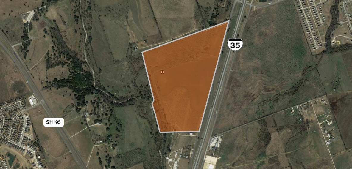
Property Record
4805 N Interstate 35, Georgetown, TX 78633

NEARBY LISTINGS FOR SALE OR LEASE
Property Detail
4805 N Interstate 35
Austin-Round Rock, TX
Roberts, Wm. Sur.
R040508
AW0524 AW0524 - ROBERTS, WM. SUR., ACRES 51.018
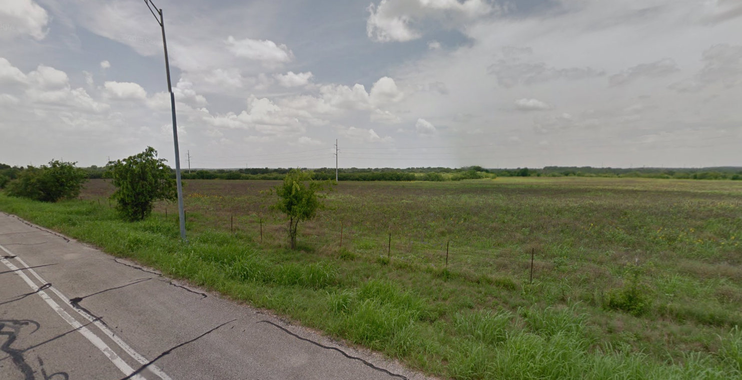
Vacantlandnec
Williamson
A
Texas
48491C0285F
17
2023
51.02 AC
2023
Georgetown
021603
Austin
DEMOGRAPHICS near 4805 N Interstate 35
1 Mile
3 Mile
5 Mile
2024 Total Population
901
9,574
45,376
2029 Population
1,147
12,113
57,665
Pop Growth 2024-2029
+ 27.30%
+ 26.52%
+ 27.08%
Average Age
41
47
48
2024 Total Households
324
3,730
19,669
HH Growth 2024-2029
+ 27.78%
+ 26.94%
+ 27.51%
Median Household Inc
$106,656
$106,201
$83,912
Avg Household Size
2.70
2.50
2.30
2024 Avg HH Vehicles
2.00
2.00
2.00
Median Home Value
$547,170
$469,198
$386,472
Median Year Built
2002
2001
2003
Nearby Places
- Restaurants
- Banks
- Shops
- Fitness
- Groceries
PUBLIC TRANSPORTATION
AIRPORT
Killeen Municipal
DRIVE
WALK
Distance
Killeen Municipal
47 min
37.4 mi
Robert Gray AAF
DRIVE
WALK
Distance
Robert Gray AAF
51 min
38.3 mi
Freight Ports
Calhoun Port
DRIVE
WALK
Distance
Calhoun Port
213 min
188.4 mi
SALE & LEASE HISTORY
LISTING DATE
SALE/LEASE

Mar 30, 2018
For Sale
Aug 25, 2017
For Sale
Aug 07, 2017
For Sale
Apr 21, 2017
For Sale
Nearby Properties
Address
Land Use
TOTAL SIZE
Lot Size
Zoning
Address
Land Use
TOTAL SIZE
Lot Size
Zoning
319,189 SF
17.39 AC
Address
Land Use
TOTAL SIZE
Lot Size
Zoning
405,439 SF
24.33 AC
Address
Land Use
TOTAL SIZE
Lot Size
Zoning
298,302 SF
20.96 AC
Address
Land Use
TOTAL SIZE
Lot Size
Zoning
86,867 SF
41.97 AC
Address
Land Use
TOTAL SIZE
Lot Size
Zoning
241,857 SF
26.60 AC
Address
Land Use
TOTAL SIZE
Lot Size
Zoning
174,955 SF
9.28 AC
Address
Land Use
TOTAL SIZE
Lot Size
Zoning
195,201 SF
8.84 AC
Address
Land Use
TOTAL SIZE
Lot Size
Zoning
160,042 SF
10.15 AC
Address
Land Use
TOTAL SIZE
Lot Size
Zoning
22,936 SF
111.18 AC
Address
Land Use
TOTAL SIZE
Lot Size
Zoning
150,808 SF
7.72 AC
2-I
Address
Land Use
TOTAL SIZE
Lot Size
Zoning
425,144 SF
32.97 AC
Address
Land Use
TOTAL SIZE
Lot Size
Zoning
62,452 SF
11 AC
Address
Land Use
TOTAL SIZE
Lot Size
Zoning
31,480 SF
19.73 AC
Address
Land Use
TOTAL SIZE
Lot Size
Zoning
57,600 SF
4.12 AC
Address
Land Use
TOTAL SIZE
Lot Size
Zoning
58,763 SF
4.24 AC
2-I
Address
Land Use
TOTAL SIZE
Lot Size
Zoning
57,600 SF
7.20 AC
Address
Land Use
TOTAL SIZE
Lot Size
Zoning
26,306 SF
10.03 AC
Address
Land Use
TOTAL SIZE
Lot Size
Zoning
40,000 SF
4.47 AC
Address
Land Use
TOTAL SIZE
Lot Size
Zoning
291,590 SF
56.14 AC
Address
Land Use
TOTAL SIZE
Lot Size
Zoning
1,453 SF
360.07 AC
Address
Land Use
TOTAL SIZE
Lot Size
Zoning
84,960 SF
5.12 AC
Address
Land Use
TOTAL SIZE
Lot Size
Zoning
11,200 SF
23.01 AC
Address
Land Use
TOTAL SIZE
Lot Size
Zoning
35,534 SF
132.39 AC
Address
Land Use
TOTAL SIZE
Lot Size
Zoning
14,652 SF
18.54 AC
Address
Land Use
TOTAL SIZE
Lot Size
Zoning
4,710 SF
5.12 AC
Address
Land Use
TOTAL SIZE
Lot Size
Zoning
45,764 SF
11.23 AC
Address
Land Use
TOTAL SIZE
Lot Size
Zoning
22,041 SF
4.14 AC
Address
Land Use
TOTAL SIZE
Lot Size
Zoning
1,020 SF
31.08 AC
Address
Land Use
TOTAL SIZE
Lot Size
Zoning
35.03 AC
Address
Land Use
TOTAL SIZE
Lot Size
Zoning
3,090 SF
10.02 AC
The World's #1 Commercial Real Estate Marketplace
Connect with us
© 2025 CoStar Group
The information above has been obtained from sources believed reliable. While we do not doubt its accuracy we have not verified it and make no guarantee, warranty or representation about it. It is your responsibility to independently confirm its accuracy and completeness. Any projections, opinions, assumptions, or estimates used are for example only and do not represent the current or future performance of the property. The value of this transaction to you depends on tax and other factors which should be evaluated by your tax, financial, and legal advisors. You and your advisors should conduct a careful, independent investigation of the property to determine to your satisfaction the suitability of the property for your needs.