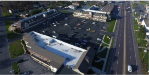
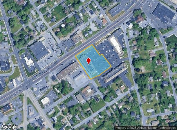
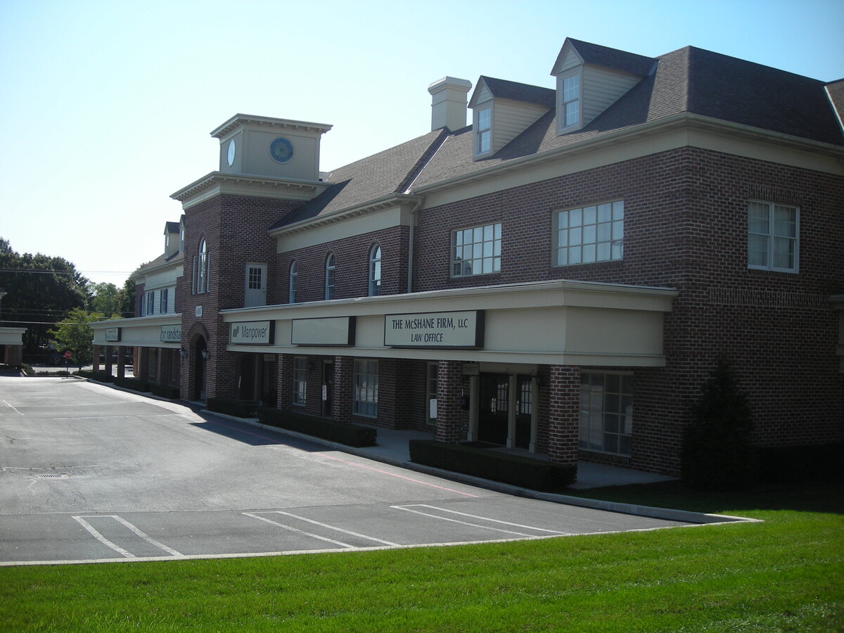
Property Record
4807 Jonestown Rd, Harrisburg, PA 17109

Current Lease Availabilities
NEARBY LISTINGS FOR SALE OR LEASE
Property Detail
4807 Jonestown Rd
Officebuilding
Dauphin
X
Pennsylvania
42043C0345D
1.17 AC
2024
Harrisburg Area East
2024
Philadelphia
022601
Harrisburg-Carlisle, PA
27,046 SF
35-053-109
DEMOGRAPHICS near 4807 Jonestown Rd
1 Mile
3 Mile
5 Mile
2024 Total Population
8,601
73,700
173,270
2029 Population
8,775
75,149
177,308
Pop Growth 2024-2029
+ 2.02%
+ 1.97%
+ 2.33%
Average Age
40
41
40
2024 Total Households
3,598
30,193
70,375
HH Growth 2024-2029
+ 2.17%
+ 2.07%
+ 2.44%
Median Household Inc
$62,402
$73,600
$65,335
Avg Household Size
2.30
2.40
2.40
2024 Avg HH Vehicles
2.00
2.00
2.00
Median Home Value
$183,744
$212,331
$191,799
Median Year Built
1963
1975
1968
Nearby Places
- Restaurants
- Banks
- Shops
- Fitness
- Groceries
PUBLIC TRANSPORTATION
COMMUTER RAIL
Harrisburg (Keystone Service - Amtrak, Pennsylvanian - Amtrak)
DRIVE
WALK
Distance
Harrisburg (Keystone Service - Amtrak, Pennsylvanian - Amtrak)
12 min
5.8 mi
AIRPORT
Harrisburg International
DRIVE
WALK
Distance
Harrisburg International
19 min
11.7 mi
Freight Ports
Port of Baltimore
DRIVE
WALK
Distance
Port of Baltimore
119 min
86.0 mi
Nearby Properties
Address
Land Use
TOTAL SIZE
Lot Size
Zoning
Address
Land Use
TOTAL SIZE
Lot Size
Zoning
210,464 SF
28.80 AC
Address
Land Use
TOTAL SIZE
Lot Size
Zoning
74,032 SF
74.81 AC
Address
Land Use
TOTAL SIZE
Lot Size
Zoning
172,289 SF
86.54 AC
Address
Land Use
TOTAL SIZE
Lot Size
Zoning
130,542 SF
28.94 AC
Address
Land Use
TOTAL SIZE
Lot Size
Zoning
9,188 SF
46.70 AC
Address
Land Use
TOTAL SIZE
Lot Size
Zoning
2,913 SF
24.28 AC
Address
Land Use
TOTAL SIZE
Lot Size
Zoning
47,022 SF
47.55 AC
Address
Land Use
TOTAL SIZE
Lot Size
Zoning
284,737 SF
28.16 AC
Address
Land Use
TOTAL SIZE
Lot Size
Zoning
192,390 SF
43.19 AC
Address
Land Use
TOTAL SIZE
Lot Size
Zoning
247,216 SF
46.91 AC
Address
Land Use
TOTAL SIZE
Lot Size
Zoning
2,000 SF
21.13 AC
Address
Land Use
TOTAL SIZE
Lot Size
Zoning
112,388 SF
38.01 AC
Address
Land Use
TOTAL SIZE
Lot Size
Zoning
226,101 SF
46.29 AC
Address
Land Use
TOTAL SIZE
Lot Size
Zoning
31,240 SF
20.25 AC
Address
Land Use
TOTAL SIZE
Lot Size
Zoning
33,916 SF
10 AC
Address
Land Use
TOTAL SIZE
Lot Size
Zoning
2,823 SF
36.87 AC
Address
Land Use
TOTAL SIZE
Lot Size
Zoning
207,012 SF
24.50 AC
Address
Land Use
TOTAL SIZE
Lot Size
Zoning
1,989 SF
16.62 AC
Address
Land Use
TOTAL SIZE
Lot Size
Zoning
139,381 SF
42.61 AC
Address
Land Use
TOTAL SIZE
Lot Size
Zoning
13,348 SF
25.38 AC
Address
Land Use
TOTAL SIZE
Lot Size
Zoning
66,864 SF
26.25 AC
Address
Land Use
TOTAL SIZE
Lot Size
Zoning
97,887 SF
11.90 AC
Address
Land Use
TOTAL SIZE
Lot Size
Zoning
233,427 SF
20.38 AC
Address
Land Use
TOTAL SIZE
Lot Size
Zoning
246,276 SF
27.26 AC
Address
Land Use
TOTAL SIZE
Lot Size
Zoning
82,881 SF
16.90 AC
Address
Land Use
TOTAL SIZE
Lot Size
Zoning
880 SF
18.68 AC
Address
Land Use
TOTAL SIZE
Lot Size
Zoning
2,129 SF
19.90 AC
Address
Land Use
TOTAL SIZE
Lot Size
Zoning
29,125 SF
11.77 AC
Address
Land Use
TOTAL SIZE
Lot Size
Zoning
107,853 SF
12 AC
Address
Land Use
TOTAL SIZE
Lot Size
Zoning
11,928 SF
8.40 AC
The World's #1 Commercial Real Estate Marketplace
Connect with us
© 2025 CoStar Group
The information above has been obtained from sources believed reliable. While we do not doubt its accuracy we have not verified it and make no guarantee, warranty or representation about it. It is your responsibility to independently confirm its accuracy and completeness. Any projections, opinions, assumptions, or estimates used are for example only and do not represent the current or future performance of the property. The value of this transaction to you depends on tax and other factors which should be evaluated by your tax, financial, and legal advisors. You and your advisors should conduct a careful, independent investigation of the property to determine to your satisfaction the suitability of the property for your needs.