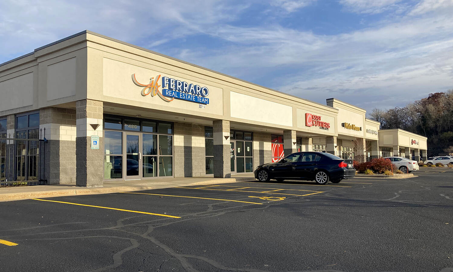
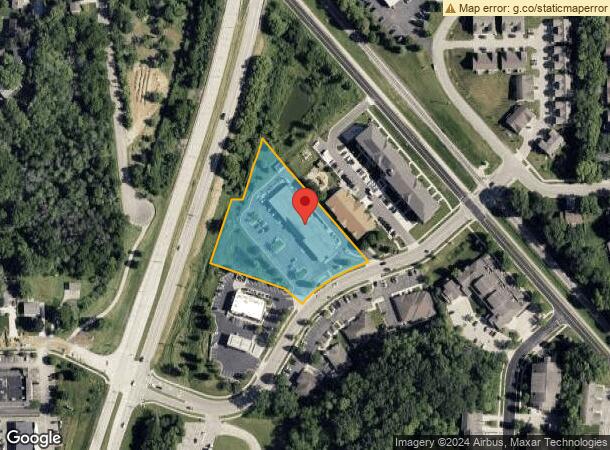
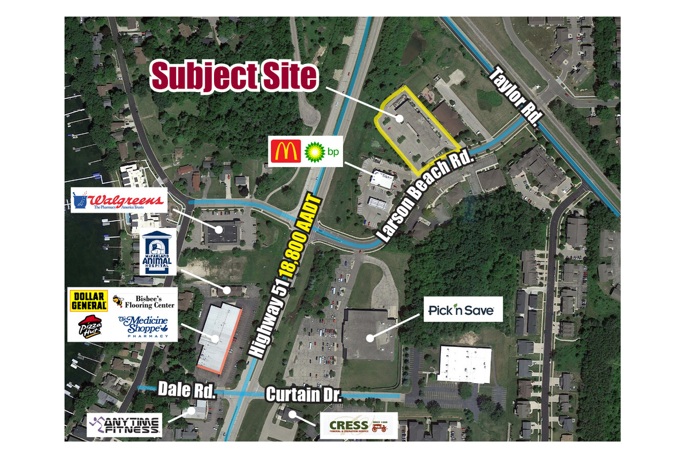
Property Record
4810 Larson Beach Rd, Mcfarland, WI 53558
Current Lease Availabilities
NEARBY LISTINGS FOR SALE OR LEASE
-
-
View all Mcfarland listings for lease on LoopNet.com
Property Detail
4810 Larson Beach Rd
Madison, WI
Woodland
0610-032-1322-1
LOT 2 CSM 11394 CS69/119&124-5/5/2005 F/K/A WOODLAND COMMONS LOTS 2 & 3 DESCR AS SEC 3-6-10 PRT NE1/4NW1/4 & SEC 34-7-10 PRT SE1/4SW1/4 (2.345 ACRES)
Commercialnec
Dane
X
Wisconsin
55025C0443H
2,3
2023
2.35 AC
2023
Southeast Madison
010504
Milwaukee/Madison
DEMOGRAPHICS near 4810 Larson Beach Rd
1 Mile
3 Mile
5 Mile
2024 Total Population
7,399
19,872
59,376
2029 Population
7,684
20,649
61,647
Pop Growth 2024-2029
+ 3.85%
+ 3.91%
+ 3.82%
Average Age
40
40
41
2024 Total Households
3,049
8,249
25,920
HH Growth 2024-2029
+ 4.03%
+ 4.04%
+ 3.95%
Median Household Inc
$83,805
$87,646
$79,410
Avg Household Size
2.40
2.40
2.20
2024 Avg HH Vehicles
2.00
2.00
2.00
Median Home Value
$324,809
$327,780
$303,953
Median Year Built
1989
1987
1978
Nearby Places
- Restaurants
- Banks
- Shops
- Fitness
- Groceries
PUBLIC TRANSPORTATION
AIRPORT
Dane County Regional/Truax Field
DRIVE
WALK
Distance
Dane County Regional/Truax Field
17 min
10.6 mi
Freight Ports
Port Milwaukee
DRIVE
WALK
Distance
Port Milwaukee
95 min
81.2 mi
Nearby Properties
Address
Land Use
TOTAL SIZE
Lot Size
Zoning
Address
Land Use
TOTAL SIZE
Lot Size
Zoning
168,685 SF
14.05 AC
IL
Address
Land Use
TOTAL SIZE
Lot Size
Zoning
2.03 AC
Address
Land Use
TOTAL SIZE
Lot Size
Zoning
3.59 AC
Address
Land Use
TOTAL SIZE
Lot Size
Zoning
2.38 AC
Address
Land Use
TOTAL SIZE
Lot Size
Zoning
6,868 SF
18.35 AC
IL
Address
Land Use
TOTAL SIZE
Lot Size
Zoning
19.81 AC
Address
Land Use
TOTAL SIZE
Lot Size
Zoning
3.49 AC
Address
Land Use
TOTAL SIZE
Lot Size
Zoning
202,800 SF
13.05 AC
IL
Address
Land Use
TOTAL SIZE
Lot Size
Zoning
5.53 AC
Address
Land Use
TOTAL SIZE
Lot Size
Zoning
17,980 SF
6.25 AC
SR-V2
Address
Land Use
TOTAL SIZE
Lot Size
Zoning
9,030 SF
6.59 AC
SR-V2
Address
Land Use
TOTAL SIZE
Lot Size
Zoning
42,967 SF
5.25 AC
SR-V2
Address
Land Use
TOTAL SIZE
Lot Size
Zoning
113,341 SF
11.66 AC
IL
Address
Land Use
TOTAL SIZE
Lot Size
Zoning
14.34 AC
IL
Address
Land Use
TOTAL SIZE
Lot Size
Zoning
11.76 AC
Address
Land Use
TOTAL SIZE
Lot Size
Zoning
221,410 SF
19.70 AC
IL
Address
Land Use
TOTAL SIZE
Lot Size
Zoning
7.98 AC
Address
Land Use
TOTAL SIZE
Lot Size
Zoning
1.23 AC
Address
Land Use
TOTAL SIZE
Lot Size
Zoning
14,946 SF
13.29 AC
IG
Address
Land Use
TOTAL SIZE
Lot Size
Zoning
14,946 SF
16.05 AC
IG
Address
Land Use
TOTAL SIZE
Lot Size
Zoning
54,160 SF
6.06 AC
SR-V2
Address
Land Use
TOTAL SIZE
Lot Size
Zoning
49,562 SF
4.42 AC
SE
Address
Land Use
TOTAL SIZE
Lot Size
Zoning
9.89 AC
Address
Land Use
TOTAL SIZE
Lot Size
Zoning
10,440 SF
9.53 AC
IL
Address
Land Use
TOTAL SIZE
Lot Size
Zoning
2.07 AC
Address
Land Use
TOTAL SIZE
Lot Size
Zoning
86,400 SF
6.53 AC
IL
Address
Land Use
TOTAL SIZE
Lot Size
Zoning
7.52 AC
IL
Address
Land Use
TOTAL SIZE
Lot Size
Zoning
60.40 AC
IL
Address
Land Use
TOTAL SIZE
Lot Size
Zoning
48,225 SF
5.50 AC
IL
The World's #1 Commercial Real Estate Marketplace
Connect with us
© 2025 CoStar Group
The information above has been obtained from sources believed reliable. While we do not doubt its accuracy we have not verified it and make no guarantee, warranty or representation about it. It is your responsibility to independently confirm its accuracy and completeness. Any projections, opinions, assumptions, or estimates used are for example only and do not represent the current or future performance of the property. The value of this transaction to you depends on tax and other factors which should be evaluated by your tax, financial, and legal advisors. You and your advisors should conduct a careful, independent investigation of the property to determine to your satisfaction the suitability of the property for your needs.