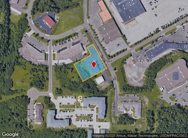
Property Record
4815 Burning Tree Rd, Duluth, MN 55811

NEARBY LISTINGS FOR SALE OR LEASE
Property Detail
4815 Burning Tree Rd
Duluth
Village Mall First Add
Duluth, MN-WI
LOT: 0009 BLOCK:001 SERIAL #
010442300100
St Louis
Commercialnec
Minnesota
2024
9
2023
1.01 AC
000301
Miller Hill/Airpark
11,700 SF
DEMOGRAPHICS near 4815 Burning Tree Rd
1 Mile
3 Mile
5 Mile
2024 Total Population
2,297
21,689
70,363
2029 Population
2,277
21,377
69,444
Pop Growth 2024-2029
(0.87%)
(1.44%)
(1.31%)
Average Age
45
41
38
2024 Total Households
1,045
8,871
29,788
HH Growth 2024-2029
(0.96%)
(1.80%)
(1.39%)
Median Household Inc
$53,333
$69,455
$56,230
Avg Household Size
2.10
2.20
2.10
2024 Avg HH Vehicles
1.00
2.00
2.00
Median Home Value
$246,976
$249,969
$213,385
Median Year Built
1989
1974
1956
Nearby Places
- Restaurants
- Banks
- Shops
- Fitness
- Groceries
PUBLIC TRANSPORTATION
AIRPORT
Duluth International
DRIVE
WALK
Distance
Duluth International
13 min
4.8 mi
Freight Ports
Port Milwaukee
DRIVE
WALK
Distance
Port Milwaukee
457 min
402.1 mi
SALE & LEASE HISTORY
LISTING DATE
SALE/LEASE

Oct 02, 2017
For Lease
Nearby Properties
Address
Land Use
TOTAL SIZE
Lot Size
Zoning
Address
Land Use
TOTAL SIZE
Lot Size
Zoning
524,275 SF
38.23 AC
Address
Land Use
TOTAL SIZE
Lot Size
Zoning
195,455 SF
54.06 AC
Address
Land Use
TOTAL SIZE
Lot Size
Zoning
32,824 SF
117.72 AC
Address
Land Use
TOTAL SIZE
Lot Size
Zoning
20,388 SF
20 AC
Address
Land Use
TOTAL SIZE
Lot Size
Zoning
178,184 SF
20 AC
Address
Land Use
TOTAL SIZE
Lot Size
Zoning
118,418 SF
13.62 AC
Address
Land Use
TOTAL SIZE
Lot Size
Zoning
7,300 SF
19.85 AC
Address
Land Use
TOTAL SIZE
Lot Size
Zoning
72,980 SF
2.85 AC
R1B
Address
Land Use
TOTAL SIZE
Lot Size
Zoning
96,031 SF
12.24 AC
Address
Land Use
TOTAL SIZE
Lot Size
Zoning
109,021 SF
10.01 AC
Address
Land Use
TOTAL SIZE
Lot Size
Zoning
62,634 SF
4.32 AC
Address
Land Use
TOTAL SIZE
Lot Size
Zoning
158,240 SF
0.13 AC
Address
Land Use
TOTAL SIZE
Lot Size
Zoning
176,840 SF
27.50 AC
Address
Land Use
TOTAL SIZE
Lot Size
Zoning
7,668 SF
63.27 AC
Address
Land Use
TOTAL SIZE
Lot Size
Zoning
15,246 SF
10.98 AC
R3
Address
Land Use
TOTAL SIZE
Lot Size
Zoning
98,994 SF
185.96 AC
Address
Land Use
TOTAL SIZE
Lot Size
Zoning
160,574 SF
20.87 AC
Address
Land Use
TOTAL SIZE
Lot Size
Zoning
174,964 SF
41.97 AC
Address
Land Use
TOTAL SIZE
Lot Size
Zoning
153,866 SF
13.83 AC
Address
Land Use
TOTAL SIZE
Lot Size
Zoning
158,778 SF
6.21 AC
Address
Land Use
TOTAL SIZE
Lot Size
Zoning
21,204 SF
26.34 AC
Address
Land Use
TOTAL SIZE
Lot Size
Zoning
123,720 SF
2.65 AC
Address
Land Use
TOTAL SIZE
Lot Size
Zoning
164,720 SF
19.81 AC
Address
Land Use
TOTAL SIZE
Lot Size
Zoning
90,980 SF
13.11 AC
R3
Address
Land Use
TOTAL SIZE
Lot Size
Zoning
112,838 SF
40 AC
Address
Land Use
TOTAL SIZE
Lot Size
Zoning
59,349 SF
0.99 AC
Address
Land Use
TOTAL SIZE
Lot Size
Zoning
46,160 SF
10.31 AC
R1B
Address
Land Use
TOTAL SIZE
Lot Size
Zoning
91,736 SF
4.21 AC
R3
Address
Land Use
TOTAL SIZE
Lot Size
Zoning
42,439 SF
Address
Land Use
TOTAL SIZE
Lot Size
Zoning
68,008 SF
2.02 AC
The World's #1 Commercial Real Estate Marketplace
Connect with us
© 2025 CoStar Group
The information above has been obtained from sources believed reliable. While we do not doubt its accuracy we have not verified it and make no guarantee, warranty or representation about it. It is your responsibility to independently confirm its accuracy and completeness. Any projections, opinions, assumptions, or estimates used are for example only and do not represent the current or future performance of the property. The value of this transaction to you depends on tax and other factors which should be evaluated by your tax, financial, and legal advisors. You and your advisors should conduct a careful, independent investigation of the property to determine to your satisfaction the suitability of the property for your needs.