Property Record
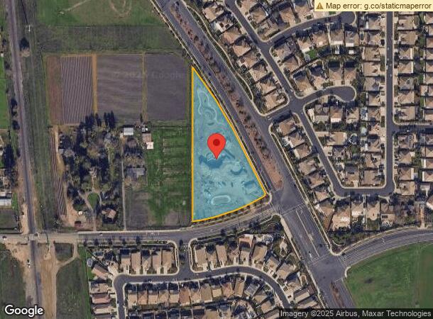
4831 Bilby Rd, Elk Grove, CA 95757

NEARBY LISTINGS FOR SALE OR LEASE
-
-
View all Elk Grove listings for sale on LoopNet.com
Property Detail
4831 Bilby Rd
Sacramento--Roseville--Arden-Arcade, CA
Bilby Ranch #1
132-1680-035
ALL THAT POR OF LAND DESIGNATED AS REMAINDER , BILBY RANCH UNIT 1, R.M.331-5
Recreationalacreage
Sacramento
X
California
06067C0315J
2.86 AC
2023
Elk Grove
2024
Sacramento
009646
DEMOGRAPHICS near 4831 Bilby Rd
1 Mile
3 Mile
5 Mile
2024 Total Population
11,488
71,112
146,897
2029 Population
11,517
71,844
148,140
Pop Growth 2024-2029
+ 0.25%
+ 1.03%
+ 0.85%
Average Age
36
39
38
2024 Total Households
3,141
22,042
46,275
HH Growth 2024-2029
+ 0.16%
+ 1.02%
+ 0.80%
Median Household Inc
$104,221
$116,252
$106,272
Avg Household Size
3.60
3.20
3.10
2024 Avg HH Vehicles
3.00
2.00
2.00
Median Home Value
$567,865
$612,584
$526,137
Median Year Built
2005
2003
1999
Nearby Places
- Restaurants
- Banks
- Shops
- Fitness
- Groceries
PUBLIC TRANSPORTATION
AIRPORT
Sacramento International
DRIVE
WALK
Distance
Sacramento International
36 min
27.7 mi
Freight Ports
Port of Stockton
DRIVE
WALK
Distance
Port of Stockton
39 min
33.2 mi
SALE & LEASE HISTORY
LISTING DATE
SALE/LEASE

Jul 22, 2019
For Sale
Nearby Properties
Address
Land Use
TOTAL SIZE
Lot Size
Zoning
Address
Land Use
TOTAL SIZE
Lot Size
Zoning
468,870 SF
26.55 AC
RD-20
Address
Land Use
TOTAL SIZE
Lot Size
Zoning
265,222 SF
14.42 AC
RD-20
Address
Land Use
TOTAL SIZE
Lot Size
Zoning
4.98 AC
RD-20
Address
Land Use
TOTAL SIZE
Lot Size
Zoning
152,217 SF
17.42 AC
SC
Address
Land Use
TOTAL SIZE
Lot Size
Zoning
192,518 SF
8.97 AC
RD-20
Address
Land Use
TOTAL SIZE
Lot Size
Zoning
242,577 SF
0.10 AC
RD-20
Address
Land Use
TOTAL SIZE
Lot Size
Zoning
3.88 AC
RD-20
Address
Land Use
TOTAL SIZE
Lot Size
Zoning
221,954 SF
7.71 AC
RD-15
Address
Land Use
TOTAL SIZE
Lot Size
Zoning
4.88 AC
RD-25
Address
Land Use
TOTAL SIZE
Lot Size
Zoning
91,226 SF
10.81 AC
SC
Address
Land Use
TOTAL SIZE
Lot Size
Zoning
88,408 SF
9.41 AC
SC
Address
Land Use
TOTAL SIZE
Lot Size
Zoning
68,190 SF
3.75 AC
BP
Address
Land Use
TOTAL SIZE
Lot Size
Zoning
68,217 SF
8.95 AC
RD-20
Address
Land Use
TOTAL SIZE
Lot Size
Zoning
126,924 SF
5.26 AC
RD-25
Address
Land Use
TOTAL SIZE
Lot Size
Zoning
148,119 SF
11.23 AC
SC
Address
Land Use
TOTAL SIZE
Lot Size
Zoning
9.02 AC
SPASEPA
Address
Land Use
TOTAL SIZE
Lot Size
Zoning
23,545 SF
9.83 AC
PS
Address
Land Use
TOTAL SIZE
Lot Size
Zoning
75,080 SF
7.76 AC
MP
Address
Land Use
TOTAL SIZE
Lot Size
Zoning
66,205 SF
5.95 AC
GC
Address
Land Use
TOTAL SIZE
Lot Size
Zoning
RD-5 RD-8
Address
Land Use
TOTAL SIZE
Lot Size
Zoning
13.28 AC
LRSPA
Address
Land Use
TOTAL SIZE
Lot Size
Zoning
RD-7 PR RD
Address
Land Use
TOTAL SIZE
Lot Size
Zoning
108,246 SF
8.82 AC
RD-20
Address
Land Use
TOTAL SIZE
Lot Size
Zoning
4.48 AC
RD-25
Address
Land Use
TOTAL SIZE
Lot Size
Zoning
52,987 SF
5.43 AC
GC
Address
Land Use
TOTAL SIZE
Lot Size
Zoning
25.22 AC
SPASEPA
Address
Land Use
TOTAL SIZE
Lot Size
Zoning
39,588 SF
1.23 AC
GC
Address
Land Use
TOTAL SIZE
Lot Size
Zoning
109,300 SF
8.97 AC
MP
Address
Land Use
TOTAL SIZE
Lot Size
Zoning
10,570 SF
1.15 AC
GC
Address
Land Use
TOTAL SIZE
Lot Size
Zoning
15 AC
SC
The World's #1 Commercial Real Estate Marketplace
Connect with us
© 2025 CoStar Group
The information above has been obtained from sources believed reliable. While we do not doubt its accuracy we have not verified it and make no guarantee, warranty or representation about it. It is your responsibility to independently confirm its accuracy and completeness. Any projections, opinions, assumptions, or estimates used are for example only and do not represent the current or future performance of the property. The value of this transaction to you depends on tax and other factors which should be evaluated by your tax, financial, and legal advisors. You and your advisors should conduct a careful, independent investigation of the property to determine to your satisfaction the suitability of the property for your needs.