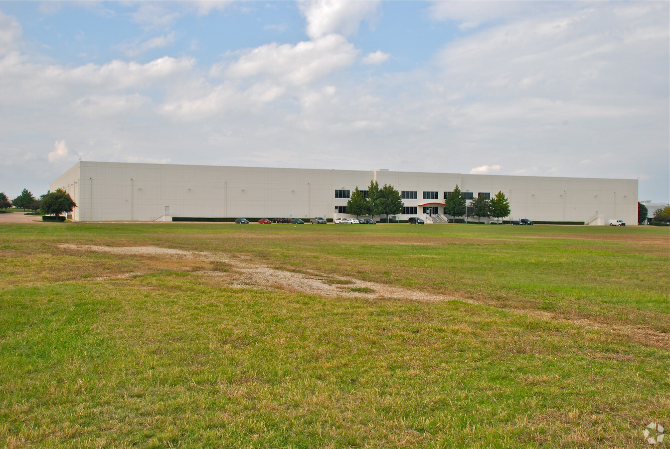
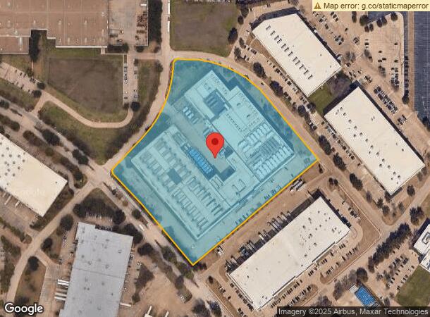
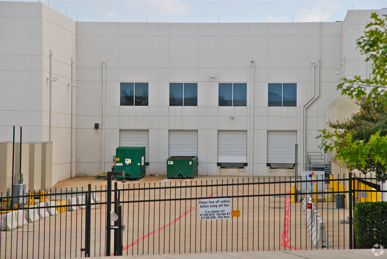
Property Record
4832 Cambridge Rd, Fort Worth, TX 76155

NEARBY LISTINGS FOR SALE OR LEASE
Property Detail
4832 Cambridge Rd
Dallas-Fort Worth-Arlington, TX
Centreport Addition
41197186
CENTREPORT ADDITION BLOCK 314A LOT 1
Commercialnec
Tarrant
X
Texas
48439C0235L
1
2023
11.47 AC
2024
Upper Great Southwest
106518
Dallas/Ft Worth
266,586 SF
DEMOGRAPHICS near 4832 Cambridge Rd
1 Mile
3 Mile
5 Mile
2024 Total Population
1,824
83,525
245,808
2029 Population
1,918
85,364
250,976
Pop Growth 2024-2029
+ 5.15%
+ 2.20%
+ 2.10%
Average Age
32
35
36
2024 Total Households
1,002
34,692
96,875
HH Growth 2024-2029
+ 4.29%
+ 2.32%
+ 2.30%
Median Household Inc
$92,815
$57,429
$64,122
Avg Household Size
1.80
2.30
2.50
2024 Avg HH Vehicles
1.00
2.00
2.00
Median Home Value
$588,235
$247,115
$267,187
Median Year Built
2011
1988
1985
Nearby Places
- Restaurants
- Banks
- Shops
- Fitness
- Groceries
PUBLIC TRANSPORTATION
COMMUTER RAIL
Centre Port/Dfw (Trinity Railway Express - Dallas Area Rapid Transit (DART))
DRIVE
WALK
Distance
Centre Port/Dfw (Trinity Railway Express - Dallas Area Rapid Transit (DART))
6 min
2.0 mi
West Tex Yard Limit (TRINITY RAILWAY - Dallas Area Rapid Transit (DART))
DRIVE
WALK
Distance
West Tex Yard Limit (TRINITY RAILWAY - Dallas Area Rapid Transit (DART))
7 min
2.2 mi
AIRPORT
Dallas-Fort Worth International
DRIVE
WALK
Distance
Dallas-Fort Worth International
11 min
6.2 mi
Dallas Love Field
DRIVE
WALK
Distance
Dallas Love Field
22 min
14.5 mi
Freight Ports
Port of Shreveport
DRIVE
WALK
Distance
Port of Shreveport
232 min
213.7 mi
Nearby Properties
Address
Land Use
TOTAL SIZE
Lot Size
Zoning
Address
Land Use
TOTAL SIZE
Lot Size
Zoning
4,923,534 SF
0.08 AC
Z392
Address
Land Use
TOTAL SIZE
Lot Size
Zoning
3,204,300 SF
124.04 AC
Address
Land Use
TOTAL SIZE
Lot Size
Zoning
1,344,594 SF
44.86 AC
Address
Land Use
TOTAL SIZE
Lot Size
Zoning
1,447,078 SF
41.52 AC
Address
Land Use
TOTAL SIZE
Lot Size
Zoning
500,000 SF
99.10 AC
Address
Land Use
TOTAL SIZE
Lot Size
Zoning
467,694 SF
24.03 AC
Address
Land Use
TOTAL SIZE
Lot Size
Zoning
468,250 SF
37.02 AC
Address
Land Use
TOTAL SIZE
Lot Size
Zoning
332,952 SF
13.54 AC
Address
Land Use
TOTAL SIZE
Lot Size
Zoning
485,911 SF
54.76 AC
Address
Land Use
TOTAL SIZE
Lot Size
Zoning
516,974 SF
23.81 AC
Address
Land Use
TOTAL SIZE
Lot Size
Zoning
501,933 SF
16.25 AC
Address
Land Use
TOTAL SIZE
Lot Size
Zoning
522,294 SF
18.35 AC
Address
Land Use
TOTAL SIZE
Lot Size
Zoning
443,420 SF
10.96 AC
Address
Land Use
TOTAL SIZE
Lot Size
Zoning
591,105 SF
46.67 AC
Address
Land Use
TOTAL SIZE
Lot Size
Zoning
294,146 SF
12.08 AC
Address
Land Use
TOTAL SIZE
Lot Size
Zoning
348,842 SF
17.08 AC
Address
Land Use
TOTAL SIZE
Lot Size
Zoning
422,880 SF
20.06 AC
Z177
Address
Land Use
TOTAL SIZE
Lot Size
Zoning
339,965 SF
15.59 AC
Address
Land Use
TOTAL SIZE
Lot Size
Zoning
342,583 SF
23.86 AC
Address
Land Use
TOTAL SIZE
Lot Size
Zoning
344,326 SF
15.24 AC
Address
Land Use
TOTAL SIZE
Lot Size
Zoning
224,654 SF
15.98 AC
Address
Land Use
TOTAL SIZE
Lot Size
Zoning
341,925 SF
17.78 AC
Z49
Address
Land Use
TOTAL SIZE
Lot Size
Zoning
286,861 SF
13.38 AC
Address
Land Use
TOTAL SIZE
Lot Size
Zoning
220,435 SF
14.97 AC
Address
Land Use
TOTAL SIZE
Lot Size
Zoning
293,822 SF
18.80 AC
Address
Land Use
TOTAL SIZE
Lot Size
Zoning
336,302 SF
16.74 AC
Z393
Address
Land Use
TOTAL SIZE
Lot Size
Zoning
253,710 SF
11.50 AC
Address
Land Use
TOTAL SIZE
Lot Size
Zoning
196,912 SF
8.53 AC
Address
Land Use
TOTAL SIZE
Lot Size
Zoning
198,800 SF
6.74 AC
The World's #1 Commercial Real Estate Marketplace
Connect with us
© 2025 CoStar Group
The information above has been obtained from sources believed reliable. While we do not doubt its accuracy we have not verified it and make no guarantee, warranty or representation about it. It is your responsibility to independently confirm its accuracy and completeness. Any projections, opinions, assumptions, or estimates used are for example only and do not represent the current or future performance of the property. The value of this transaction to you depends on tax and other factors which should be evaluated by your tax, financial, and legal advisors. You and your advisors should conduct a careful, independent investigation of the property to determine to your satisfaction the suitability of the property for your needs.