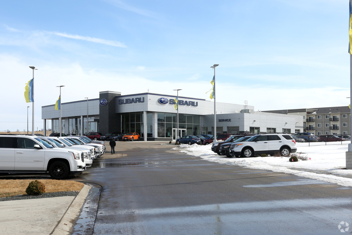
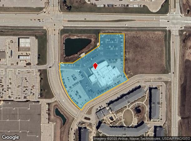
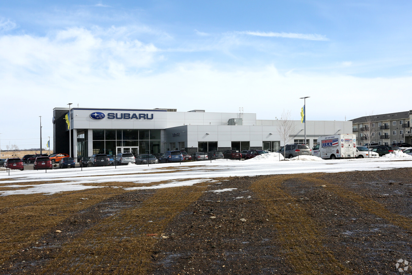
Property Record
4840 Maine Ave Se, Rochester, MN 55904
NEARBY LISTINGS FOR SALE OR LEASE
Property Detail
4840 Maine Ave Se
Rochester, MN
Maine Heights
64.26.44.082531
SECT-26 TWP-106 RANGE-014 MAINE HEIGHTS LOT-001 BLOCK-002
Autorepair
Olmsted
X
Minnesota
27109C0304E
1
2023
5.68 AC
2023
Historic Southwest
0009031081
Other Market Areas
39,650 SF
DEMOGRAPHICS near 4840 Maine Ave Se
1 Mile
3 Mile
5 Mile
2024 Total Population
2,534
15,681
51,333
2029 Population
2,600
15,988
52,970
Pop Growth 2024-2029
+ 2.60%
+ 1.96%
+ 3.19%
Average Age
38
39
39
2024 Total Households
1,008
5,809
21,081
HH Growth 2024-2029
+ 2.48%
+ 1.84%
+ 3.27%
Median Household Inc
$106,553
$111,679
$76,975
Avg Household Size
2.50
2.60
2.30
2024 Avg HH Vehicles
2.00
2.00
2.00
Median Home Value
$388,516
$322,474
$288,996
Median Year Built
2007
1996
1985
Nearby Places
- Restaurants
- Banks
- Shops
- Fitness
- Groceries
PUBLIC TRANSPORTATION
AIRPORT
Rochester International
DRIVE
WALK
Distance
Rochester International
7 min
4.1 mi
Freight Ports
Port Milwaukee
DRIVE
WALK
Distance
Port Milwaukee
304 min
276.5 mi
SALE & LEASE HISTORY
LISTING DATE
SALE/LEASE

Dec 05, 2017
For Lease
Nearby Properties
Address
Land Use
TOTAL SIZE
Lot Size
Zoning
Address
Land Use
TOTAL SIZE
Lot Size
Zoning
6.83 AC
Address
Land Use
TOTAL SIZE
Lot Size
Zoning
287,670 SF
13.59 AC
Address
Land Use
TOTAL SIZE
Lot Size
Zoning
190,062 SF
10.62 AC
Address
Land Use
TOTAL SIZE
Lot Size
Zoning
133,474 SF
22.12 AC
Address
Land Use
TOTAL SIZE
Lot Size
Zoning
123,608 SF
3.85 AC
Address
Land Use
TOTAL SIZE
Lot Size
Zoning
117,152 SF
3.69 AC
Address
Land Use
TOTAL SIZE
Lot Size
Zoning
12.23 AC
Address
Land Use
TOTAL SIZE
Lot Size
Zoning
99,888 SF
6.41 AC
Address
Land Use
TOTAL SIZE
Lot Size
Zoning
88,634 SF
9.42 AC
Address
Land Use
TOTAL SIZE
Lot Size
Zoning
306,910 SF
25.68 AC
Address
Land Use
TOTAL SIZE
Lot Size
Zoning
57.26 AC
Address
Land Use
TOTAL SIZE
Lot Size
Zoning
205,478 SF
16.88 AC
Address
Land Use
TOTAL SIZE
Lot Size
Zoning
91,087 SF
14.95 AC
Address
Land Use
TOTAL SIZE
Lot Size
Zoning
174,907 SF
13.16 AC
Address
Land Use
TOTAL SIZE
Lot Size
Zoning
46,773 SF
5.66 AC
Address
Land Use
TOTAL SIZE
Lot Size
Zoning
23,760 SF
12.77 AC
Address
Land Use
TOTAL SIZE
Lot Size
Zoning
821,407 SF
24.42 AC
Address
Land Use
TOTAL SIZE
Lot Size
Zoning
92,424 SF
5.74 AC
Address
Land Use
TOTAL SIZE
Lot Size
Zoning
159,417 SF
12.17 AC
Address
Land Use
TOTAL SIZE
Lot Size
Zoning
97,024 SF
8.86 AC
Address
Land Use
TOTAL SIZE
Lot Size
Zoning
94,758 SF
8.61 AC
Address
Land Use
TOTAL SIZE
Lot Size
Zoning
193,600 SF
18.43 AC
Address
Land Use
TOTAL SIZE
Lot Size
Zoning
22,106 SF
2.02 AC
Address
Land Use
TOTAL SIZE
Lot Size
Zoning
51,044 SF
3.03 AC
Address
Land Use
TOTAL SIZE
Lot Size
Zoning
56,400 SF
4.12 AC
Address
Land Use
TOTAL SIZE
Lot Size
Zoning
74,986 SF
9.48 AC
Address
Land Use
TOTAL SIZE
Lot Size
Zoning
34,390 SF
6.17 AC
Address
Land Use
TOTAL SIZE
Lot Size
Zoning
116,993 SF
4.96 AC
The World's #1 Commercial Real Estate Marketplace
Connect with us
© 2025 CoStar Group
The information above has been obtained from sources believed reliable. While we do not doubt its accuracy we have not verified it and make no guarantee, warranty or representation about it. It is your responsibility to independently confirm its accuracy and completeness. Any projections, opinions, assumptions, or estimates used are for example only and do not represent the current or future performance of the property. The value of this transaction to you depends on tax and other factors which should be evaluated by your tax, financial, and legal advisors. You and your advisors should conduct a careful, independent investigation of the property to determine to your satisfaction the suitability of the property for your needs.