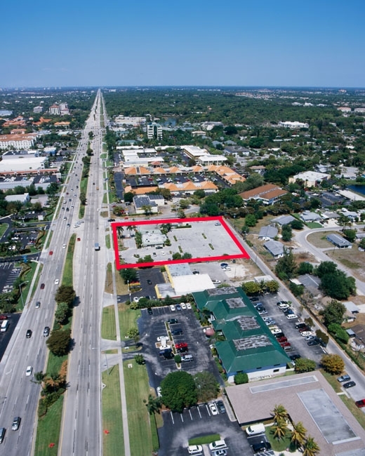
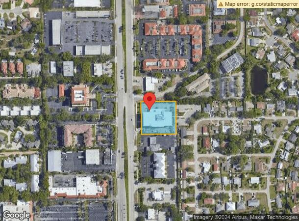
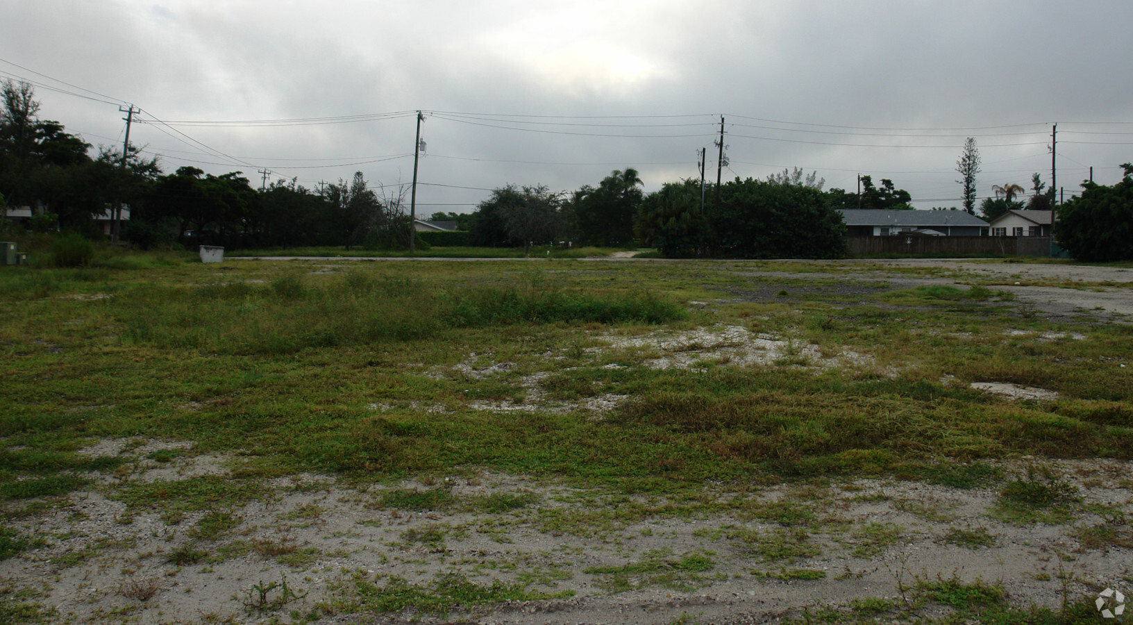
Property Record
4850 Tamiami Trl N, Naples, FL 34103
NEARBY LISTINGS FOR SALE OR LEASE
Property Detail
4850 Tamiami Trl N
Naples-Immokalee-Marco Island, FL
Naples Twin Lakes
63400040005
NAPLES TWIN LAKES BLK 1 LOTS 1 THRU 4 + N 25FT OF LOT 5 OR 1361 PG 885
Officebuilding
Collier
AH
Florida
12021C0383J
1
2023
1.32 AC
2023
North Naples
010300
Southwest Florida
43,337 SF
DEMOGRAPHICS near 4850 Tamiami Trl N
1 Mile
3 Mile
5 Mile
2024 Total Population
9,445
47,108
99,552
2029 Population
10,864
54,176
114,093
Pop Growth 2024-2029
+ 15.02%
+ 15.00%
+ 14.61%
Average Age
56
56
54
2024 Total Households
4,508
23,117
47,196
HH Growth 2024-2029
+ 14.97%
+ 14.84%
+ 14.48%
Median Household Inc
$107,653
$102,589
$91,824
Avg Household Size
2.00
1.90
2.00
2024 Avg HH Vehicles
2.00
2.00
2.00
Median Home Value
$878,340
$813,806
$693,692
Median Year Built
1983
1988
1991
Nearby Places
- Restaurants
- Banks
- Shops
- Fitness
- Groceries
PUBLIC TRANSPORTATION
AIRPORT
Southwest Florida International
DRIVE
WALK
Distance
Southwest Florida International
42 min
31.5 mi
Freight Ports
Port Everglades
DRIVE
WALK
Distance
Port Everglades
124 min
109.6 mi
Nearby Properties
Address
Land Use
TOTAL SIZE
Lot Size
Zoning
Address
Land Use
TOTAL SIZE
Lot Size
Zoning
688,632 SF
29.28 AC
A
Address
Land Use
TOTAL SIZE
Lot Size
Zoning
905,326 SF
69.45 AC
GC
Address
Land Use
TOTAL SIZE
Lot Size
Zoning
Address
Land Use
TOTAL SIZE
Lot Size
Zoning
411,909 SF
181.63 AC
RSF-3
Address
Land Use
TOTAL SIZE
Lot Size
Zoning
123,282 SF
6.50 AC
PUD
Address
Land Use
TOTAL SIZE
Lot Size
Zoning
250,674 SF
33.61 AC
NAPLES
Address
Land Use
TOTAL SIZE
Lot Size
Zoning
398,094 SF
17.78 AC
A
Address
Land Use
TOTAL SIZE
Lot Size
Zoning
363,275 SF
21.02 AC
PUD
Address
Land Use
TOTAL SIZE
Lot Size
Zoning
218,013 SF
77.73 AC
A
Address
Land Use
TOTAL SIZE
Lot Size
Zoning
453,819 SF
4.53 AC
Address
Land Use
TOTAL SIZE
Lot Size
Zoning
932,389 SF
36.28 AC
NAPLES
Address
Land Use
TOTAL SIZE
Lot Size
Zoning
72,844 SF
15.94 AC
RSF-1
Address
Land Use
TOTAL SIZE
Lot Size
Zoning
418,075 SF
38.19 AC
Address
Land Use
TOTAL SIZE
Lot Size
Zoning
137,799 SF
5.78 AC
Address
Land Use
TOTAL SIZE
Lot Size
Zoning
82,382 SF
9.98 AC
PUD
Address
Land Use
TOTAL SIZE
Lot Size
Zoning
164,004 SF
2.66 AC
Address
Land Use
TOTAL SIZE
Lot Size
Zoning
256,507 SF
26.32 AC
PUD
Address
Land Use
TOTAL SIZE
Lot Size
Zoning
277,290 SF
31.01 AC
PUD
Address
Land Use
TOTAL SIZE
Lot Size
Zoning
134,551 SF
19.50 AC
PUD
Address
Land Use
TOTAL SIZE
Lot Size
Zoning
71,516 SF
2.88 AC
NAPLES
Address
Land Use
TOTAL SIZE
Lot Size
Zoning
255,522 SF
21.83 AC
NAPLES
Address
Land Use
TOTAL SIZE
Lot Size
Zoning
203,171 SF
16.64 AC
NAPLES
Address
Land Use
TOTAL SIZE
Lot Size
Zoning
100,375 SF
3.71 AC
Address
Land Use
TOTAL SIZE
Lot Size
Zoning
99,700 SF
3.08 AC
Address
Land Use
TOTAL SIZE
Lot Size
Zoning
99,700 SF
3.05 AC
Address
Land Use
TOTAL SIZE
Lot Size
Zoning
145,061 SF
18.82 AC
PUD
Address
Land Use
TOTAL SIZE
Lot Size
Zoning
33,802 SF
45.05 AC
A
Address
Land Use
TOTAL SIZE
Lot Size
Zoning
133,302 SF
3.82 AC
NAPLES
Address
Land Use
TOTAL SIZE
Lot Size
Zoning
29,443 SF
26.05 AC
NAPLES
Address
Land Use
TOTAL SIZE
Lot Size
Zoning
119,011 SF
13.50 AC
PD
The World's #1 Commercial Real Estate Marketplace
Connect with us
© 2025 CoStar Group
The information above has been obtained from sources believed reliable. While we do not doubt its accuracy we have not verified it and make no guarantee, warranty or representation about it. It is your responsibility to independently confirm its accuracy and completeness. Any projections, opinions, assumptions, or estimates used are for example only and do not represent the current or future performance of the property. The value of this transaction to you depends on tax and other factors which should be evaluated by your tax, financial, and legal advisors. You and your advisors should conduct a careful, independent investigation of the property to determine to your satisfaction the suitability of the property for your needs.