Property Record
4875 Baldwin St, Bronx, NY 10470
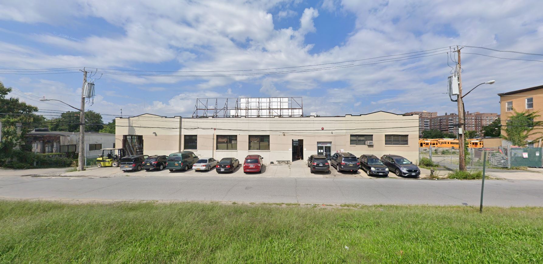

This Property Is For Sale
NEARBY LISTINGS FOR SALE OR LEASE
Property Detail
4875 Baldwin St
05130-0103
Bronx
Heavyindustrial
New York
X
100
36119C0336F
0.54 AC
2024
Bronx
2024
Westchester/So Connecticut
045102
New York-Jersey City-White Plains, NY-NJ
20,500 SF
DEMOGRAPHICS near 4875 Baldwin St
1 Mile
3 Mile
5 Mile
2024 Total Population
57,993
467,326
1,133,661
2029 Population
54,356
438,204
1,066,646
Pop Growth 2024-2029
(6.27%)
(6.23%)
(5.91%)
Average Age
40
40
40
2024 Total Households
22,154
173,515
417,442
HH Growth 2024-2029
(6.29%)
(6.54%)
(6.32%)
Median Household Inc
$65,418
$63,540
$58,945
Avg Household Size
2.50
2.60
2.60
2024 Avg HH Vehicles
1.00
1.00
1.00
Median Home Value
$454,900
$469,138
$514,373
Median Year Built
1948
1951
1951
Nearby Places
- Restaurants
- Banks
- Shops
- Fitness
- Groceries
PUBLIC TRANSPORTATION
TRANSIT/SUBWAY
233 Street (2 - New York MTA Subway (The Subway), 5 - New York MTA Subway (The Subway))
DRIVE
WALK
Distance
233 Street (2 - New York MTA Subway (The Subway), 5 - New York MTA Subway (The Subway))
1 min
14 min
0.7 mi
COMMUTER RAIL
Woodlawn Station (Harlem Line - Metro-North Commuter Railroad Company (Metro-North))
DRIVE
WALK
Distance
Woodlawn Station (Harlem Line - Metro-North Commuter Railroad Company (Metro-North))
1 min
7 min
0.4 mi
Wakefield Station (Harlem Line - Metro-North Commuter Railroad Company (Metro-North))
DRIVE
WALK
Distance
Wakefield Station (Harlem Line - Metro-North Commuter Railroad Company (Metro-North))
3 min
1.7 mi
AIRPORT
Laguardia
DRIVE
WALK
Distance
Laguardia
24 min
13.5 mi
Westchester County
DRIVE
WALK
Distance
Westchester County
30 min
19.5 mi
John F Kennedy International
DRIVE
WALK
Distance
John F Kennedy International
31 min
21.5 mi
Freight Ports
NY - Red Hook Container Terminal
DRIVE
WALK
Distance
NY - Red Hook Container Terminal
37 min
21.7 mi
Nearby Properties
Address
Land Use
TOTAL SIZE
Lot Size
Zoning
Address
Land Use
TOTAL SIZE
Lot Size
Zoning
481,172 SF
205.58 AC
PARK
Address
Land Use
TOTAL SIZE
Lot Size
Zoning
1,132,500 SF
62.44 AC
R6
Address
Land Use
TOTAL SIZE
Lot Size
Zoning
895,256 SF
8.32 AC
R7-1
Address
Land Use
TOTAL SIZE
Lot Size
Zoning
1,237,424 SF
21.25 AC
R6
Address
Land Use
TOTAL SIZE
Lot Size
Zoning
204,200 SF
1.68 AC
R7-1
Address
Land Use
TOTAL SIZE
Lot Size
Zoning
617,567 SF
3.19 AC
R7-1
Address
Land Use
TOTAL SIZE
Lot Size
Zoning
545,388 SF
29.07 AC
C4-3
Address
Land Use
TOTAL SIZE
Lot Size
Zoning
707,353 SF
29.34 AC
R6
Address
Land Use
TOTAL SIZE
Lot Size
Zoning
Address
Land Use
TOTAL SIZE
Lot Size
Zoning
Address
Land Use
TOTAL SIZE
Lot Size
Zoning
18,445 SF
510.83 AC
PARK
Address
Land Use
TOTAL SIZE
Lot Size
Zoning
87,000 SF
455.70 AC
PARK
Address
Land Use
TOTAL SIZE
Lot Size
Zoning
64,165 SF
3.24 AC
B
Address
Land Use
TOTAL SIZE
Lot Size
Zoning
165,529 SF
7.05 AC
RA3
Address
Land Use
TOTAL SIZE
Lot Size
Zoning
269,100 SF
1.63 AC
R4
Address
Land Use
TOTAL SIZE
Lot Size
Zoning
450,784 SF
42.36 AC
R4
Address
Land Use
TOTAL SIZE
Lot Size
Zoning
251,884 SF
21.53 AC
R6
Address
Land Use
TOTAL SIZE
Lot Size
Zoning
785,230 SF
13.39 AC
C4-3
Address
Land Use
TOTAL SIZE
Lot Size
Zoning
434,650 SF
2 AC
R7-1
Address
Land Use
TOTAL SIZE
Lot Size
Zoning
614,887 SF
14.77 AC
R4
Address
Land Use
TOTAL SIZE
Lot Size
Zoning
61,055 SF
343.42 AC
R6
Address
Land Use
TOTAL SIZE
Lot Size
Zoning
285,373 SF
2.66 AC
R4
Address
Land Use
TOTAL SIZE
Lot Size
Zoning
280,539 SF
3.11 AC
R6
Address
Land Use
TOTAL SIZE
Lot Size
Zoning
493,000 SF
3.02 AC
R5
Address
Land Use
TOTAL SIZE
Lot Size
Zoning
1,028,976 SF
23.03 AC
R5
Address
Land Use
TOTAL SIZE
Lot Size
Zoning
1,038,034 SF
23.41 AC
R5
Address
Land Use
TOTAL SIZE
Lot Size
Zoning
203,837 SF
1.92 AC
R6
Address
Land Use
TOTAL SIZE
Lot Size
Zoning
453,364 SF
8.26 AC
R6
Address
Land Use
TOTAL SIZE
Lot Size
Zoning
537,765 SF
6.49 AC
C4-3
Address
Land Use
TOTAL SIZE
Lot Size
Zoning
111,229 SF
137.74 AC
PARK
The World's #1 Commercial Real Estate Marketplace
Connect with us
© 2025 CoStar Group
The information above has been obtained from sources believed reliable. While we do not doubt its accuracy we have not verified it and make no guarantee, warranty or representation about it. It is your responsibility to independently confirm its accuracy and completeness. Any projections, opinions, assumptions, or estimates used are for example only and do not represent the current or future performance of the property. The value of this transaction to you depends on tax and other factors which should be evaluated by your tax, financial, and legal advisors. You and your advisors should conduct a careful, independent investigation of the property to determine to your satisfaction the suitability of the property for your needs.