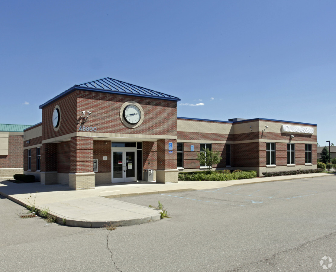
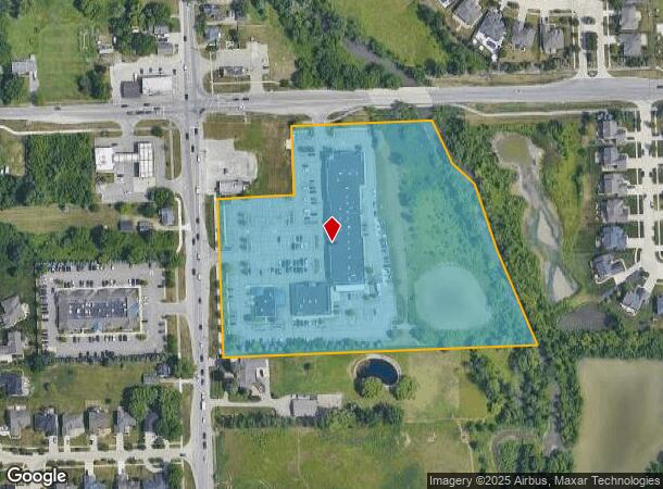
Property Record
48800 Romeo Plank Rd, Macomb, MI 48044

NEARBY LISTINGS FOR SALE OR LEASE
Property Detail
48800 Romeo Plank Rd
20-08-28-101-010
T3N R13E SEC 28; COMM AT NW COR SEC 28; TH E 257.50 FT TO POB; TH E 355.0 FT; TH S22*57'28"E 155.43 FT; TH S31*21'18"E 151.40
Commercialnec
Macomb
AE
Michigan
26099C0245G
9.01 AC
2023
Macomb East
2024
Detroit
224102
Detroit-Warren-Dearborn, MI
DEMOGRAPHICS near 48800 Romeo Plank Rd
1 Mile
3 Mile
5 Mile
2024 Total Population
12,184
93,751
206,355
2029 Population
11,959
92,334
204,029
Pop Growth 2024-2029
(1.85%)
(1.51%)
(1.13%)
Average Age
41
41
42
2024 Total Households
4,040
34,906
80,022
HH Growth 2024-2029
(1.83%)
(1.62%)
(1.16%)
Median Household Inc
$116,315
$94,705
$84,791
Avg Household Size
3.00
2.60
2.50
2024 Avg HH Vehicles
3.00
2.00
2.00
Median Home Value
$324,811
$305,306
$276,526
Median Year Built
1996
1996
1992
Nearby Places
- Restaurants
- Banks
- Shops
- Fitness
- Groceries
PUBLIC TRANSPORTATION
AIRPORT
Windsor International
DRIVE
WALK
Distance
Windsor International
67 min
41.8 mi
Freight Ports
Port of Toledo
DRIVE
WALK
Distance
Port of Toledo
117 min
89.9 mi
SALE & LEASE HISTORY
LISTING DATE
SALE/LEASE

Sep 25, 2016
For Lease
Apr 07, 2017
For Sale
Nearby Properties
Address
Land Use
TOTAL SIZE
Lot Size
Zoning
Address
Land Use
TOTAL SIZE
Lot Size
Zoning
42.79 AC
B-4
Address
Land Use
TOTAL SIZE
Lot Size
Zoning
122.50 AC
RML
Address
Land Use
TOTAL SIZE
Lot Size
Zoning
20,891 SF
289.61 AC
R3
Address
Land Use
TOTAL SIZE
Lot Size
Zoning
20,560 SF
37.09 AC
R2
Address
Land Use
TOTAL SIZE
Lot Size
Zoning
401,014 SF
32.54 AC
RML
Address
Land Use
TOTAL SIZE
Lot Size
Zoning
35 AC
RML
Address
Land Use
TOTAL SIZE
Lot Size
Zoning
182,708 SF
10.69 AC
RMH
Address
Land Use
TOTAL SIZE
Lot Size
Zoning
118,343 SF
7.33 AC
R1
Address
Land Use
TOTAL SIZE
Lot Size
Zoning
44.65 AC
RML
Address
Land Use
TOTAL SIZE
Lot Size
Zoning
10.29 AC
LM
Address
Land Use
TOTAL SIZE
Lot Size
Zoning
89,559 SF
44.54 AC
O2
Address
Land Use
TOTAL SIZE
Lot Size
Zoning
120,658 SF
13.97 AC
C-3
Address
Land Use
TOTAL SIZE
Lot Size
Zoning
17.40 AC
CK MAP
Address
Land Use
TOTAL SIZE
Lot Size
Zoning
20.27 AC
RML
Address
Land Use
TOTAL SIZE
Lot Size
Zoning
25.14 AC
RML
Address
Land Use
TOTAL SIZE
Lot Size
Zoning
90,185 SF
14.73 AC
C2
Address
Land Use
TOTAL SIZE
Lot Size
Zoning
233,584 SF
26.03 AC
C-3
Address
Land Use
TOTAL SIZE
Lot Size
Zoning
148,446 SF
10.01 AC
RMH
Address
Land Use
TOTAL SIZE
Lot Size
Zoning
79,942 SF
4.65 AC
M1
Address
Land Use
TOTAL SIZE
Lot Size
Zoning
293,800 SF
M1
Address
Land Use
TOTAL SIZE
Lot Size
Zoning
45,000 SF
7.58 AC
B-4
Address
Land Use
TOTAL SIZE
Lot Size
Zoning
152,568 SF
18.44 AC
CK MAP
Address
Land Use
TOTAL SIZE
Lot Size
Zoning
600 SF
18.79 AC
R2L
Address
Land Use
TOTAL SIZE
Lot Size
Zoning
26.92 AC
RML
Address
Land Use
TOTAL SIZE
Lot Size
Zoning
72,572 SF
10 AC
B-3
Address
Land Use
TOTAL SIZE
Lot Size
Zoning
94,332 SF
3.47 AC
B-3
Address
Land Use
TOTAL SIZE
Lot Size
Zoning
175,143 SF
22.87 AC
B-4
Address
Land Use
TOTAL SIZE
Lot Size
Zoning
14.38 AC
C3
Address
Land Use
TOTAL SIZE
Lot Size
Zoning
150,854 SF
8.50 AC
LM
Address
Land Use
TOTAL SIZE
Lot Size
Zoning
4,064 SF
99.98 AC
R3
The World's #1 Commercial Real Estate Marketplace
Connect with us
© 2025 CoStar Group
The information above has been obtained from sources believed reliable. While we do not doubt its accuracy we have not verified it and make no guarantee, warranty or representation about it. It is your responsibility to independently confirm its accuracy and completeness. Any projections, opinions, assumptions, or estimates used are for example only and do not represent the current or future performance of the property. The value of this transaction to you depends on tax and other factors which should be evaluated by your tax, financial, and legal advisors. You and your advisors should conduct a careful, independent investigation of the property to determine to your satisfaction the suitability of the property for your needs.