Property Record
49 Franks Ln, Hanover, MA 02339
NEARBY LISTINGS FOR SALE OR LEASE
-
-
View all Hanover listings for sale on LoopNet.com
Property Detail
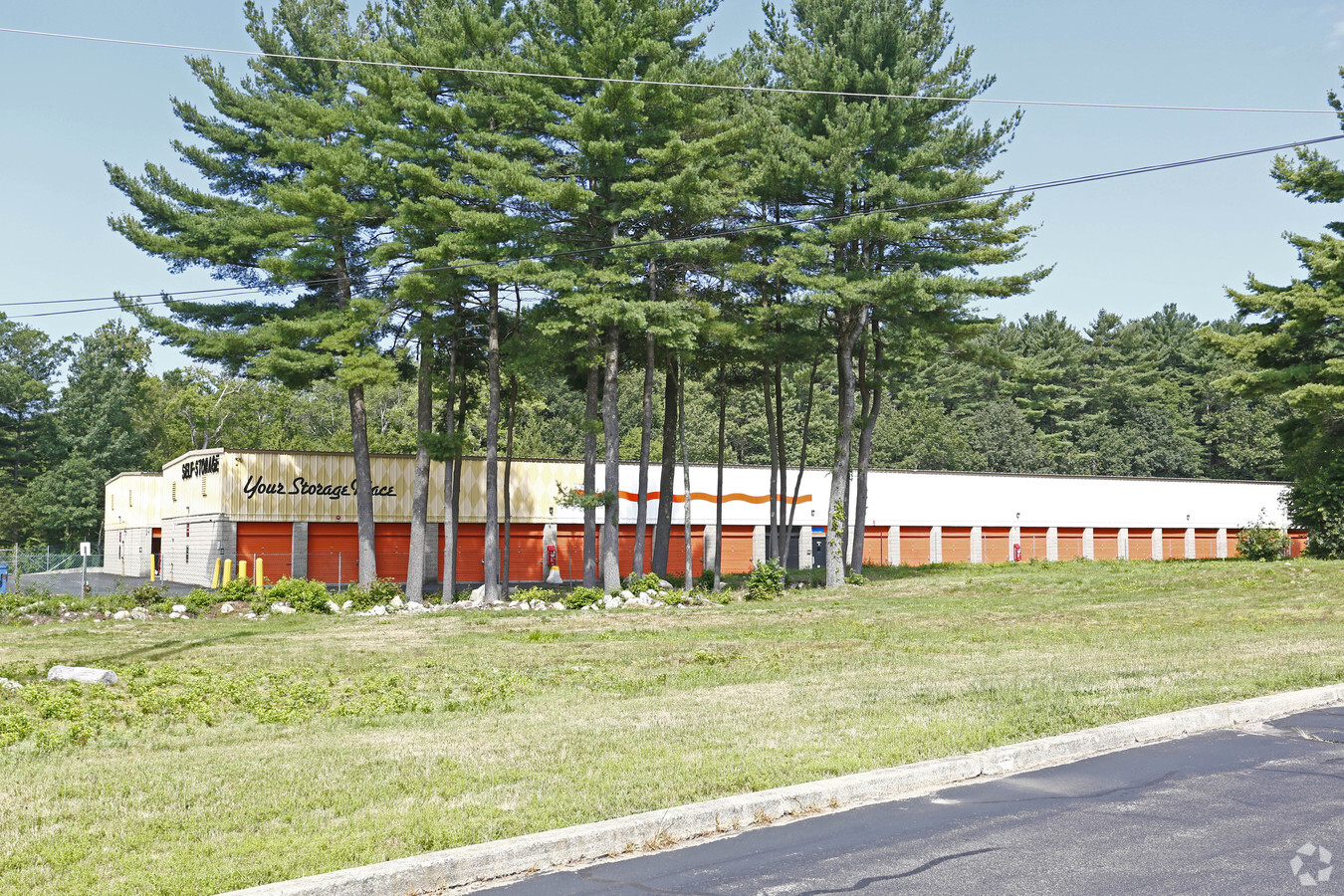
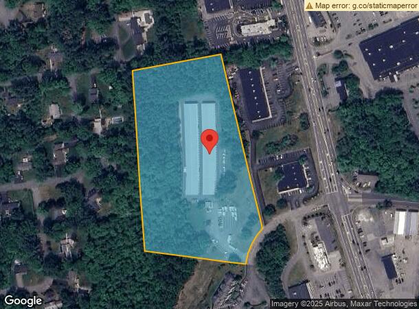
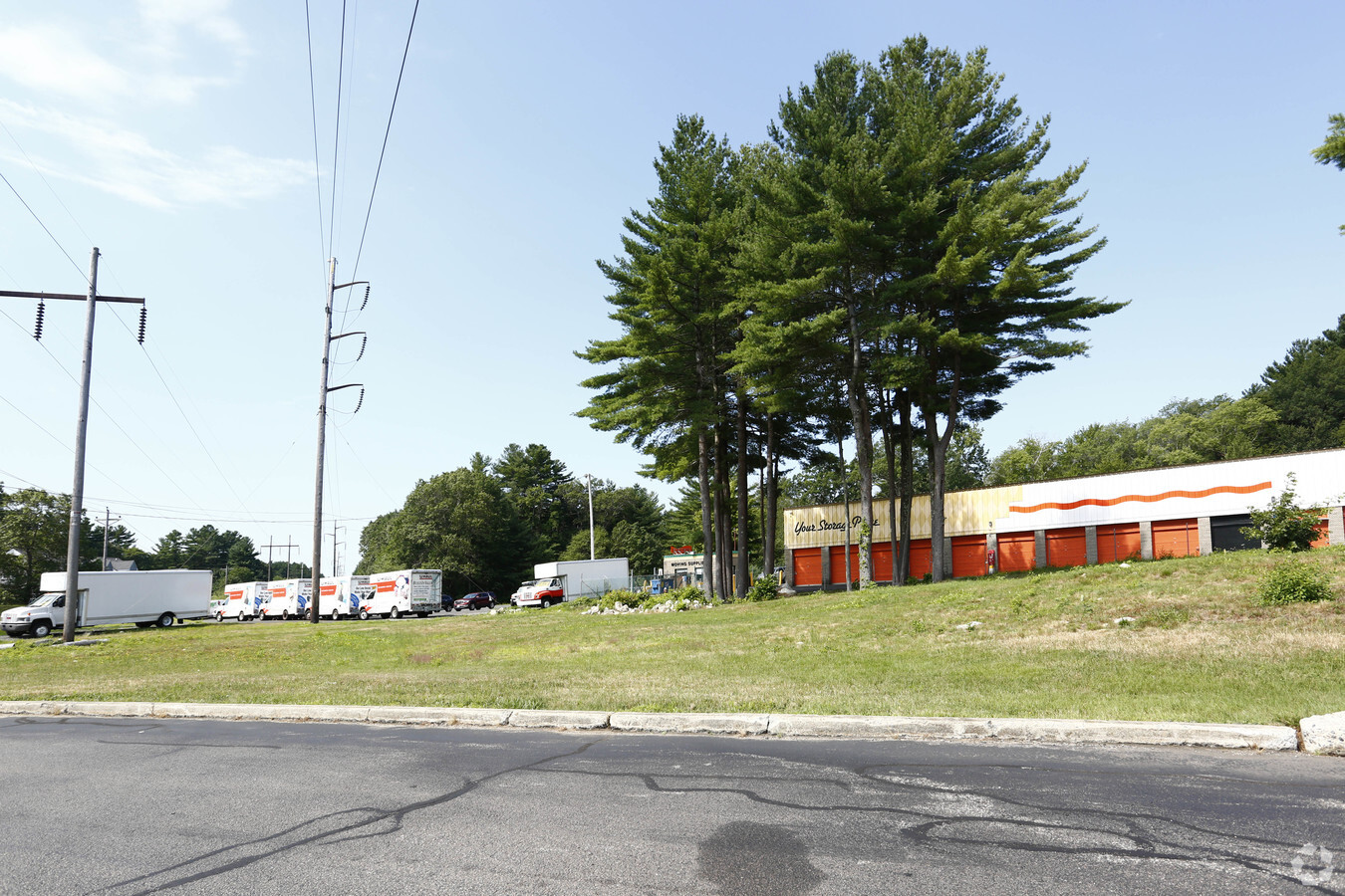
49 Franks Ln
HANO-000017-000000-000005
Plymouth
Commercialnec
Massachusetts
X
5
25023C0113K
8.50 AC
2023
Route 3 Corridor
2024
Boston
503101
Boston-Cambridge-Newton, MA-NH
DEMOGRAPHICS near 49 Franks Ln
1 Mile
3 Mile
5 Mile
2024 Total Population
2,594
23,402
65,638
2029 Population
2,648
23,506
65,739
Pop Growth 2024-2029
+ 2.08%
+ 0.44%
+ 0.15%
Average Age
41
41
42
2024 Total Households
918
7,989
23,365
HH Growth 2024-2029
+ 2.07%
+ 0.43%
+ 0.09%
Median Household Inc
$137,500
$157,036
$138,898
Avg Household Size
2.80
2.90
2.70
2024 Avg HH Vehicles
2.00
2.00
2.00
Median Home Value
$692,343
$657,476
$610,038
Median Year Built
1969
1970
1969
Nearby Places
- Restaurants
- Banks
- Shops
- Fitness
- Groceries
PUBLIC TRANSPORTATION
COMMUTER RAIL
Abington (Kingston/Plymouth Line - Massachusetts Bay Transportation Authority Commuter Rail (Purple Line))
DRIVE
WALK
Distance
Abington (Kingston/Plymouth Line - Massachusetts Bay Transportation Authority Commuter Rail (Purple Line))
16 min
7.5 mi
South Weymouth (Kingston/Plymouth Line - Massachusetts Bay Transportation Authority Commuter Rail (Purple Line))
DRIVE
WALK
Distance
South Weymouth (Kingston/Plymouth Line - Massachusetts Bay Transportation Authority Commuter Rail (Purple Line))
16 min
7.7 mi
AIRPORT
General Edward Lawrence Logan International
DRIVE
WALK
Distance
General Edward Lawrence Logan International
38 min
24.9 mi
Freight Ports
Port of Boston
DRIVE
WALK
Distance
Port of Boston
35 min
22.7 mi
Nearby Properties
Address
Land Use
TOTAL SIZE
Lot Size
Zoning
Address
Land Use
TOTAL SIZE
Lot Size
Zoning
23.41 AC
R
Address
Land Use
TOTAL SIZE
Lot Size
Zoning
67.07 AC
Address
Land Use
TOTAL SIZE
Lot Size
Zoning
276,753 SF
25.44 AC
Address
Land Use
TOTAL SIZE
Lot Size
Zoning
78.50 AC
R
Address
Land Use
TOTAL SIZE
Lot Size
Zoning
13.15 AC
Address
Land Use
TOTAL SIZE
Lot Size
Zoning
94.53 AC
Address
Land Use
TOTAL SIZE
Lot Size
Zoning
251.33 AC
Address
Land Use
TOTAL SIZE
Lot Size
Zoning
141,514 SF
46.60 AC
R
Address
Land Use
TOTAL SIZE
Lot Size
Zoning
141,687 SF
17.27 AC
Address
Land Use
TOTAL SIZE
Lot Size
Zoning
91,586 SF
13.70 AC
R
Address
Land Use
TOTAL SIZE
Lot Size
Zoning
121,832 SF
0.97 AC
C
Address
Land Use
TOTAL SIZE
Lot Size
Zoning
54,756 SF
15.40 AC
Address
Land Use
TOTAL SIZE
Lot Size
Zoning
108,958 SF
7.37 AC
LI
Address
Land Use
TOTAL SIZE
Lot Size
Zoning
93,933 SF
13 AC
Address
Land Use
TOTAL SIZE
Lot Size
Zoning
107,123 SF
15.92 AC
Address
Land Use
TOTAL SIZE
Lot Size
Zoning
137,617 SF
24.54 AC
C
Address
Land Use
TOTAL SIZE
Lot Size
Zoning
12.04 AC
C
Address
Land Use
TOTAL SIZE
Lot Size
Zoning
13.10 AC
Address
Land Use
TOTAL SIZE
Lot Size
Zoning
101,935 SF
10.61 AC
INDUST
Address
Land Use
TOTAL SIZE
Lot Size
Zoning
66,834 SF
13.03 AC
Address
Land Use
TOTAL SIZE
Lot Size
Zoning
62,569 SF
3.52 AC
C
Address
Land Use
TOTAL SIZE
Lot Size
Zoning
89,369 SF
15.40 AC
Address
Land Use
TOTAL SIZE
Lot Size
Zoning
24.07 AC
BD
Address
Land Use
TOTAL SIZE
Lot Size
Zoning
3.88 AC
BD
Address
Land Use
TOTAL SIZE
Lot Size
Zoning
48,300 SF
7.81 AC
PSC
Address
Land Use
TOTAL SIZE
Lot Size
Zoning
11.48 AC
C
Address
Land Use
TOTAL SIZE
Lot Size
Zoning
110,760 SF
2.09 AC
MC
Address
Land Use
TOTAL SIZE
Lot Size
Zoning
23.31 AC
B
Address
Land Use
TOTAL SIZE
Lot Size
Zoning
54,216 SF
5.69 AC
Address
Land Use
TOTAL SIZE
Lot Size
Zoning
71,327 SF
6.58 AC
The World's #1 Commercial Real Estate Marketplace
Connect with us
© 2025 CoStar Group
The information above has been obtained from sources believed reliable. While we do not doubt its accuracy we have not verified it and make no guarantee, warranty or representation about it. It is your responsibility to independently confirm its accuracy and completeness. Any projections, opinions, assumptions, or estimates used are for example only and do not represent the current or future performance of the property. The value of this transaction to you depends on tax and other factors which should be evaluated by your tax, financial, and legal advisors. You and your advisors should conduct a careful, independent investigation of the property to determine to your satisfaction the suitability of the property for your needs.