Property Record
49 Pine St, New Canaan, CT 06840
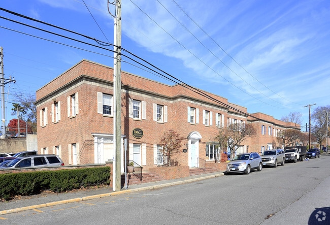
This Property Is For Sale
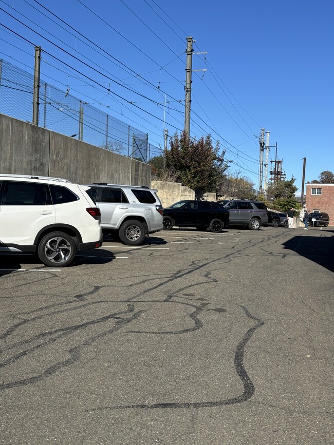
Property Detail
49 Pine St
Officecondo
Western Ct
700
Connecticut
B and X Area of moderate flood hazard, usually the area between the limits of the 100-year and 500-year floods.
931
2025
New Canaan
2025
Westchester/So Connecticut
035102
Bridgeport-Stamford-Danbury, CT
840 SF
NCAN-000000-L000017-000931-000001
NEARBY LISTINGS FOR SALE OR LEASE
DEMOGRAPHICS near 49 Pine St
1 mile
3 mile
5 mile
2025 Total Population
9,155
30,498
129,394
2030 Population
9,498
31,372
132,414
Pop Growth 2025-2030
+ 3.75%
+ 2.87%
+ 2.33%
Average Age
42
42
42
2025 Total Households
3,469
10,341
47,389
HH Growth 2025-2030
+ 3.78%
+ 2.84%
+ 2.31%
Median Household Inc
$188,715
$212,305
$146,616
Avg Household Size
2.60
2.90
2.70
2025 Avg HH Vehicles
2.00
2.00
2.00
Median Home Value
$1,079,434
$1,047,741
$818,793
Median Year Built
1966
1965
1966
Nearby Places
Map Layers
Map Styles
 Street
 Aerial
Layers
 Traffic
 Biking
Places
Listings with unknown addresses are not visible on the map
- Restaurants
- Banks
- Shops
- Fitness
- Groceries
PUBLIC TRANSPORTATION
TRANSIT/SUBWAY
New Canaan Station (New Haven Line - Metro-North Commuter Railroad Company (Metro-North))
Drive
Walk
Distance
New Canaan Station (New Haven Line - Metro-North Commuter Railroad Company (Metro-North))
1 min
3 min
0.1 mi
COMMUTER RAIL
New Canaan Station (New Haven Line - Metro-North Commuter Railroad Company (Metro-North))
Drive
Walk
Distance
New Canaan Station (New Haven Line - Metro-North Commuter Railroad Company (Metro-North))
1 min
5 min
0.2 mi
Talmadge Hill Station (New Haven Line - Metro-North Commuter Railroad Company (Metro-North))
Drive
Walk
Distance
Talmadge Hill Station (New Haven Line - Metro-North Commuter Railroad Company (Metro-North))
6 min
2.4 mi
AIRPORT
Westchester County
Drive
Walk
Distance
Westchester County
31 min
19.9 mi
LaGuardia
Drive
Walk
Distance
LaGuardia
63 min
41.5 mi
Freight Ports
Port of New Haven
Drive
Walk
Distance
Port of New Haven
55 min
37.7 mi
Nearby Properties
Address
Land Use
TOTAL SIZE
Lot Size
Zoning
Address
Land Use
TOTAL SIZE
Lot Size
Zoning
219,282 SF
23.67 AC
WAVE
Address
Land Use
TOTAL SIZE
Lot Size
Zoning
76.36 AC
2AC
Address
Land Use
TOTAL SIZE
Lot Size
Zoning
177,414 SF
39.67 AC
1AC
Address
Land Use
TOTAL SIZE
Lot Size
Zoning
34.05 AC
RA1
Address
Land Use
TOTAL SIZE
Lot Size
Zoning
202.60 AC
WAVE
Address
Land Use
TOTAL SIZE
Lot Size
Zoning
58,269 SF
9.86 AC
MU
Address
Land Use
TOTAL SIZE
Lot Size
Zoning
29.26 AC
PRO
Address
Land Use
TOTAL SIZE
Lot Size
Zoning
9.12 AC
950
Address
Land Use
TOTAL SIZE
Lot Size
Zoning
4.47 AC
BRES
Address
Land Use
TOTAL SIZE
Lot Size
Zoning
84,830 SF
7.01 AC
1AC
Address
Land Use
TOTAL SIZE
Lot Size
Zoning
153.35 AC
4AC
Address
Land Use
TOTAL SIZE
Lot Size
Zoning
4.89 AC
950
Address
Land Use
TOTAL SIZE
Lot Size
Zoning
12.13 AC
WAVE
Address
Land Use
TOTAL SIZE
Lot Size
Zoning
83,095 SF
47.47 AC
2AC
Address
Land Use
TOTAL SIZE
Lot Size
Zoning
2.19 AC
BUSA
Address
Land Use
TOTAL SIZE
Lot Size
Zoning
3.71 AC
RETA
Address
Land Use
TOTAL SIZE
Lot Size
Zoning
12.40 AC
5AC
Address
Land Use
TOTAL SIZE
Lot Size
Zoning
66.46 AC
RD
Address
Land Use
TOTAL SIZE
Lot Size
Zoning
77,026 SF
12 AC
ARES
Address
Land Use
TOTAL SIZE
Lot Size
Zoning
84.37 AC
RA2
Address
Land Use
TOTAL SIZE
Lot Size
Zoning
2.90 AC
BRES
Address
Land Use
TOTAL SIZE
Lot Size
Zoning
2.04 AC
900
Address
Land Use
TOTAL SIZE
Lot Size
Zoning
96,643 SF
73.90 AC
RA3
Address
Land Use
TOTAL SIZE
Lot Size
Zoning
35.33 AC
2AC
Address
Land Use
TOTAL SIZE
Lot Size
Zoning
4.37 AC
APT
Address
Land Use
TOTAL SIZE
Lot Size
Zoning
27.57 AC
RA1
Address
Land Use
TOTAL SIZE
Lot Size
Zoning
13.13 AC
RA1
Address
Land Use
TOTAL SIZE
Lot Size
Zoning
56,052 SF
16.80 AC
A3
Address
Land Use
TOTAL SIZE
Lot Size
Zoning
37,291 SF
20.03 AC
2AC
Address
Land Use
TOTAL SIZE
Lot Size
Zoning
1,166 SF
11.17 AC
4AC
The World's #1 Commercial Real Estate Marketplace
Connect with us
© 2026 CoStar Group
The information above has been obtained from sources believed reliable. While we do not doubt its accuracy we have not verified it and make no guarantee, warranty or representation about it. It is your responsibility to independently confirm its accuracy and completeness. Any projections, opinions, assumptions, or estimates used are for example only and do not represent the current or future performance of the property. The value of this transaction to you depends on tax and other factors which should be evaluated by your tax, financial, and legal advisors. You and your advisors should conduct a careful, independent investigation of the property to determine to your satisfaction the suitability of the property for your needs.