Property Record
490 W Specht Rd, San Antonio, TX 78260

NEARBY LISTINGS FOR SALE OR LEASE
-
-
View all San Antonio listings for sale on LoopNet.com
Property Detail
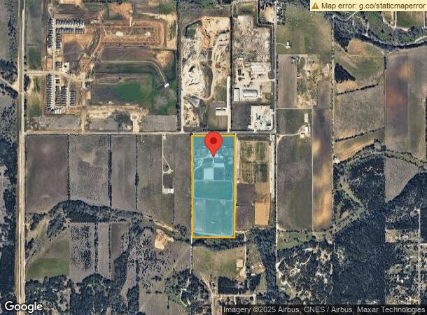
490 W Specht Rd
San Antonio-New Braunfels, TX
Conv A/S Code
04837-000-0240
CB 4837 P-24 ABS 612 EXEMPT ACCT REFER TO 04837-000-0241 2021-2023 SPLIT PER CR #56378, PLEASE SEE PID 1371851-TAX ACCT PURPOSE, JE/GIS DEPT.
Stable
Bexar
AE
Texas
48029C0110G
24
2023
36.10 AC
2023
Far North Central
191804
San Antonio
10,828 SF
DEMOGRAPHICS near 490 W Specht Rd
1 Mile
3 Mile
5 Mile
2024 Total Population
398
16,653
52,344
2029 Population
438
18,363
58,354
Pop Growth 2024-2029
+ 10.05%
+ 10.27%
+ 11.48%
Average Age
38
39
38
2024 Total Households
128
5,649
17,395
HH Growth 2024-2029
+ 9.38%
+ 10.46%
+ 11.84%
Median Household Inc
$165,000
$125,522
$125,259
Avg Household Size
3.10
2.90
3.00
2024 Avg HH Vehicles
2.00
2.00
2.00
Median Home Value
$427,000
$381,541
$391,689
Median Year Built
2011
2008
2006
Nearby Places
- Restaurants
- Banks
- Shops
- Fitness
- Groceries
PUBLIC TRANSPORTATION
AIRPORT
San Antonio International
DRIVE
WALK
Distance
San Antonio International
27 min
18.7 mi
Freight Ports
Calhoun Port
DRIVE
WALK
Distance
Calhoun Port
202 min
167.5 mi
Nearby Properties
Address
Land Use
TOTAL SIZE
Lot Size
Zoning
Address
Land Use
TOTAL SIZE
Lot Size
Zoning
310,384 SF
14.25 AC
Address
Land Use
TOTAL SIZE
Lot Size
Zoning
25.20 AC
Address
Land Use
TOTAL SIZE
Lot Size
Zoning
76,120 SF
3.90 AC
Address
Land Use
TOTAL SIZE
Lot Size
Zoning
183.24 AC
Address
Land Use
TOTAL SIZE
Lot Size
Zoning
20.13 AC
Address
Land Use
TOTAL SIZE
Lot Size
Zoning
6,590 SF
211.63 AC
Address
Land Use
TOTAL SIZE
Lot Size
Zoning
Address
Land Use
TOTAL SIZE
Lot Size
Zoning
134.81 AC
Address
Land Use
TOTAL SIZE
Lot Size
Zoning
101.83 AC
Address
Land Use
TOTAL SIZE
Lot Size
Zoning
12,180 SF
0.75 AC
Address
Land Use
TOTAL SIZE
Lot Size
Zoning
8.39 AC
Address
Land Use
TOTAL SIZE
Lot Size
Zoning
19,523 SF
1.68 AC
Address
Land Use
TOTAL SIZE
Lot Size
Zoning
13,904 SF
2.36 AC
Address
Land Use
TOTAL SIZE
Lot Size
Zoning
9.73 AC
Address
Land Use
TOTAL SIZE
Lot Size
Zoning
4,908 SF
92.87 AC
Address
Land Use
TOTAL SIZE
Lot Size
Zoning
7.47 AC
Address
Land Use
TOTAL SIZE
Lot Size
Zoning
6.32 AC
Address
Land Use
TOTAL SIZE
Lot Size
Zoning
88.76 AC
Address
Land Use
TOTAL SIZE
Lot Size
Zoning
55.94 AC
Address
Land Use
TOTAL SIZE
Lot Size
Zoning
6,600 SF
0.71 AC
Address
Land Use
TOTAL SIZE
Lot Size
Zoning
994 SF
119.96 AC
Address
Land Use
TOTAL SIZE
Lot Size
Zoning
25,200 SF
35.54 AC
Address
Land Use
TOTAL SIZE
Lot Size
Zoning
95.60 AC
Address
Land Use
TOTAL SIZE
Lot Size
Zoning
10,792 SF
23.09 AC
Address
Land Use
TOTAL SIZE
Lot Size
Zoning
77.96 AC
Address
Land Use
TOTAL SIZE
Lot Size
Zoning
10.55 AC
Address
Land Use
TOTAL SIZE
Lot Size
Zoning
Address
Land Use
TOTAL SIZE
Lot Size
Zoning
41.39 AC
Address
Land Use
TOTAL SIZE
Lot Size
Zoning
9,750 SF
11.51 AC
Address
Land Use
TOTAL SIZE
Lot Size
Zoning
62.34 AC
The World's #1 Commercial Real Estate Marketplace
Connect with us
© 2025 CoStar Group
The information above has been obtained from sources believed reliable. While we do not doubt its accuracy we have not verified it and make no guarantee, warranty or representation about it. It is your responsibility to independently confirm its accuracy and completeness. Any projections, opinions, assumptions, or estimates used are for example only and do not represent the current or future performance of the property. The value of this transaction to you depends on tax and other factors which should be evaluated by your tax, financial, and legal advisors. You and your advisors should conduct a careful, independent investigation of the property to determine to your satisfaction the suitability of the property for your needs.