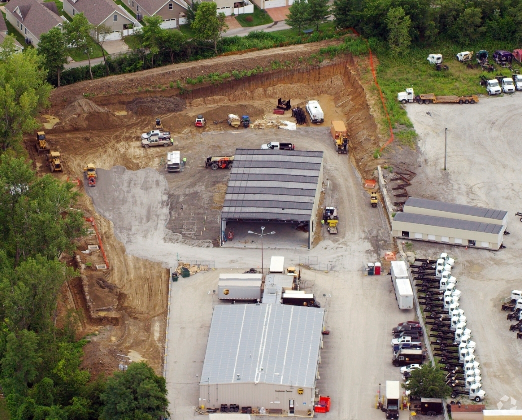
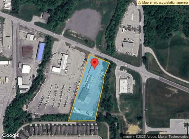
Property Record
4902 Se Highway 169, Saint Joseph, MO 64507
NEARBY LISTINGS FOR SALE OR LEASE
Property Detail
4902 Se Highway 169
Kansas City
Mungers Sub-Division
St. Joseph, MO-KS
SUB:MUNGER'S SUB-DIVISION LOT:3 BLK:LGL DESC:PT SW4 BEING PT LOT 3 MUNGERS SUB BG AT PT ON C/L HY 169 AT PT X WITH E/L SW4 S
06-7.0-25-003-000-011.000
Buchanan
Warehouse
Missouri
2024
3
2024
3.32 AC
001700
St Joseph
17,852 SF
DEMOGRAPHICS near 4902 Se Highway 169
1 Mile
3 Mile
5 Mile
2024 Total Population
476
11,687
53,103
2029 Population
455
11,286
51,832
Pop Growth 2024-2029
(4.41%)
(3.43%)
(2.39%)
Average Age
43
41
39
2024 Total Households
185
4,887
21,198
HH Growth 2024-2029
(4.32%)
(3.54%)
(2.43%)
Median Household Inc
$77,604
$62,593
$47,191
Avg Household Size
2.60
2.30
2.30
2024 Avg HH Vehicles
2.00
2.00
2.00
Median Home Value
$225,781
$160,301
$142,550
Median Year Built
1984
1971
1961
Nearby Places
- Restaurants
- Banks
- Shops
- Fitness
- Groceries
PUBLIC TRANSPORTATION
AIRPORT
Kansas City International
DRIVE
WALK
Distance
Kansas City International
38 min
32.6 mi
Freight Ports
Tulsa Port Of Catoosa
DRIVE
WALK
Distance
Tulsa Port Of Catoosa
315 min
284.0 mi
Nearby Properties
Address
Land Use
TOTAL SIZE
Lot Size
Zoning
Address
Land Use
TOTAL SIZE
Lot Size
Zoning
Address
Land Use
TOTAL SIZE
Lot Size
Zoning
140,200 SF
141.50 AC
CITY
Address
Land Use
TOTAL SIZE
Lot Size
Zoning
141,520 SF
Address
Land Use
TOTAL SIZE
Lot Size
Zoning
85,350 SF
Address
Land Use
TOTAL SIZE
Lot Size
Zoning
Address
Land Use
TOTAL SIZE
Lot Size
Zoning
22.72 AC
CITY
Address
Land Use
TOTAL SIZE
Lot Size
Zoning
37,100 SF
17.24 AC
CITY
Address
Land Use
TOTAL SIZE
Lot Size
Zoning
258,800 SF
19.51 AC
CITY
Address
Land Use
TOTAL SIZE
Lot Size
Zoning
351,550 SF
40.07 AC
CITY
Address
Land Use
TOTAL SIZE
Lot Size
Zoning
3,947 SF
8.29 AC
CITY
Address
Land Use
TOTAL SIZE
Lot Size
Zoning
60,036 SF
88.08 AC
CITY
Address
Land Use
TOTAL SIZE
Lot Size
Zoning
62,595 SF
4.15 AC
CITY
Address
Land Use
TOTAL SIZE
Lot Size
Zoning
18,017 SF
5.24 AC
CITY
Address
Land Use
TOTAL SIZE
Lot Size
Zoning
Address
Land Use
TOTAL SIZE
Lot Size
Zoning
Address
Land Use
TOTAL SIZE
Lot Size
Zoning
32,855 SF
27.35 AC
CITY
Address
Land Use
TOTAL SIZE
Lot Size
Zoning
22,680 SF
Address
Land Use
TOTAL SIZE
Lot Size
Zoning
41,454 SF
6.28 AC
CITY
Address
Land Use
TOTAL SIZE
Lot Size
Zoning
40,812 SF
15.37 AC
R-1
Address
Land Use
TOTAL SIZE
Lot Size
Zoning
28,875 SF
8.78 AC
CITY
Address
Land Use
TOTAL SIZE
Lot Size
Zoning
Address
Land Use
TOTAL SIZE
Lot Size
Zoning
161,940 SF
16.43 AC
CITY
Address
Land Use
TOTAL SIZE
Lot Size
Zoning
333,670 SF
49.03 AC
CITY
Address
Land Use
TOTAL SIZE
Lot Size
Zoning
311,177 SF
19.30 AC
CITY
Address
Land Use
TOTAL SIZE
Lot Size
Zoning
93,701 SF
10.93 AC
CITY
Address
Land Use
TOTAL SIZE
Lot Size
Zoning
Address
Land Use
TOTAL SIZE
Lot Size
Zoning
155,836 SF
23.23 AC
CITY
Address
Land Use
TOTAL SIZE
Lot Size
Zoning
30,590 SF
5.85 AC
CITY
Address
Land Use
TOTAL SIZE
Lot Size
Zoning
14,940 SF
4.34 AC
CITY
Address
Land Use
TOTAL SIZE
Lot Size
Zoning
26,739 SF
9.27 AC
CITY
The World's #1 Commercial Real Estate Marketplace
Connect with us
© 2025 CoStar Group
The information above has been obtained from sources believed reliable. While we do not doubt its accuracy we have not verified it and make no guarantee, warranty or representation about it. It is your responsibility to independently confirm its accuracy and completeness. Any projections, opinions, assumptions, or estimates used are for example only and do not represent the current or future performance of the property. The value of this transaction to you depends on tax and other factors which should be evaluated by your tax, financial, and legal advisors. You and your advisors should conduct a careful, independent investigation of the property to determine to your satisfaction the suitability of the property for your needs.