Property Record
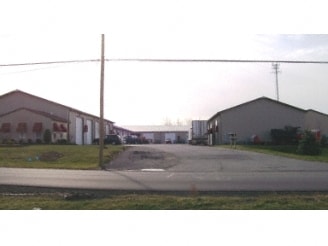
491 Erie St, Lancaster, NY 14086

NEARBY LISTINGS FOR SALE OR LEASE
Property Detail
491 Erie St
145289-105-000-0005-045-211
Erie
Warehouse
New York
X
45.211
36029C0244H
3.09 AC
2025
East
2024
Buffalo/Niagara Falls
014204
Buffalo-Cheektowaga-Niagara Falls, NY
5,664 SF
DEMOGRAPHICS near 491 Erie St
1 Mile
3 Mile
5 Mile
2024 Total Population
3,200
35,339
83,586
2029 Population
3,195
35,188
83,203
Pop Growth 2024-2029
(0.16%)
(0.43%)
(0.46%)
Average Age
48
43
44
2024 Total Households
1,520
14,735
35,911
HH Growth 2024-2029
(0.26%)
(0.58%)
(0.56%)
Median Household Inc
$65,180
$81,000
$76,043
Avg Household Size
2.00
2.30
2.30
2024 Avg HH Vehicles
2.00
2.00
2.00
Median Home Value
$236,617
$235,495
$209,456
Median Year Built
1990
1971
1970
Nearby Places
Map Layers
Map Styles
 Street
 Aerial
- Restaurants
- Banks
- Shops
- Fitness
- Groceries
PUBLIC TRANSPORTATION
COMMUTER RAIL
Buffalo Depew Station (Empire Service - Amtrak, Lake Shore Limited - Amtrak, Maple Leaf - Amtrak)
DRIVE
WALK
Distance
Buffalo Depew Station (Empire Service - Amtrak, Lake Shore Limited - Amtrak, Maple Leaf - Amtrak)
12 min
5.3 mi
Buffalo (Depew) (Toronto - New York - VIA Rail)
DRIVE
WALK
Distance
Buffalo (Depew) (Toronto - New York - VIA Rail)
12 min
5.3 mi
AIRPORT
Buffalo Niagara International
DRIVE
WALK
Distance
Buffalo Niagara International
16 min
7.4 mi
Niagara Falls International
DRIVE
WALK
Distance
Niagara Falls International
45 min
24.9 mi
Freight Ports
Albany, NY Port
DRIVE
WALK
Distance
Albany, NY Port
331 min
278.7 mi
Nearby Properties
Address
Land Use
TOTAL SIZE
Lot Size
Zoning
Address
Land Use
TOTAL SIZE
Lot Size
Zoning
868,362 SF
135.20 AC
Address
Land Use
TOTAL SIZE
Lot Size
Zoning
215,000 SF
14.56 AC
Address
Land Use
TOTAL SIZE
Lot Size
Zoning
6,618 SF
36.08 AC
MFMU
Address
Land Use
TOTAL SIZE
Lot Size
Zoning
488,282 SF
32 AC
Address
Land Use
TOTAL SIZE
Lot Size
Zoning
1,235 SF
12.50 AC
COMM
Address
Land Use
TOTAL SIZE
Lot Size
Zoning
191,441 SF
54.90 AC
Address
Land Use
TOTAL SIZE
Lot Size
Zoning
320,945 SF
62.80 AC
RES
Address
Land Use
TOTAL SIZE
Lot Size
Zoning
122,494 SF
9.74 AC
Address
Land Use
TOTAL SIZE
Lot Size
Zoning
268,620 SF
70.25 AC
GI
Address
Land Use
TOTAL SIZE
Lot Size
Zoning
Address
Land Use
TOTAL SIZE
Lot Size
Zoning
122,408 SF
10.35 AC
Address
Land Use
TOTAL SIZE
Lot Size
Zoning
96,190 SF
41.04 AC
LI
Address
Land Use
TOTAL SIZE
Lot Size
Zoning
Address
Land Use
TOTAL SIZE
Lot Size
Zoning
Address
Land Use
TOTAL SIZE
Lot Size
Zoning
14,100 SF
11.57 AC
Address
Land Use
TOTAL SIZE
Lot Size
Zoning
158,241 SF
17.04 AC
Address
Land Use
TOTAL SIZE
Lot Size
Zoning
161,602 SF
8.45 AC
Address
Land Use
TOTAL SIZE
Lot Size
Zoning
3.27 AC
Address
Land Use
TOTAL SIZE
Lot Size
Zoning
6,000 SF
2.30 AC
Address
Land Use
TOTAL SIZE
Lot Size
Zoning
44,612 SF
4.98 AC
COMM
Address
Land Use
TOTAL SIZE
Lot Size
Zoning
19,082 SF
19.71 AC
Address
Land Use
TOTAL SIZE
Lot Size
Zoning
77,500 SF
5.15 AC
Address
Land Use
TOTAL SIZE
Lot Size
Zoning
37,240 SF
3.90 AC
COMM
Address
Land Use
TOTAL SIZE
Lot Size
Zoning
119,835 SF
19.53 AC
Address
Land Use
TOTAL SIZE
Lot Size
Zoning
156,664 SF
11.77 AC
Address
Land Use
TOTAL SIZE
Lot Size
Zoning
69,786 SF
6.30 AC
Address
Land Use
TOTAL SIZE
Lot Size
Zoning
127,294 SF
8.50 AC
BUSIND
Address
Land Use
TOTAL SIZE
Lot Size
Zoning
150,642 SF
2.30 AC
RES
Address
Land Use
TOTAL SIZE
Lot Size
Zoning
154,350 SF
8.38 AC
The World's #1 Commercial Real Estate Marketplace
Connect with us
© 2026 CoStar Group
The information above has been obtained from sources believed reliable. While we do not doubt its accuracy we have not verified it and make no guarantee, warranty or representation about it. It is your responsibility to independently confirm its accuracy and completeness. Any projections, opinions, assumptions, or estimates used are for example only and do not represent the current or future performance of the property. The value of this transaction to you depends on tax and other factors which should be evaluated by your tax, financial, and legal advisors. You and your advisors should conduct a careful, independent investigation of the property to determine to your satisfaction the suitability of the property for your needs.