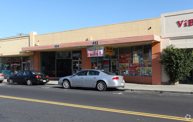
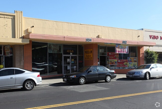
Property Record
492 San Mateo Ave, San Bruno, CA 94066

NEARBY LISTINGS FOR SALE OR LEASE
Property Detail
492 San Mateo Ave
San Francisco-Redwood City-South San Francisco, CA
San Bruno Park 3Rd Add
020-363-200
LOTS 7 & 8 BLOCK 18 SAN BRUNO PARK 3RD ADD RSM E/72
Storebuilding
San Mateo
X
California
06081C0131F
7,8
2024
0.12 AC
2025
San Bruno/Millbrae
604103
San Francisco
DEMOGRAPHICS near 492 San Mateo Ave
1 Mile
3 Mile
5 Mile
2024 Total Population
20,477
108,289
213,997
2029 Population
19,393
102,961
203,657
Pop Growth 2024-2029
(5.29%)
(4.92%)
(4.83%)
Average Age
41
42
43
2024 Total Households
6,824
37,309
75,326
HH Growth 2024-2029
(5.52%)
(5.21%)
(5.04%)
Median Household Inc
$115,095
$116,900
$126,084
Avg Household Size
2.90
2.80
2.70
2024 Avg HH Vehicles
2.00
2.00
2.00
Median Home Value
$1,052,617
$1,090,591
$1,085,092
Median Year Built
1954
1961
1964
Nearby Places
Map Layers
Map Styles
 Street
 Aerial
- Restaurants
- Banks
- Shops
- Fitness
- Groceries
PUBLIC TRANSPORTATION
TRANSIT/SUBWAY
San Bruno Station (Dublin/Pleasanton - Millbrae - Bay Area Rapid Transit (BART), Pittsburg/Bay Point - San Francisco International - Bay Area Rapid Transit (BART), Richmond - Millbrae - Bay Area Rapid Transit (BART))
DRIVE
WALK
Distance
San Bruno Station (Dublin/Pleasanton - Millbrae - Bay Area Rapid Transit (BART), Pittsburg/Bay Point - San Francisco International - Bay Area Rapid Transit (BART), Richmond - Millbrae - Bay Area Rapid Transit (BART))
4 min
20 min
1.0 mi
COMMUTER RAIL
DRIVE
WALK
Distance
2 min
9 min
0.5 mi
Millbrae (Caltrain - Caltrain (Caltrain))
DRIVE
WALK
Distance
Millbrae (Caltrain - Caltrain (Caltrain))
7 min
2.8 mi
AIRPORT
San Francisco International
DRIVE
WALK
Distance
San Francisco International
8 min
3.0 mi
Metro Oakland International
DRIVE
WALK
Distance
Metro Oakland International
44 min
32.6 mi
Norman Y Mineta San Jose International
DRIVE
WALK
Distance
Norman Y Mineta San Jose International
44 min
34.0 mi
Nearby Properties
Address
Land Use
TOTAL SIZE
Lot Size
Zoning
Address
Land Use
TOTAL SIZE
Lot Size
Zoning
780,375 SF
23.23 AC
Address
Land Use
TOTAL SIZE
Lot Size
Zoning
2,008 SF
16.83 AC
Address
Land Use
TOTAL SIZE
Lot Size
Zoning
Address
Land Use
TOTAL SIZE
Lot Size
Zoning
6.67 AC
PD0000
Address
Land Use
TOTAL SIZE
Lot Size
Zoning
323,091 SF
14.83 AC
Address
Land Use
TOTAL SIZE
Lot Size
Zoning
Address
Land Use
TOTAL SIZE
Lot Size
Zoning
24,070 SF
6.44 AC
M2000H
Address
Land Use
TOTAL SIZE
Lot Size
Zoning
529,342 SF
5.28 AC
Address
Land Use
TOTAL SIZE
Lot Size
Zoning
161,850 SF
7.48 AC
Address
Land Use
TOTAL SIZE
Lot Size
Zoning
4,047 SF
4.25 AC
Address
Land Use
TOTAL SIZE
Lot Size
Zoning
293,445 SF
6.70 AC
MH00M2
Address
Land Use
TOTAL SIZE
Lot Size
Zoning
10,000 SF
0.48 AC
ML00M1
Address
Land Use
TOTAL SIZE
Lot Size
Zoning
528,605 SF
17.06 AC
M2000H
Address
Land Use
TOTAL SIZE
Lot Size
Zoning
152,145 SF
6.10 AC
MH00M2
Address
Land Use
TOTAL SIZE
Lot Size
Zoning
176,096 SF
2.74 AC
Address
Land Use
TOTAL SIZE
Lot Size
Zoning
2,016 SF
3.61 AC
Address
Land Use
TOTAL SIZE
Lot Size
Zoning
112,912 SF
5.96 AC
MH00M2
Address
Land Use
TOTAL SIZE
Lot Size
Zoning
254,775 SF
17.01 AC
Address
Land Use
TOTAL SIZE
Lot Size
Zoning
198,375 SF
5.52 AC
PD0000
Address
Land Use
TOTAL SIZE
Lot Size
Zoning
5.02 AC
Address
Land Use
TOTAL SIZE
Lot Size
Zoning
126,971 SF
3.04 AC
Address
Land Use
TOTAL SIZE
Lot Size
Zoning
19,657 SF
0.69 AC
Address
Land Use
TOTAL SIZE
Lot Size
Zoning
Address
Land Use
TOTAL SIZE
Lot Size
Zoning
107,773 SF
6.73 AC
M20000
Address
Land Use
TOTAL SIZE
Lot Size
Zoning
2,008 SF
8.84 AC
Address
Land Use
TOTAL SIZE
Lot Size
Zoning
2.83 AC
Address
Land Use
TOTAL SIZE
Lot Size
Zoning
55,000 SF
1.64 AC
ML00M1
Address
Land Use
TOTAL SIZE
Lot Size
Zoning
403,363 SF
11.26 AC
PD0000
Address
Land Use
TOTAL SIZE
Lot Size
Zoning
85,500 SF
2.20 AC
Address
Land Use
TOTAL SIZE
Lot Size
Zoning
210,895 SF
2.89 AC
The World's #1 Commercial Real Estate Marketplace
Connect with us
© 2025 CoStar Group
The information above has been obtained from sources believed reliable. While we do not doubt its accuracy we have not verified it and make no guarantee, warranty or representation about it. It is your responsibility to independently confirm its accuracy and completeness. Any projections, opinions, assumptions, or estimates used are for example only and do not represent the current or future performance of the property. The value of this transaction to you depends on tax and other factors which should be evaluated by your tax, financial, and legal advisors. You and your advisors should conduct a careful, independent investigation of the property to determine to your satisfaction the suitability of the property for your needs.