Property Record
4922 Lasalle Rd, Hyattsville, MD 20782


NEARBY LISTINGS FOR SALE OR LEASE
Property Detail
4922 Lasalle Rd
17-1853035
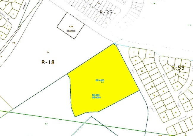
Carroll Manor Prcl C & D
Hospitalprivate
PARCEL C NURSING HOME
X
Prince George's
24033C0128E
Maryland
2024
7.11 AC
2025
College Park
804900
Washington, DC
204,000 SF
Washington-Arlington-Alexandria, DC-VA-MD-WV
DEMOGRAPHICS near 4922 Lasalle Rd
1 Mile
3 Mile
5 Mile
2024 Total Population
28,895
248,392
726,533
2029 Population
27,516
234,059
682,732
Pop Growth 2024-2029
(4.77%)
(5.77%)
(6.03%)
Average Age
39
37
37
2024 Total Households
11,046
89,893
300,174
HH Growth 2024-2029
(5.22%)
(6.57%)
(7.10%)
Median Household Inc
$67,699
$80,365
$92,438
Avg Household Size
2.50
2.60
2.30
2024 Avg HH Vehicles
1.00
1.00
1.00
Median Home Value
$476,409
$576,716
$608,534
Median Year Built
1956
1953
1957
Nearby Places
Map Layers
Map Styles
 Street
 Aerial
- Restaurants
- Banks
- Shops
- Fitness
- Groceries
PUBLIC TRANSPORTATION
TRANSIT/SUBWAY
West Hyattsville, Green/Yellow Line Track 1 Platform (Metrorail Green Line - WMATA)
DRIVE
WALK
Distance
West Hyattsville, Green/Yellow Line Track 1 Platform (Metrorail Green Line - WMATA)
4 min
16 min
0.8 mi
West Hyattsville, Green/Yellow Line Track 2 Platform (Metrorail Green Line - WMATA)
DRIVE
WALK
Distance
West Hyattsville, Green/Yellow Line Track 2 Platform (Metrorail Green Line - WMATA)
4 min
17 min
0.9 mi
COMMUTER RAIL
Riverdale (CAMDEN - WASHINGTON - Maryland Area Regional Commuter Trains (The MARC), Camden Line - Maryland Area Regional Commuter Trains (The MARC))
DRIVE
WALK
Distance
Riverdale (CAMDEN - WASHINGTON - Maryland Area Regional Commuter Trains (The MARC), Camden Line - Maryland Area Regional Commuter Trains (The MARC))
7 min
2.9 mi
College Park Marc Nb (CAMDEN - WASHINGTON - Maryland Transit Administration)
DRIVE
WALK
Distance
College Park Marc Nb (CAMDEN - WASHINGTON - Maryland Transit Administration)
10 min
4.0 mi
AIRPORT
Ronald Reagan Washington Ntl
DRIVE
WALK
Distance
Ronald Reagan Washington Ntl
19 min
10.4 mi
Baltimore/Washington International Thurgood Marshall
DRIVE
WALK
Distance
Baltimore/Washington International Thurgood Marshall
43 min
27.1 mi
Washington Dulles International
DRIVE
WALK
Distance
Washington Dulles International
54 min
33.2 mi
Freight Ports
Port of Baltimore
DRIVE
WALK
Distance
Port of Baltimore
50 min
34.9 mi
Nearby Properties
Address
Land Use
TOTAL SIZE
Lot Size
Zoning
Address
Land Use
TOTAL SIZE
Lot Size
Zoning
58,289 SF
418.97 AC
MU-4;PDR-1
Address
Land Use
TOTAL SIZE
Lot Size
Zoning
1,583,364 SF
276.66 AC
UNZONED
Address
Land Use
TOTAL SIZE
Lot Size
Zoning
95.32 AC
RA-1
Address
Land Use
TOTAL SIZE
Lot Size
Zoning
1,835,827 SF
34.66 AC
UNZONED
Address
Land Use
TOTAL SIZE
Lot Size
Zoning
791,730 SF
37.44 AC
RA-1
Address
Land Use
TOTAL SIZE
Lot Size
Zoning
1,095,275 SF
30.70 AC
MU-4;RA-2
Address
Land Use
TOTAL SIZE
Lot Size
Zoning
823,802 SF
7.30 AC
MU-2
Address
Land Use
TOTAL SIZE
Lot Size
Zoning
2,985,682 SF
4.33 AC
RSF65
Address
Land Use
TOTAL SIZE
Lot Size
Zoning
248,643 SF
8.66 AC
RA-1
Address
Land Use
TOTAL SIZE
Lot Size
Zoning
1,201,133 SF
41.56 AC
RTOHC
Address
Land Use
TOTAL SIZE
Lot Size
Zoning
869,190 SF
4.97 AC
RA-1
Address
Land Use
TOTAL SIZE
Lot Size
Zoning
74,664 SF
1.83 AC
RTOLE
Address
Land Use
TOTAL SIZE
Lot Size
Zoning
41.12 AC
RA-1
Address
Land Use
TOTAL SIZE
Lot Size
Zoning
330,003 SF
1.74 AC
RTOLE
Address
Land Use
TOTAL SIZE
Lot Size
Zoning
326,985 SF
1.13 AC
MU-6B
Address
Land Use
TOTAL SIZE
Lot Size
Zoning
169,500 SF
9.14 AC
RA-1
Address
Land Use
TOTAL SIZE
Lot Size
Zoning
492,835 SF
21.61 AC
RA-1
Address
Land Use
TOTAL SIZE
Lot Size
Zoning
4,924 SF
53.06 AC
R-3
Address
Land Use
TOTAL SIZE
Lot Size
Zoning
102,968 SF
18.08 AC
RF-1
Address
Land Use
TOTAL SIZE
Lot Size
Zoning
8,060 SF
1.63 AC
LTOE
Address
Land Use
TOTAL SIZE
Lot Size
Zoning
383,000 SF
2.29 AC
WR-3;WR-4
Address
Land Use
TOTAL SIZE
Lot Size
Zoning
288,480 SF
16.95 AC
MU-2;RA-2
Address
Land Use
TOTAL SIZE
Lot Size
Zoning
247,494 SF
WR-3;WR-5;
Address
Land Use
TOTAL SIZE
Lot Size
Zoning
3.64 AC
RTOHC
Address
Land Use
TOTAL SIZE
Lot Size
Zoning
390,851 SF
16.59 AC
RF-1
Address
Land Use
TOTAL SIZE
Lot Size
Zoning
0.30 AC
PDR-2
Address
Land Use
TOTAL SIZE
Lot Size
Zoning
578,232 SF
1.43 AC
RTOHC
Address
Land Use
TOTAL SIZE
Lot Size
Zoning
590 SF
20.11 AC
LTOE
Address
Land Use
TOTAL SIZE
Lot Size
Zoning
270,109 SF
17.63 AC
PDR-1;PDR-
Address
Land Use
TOTAL SIZE
Lot Size
Zoning
190,514 SF
1.54 AC
MU-2
The World's #1 Commercial Real Estate Marketplace
Connect with us
© 2025 CoStar Group
The information above has been obtained from sources believed reliable. While we do not doubt its accuracy we have not verified it and make no guarantee, warranty or representation about it. It is your responsibility to independently confirm its accuracy and completeness. Any projections, opinions, assumptions, or estimates used are for example only and do not represent the current or future performance of the property. The value of this transaction to you depends on tax and other factors which should be evaluated by your tax, financial, and legal advisors. You and your advisors should conduct a careful, independent investigation of the property to determine to your satisfaction the suitability of the property for your needs.