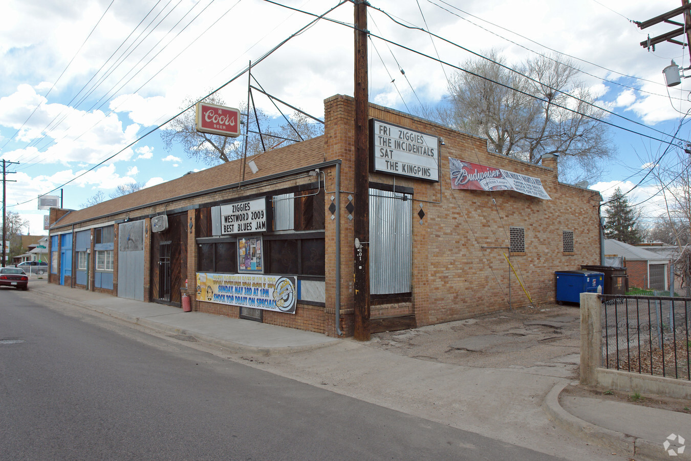
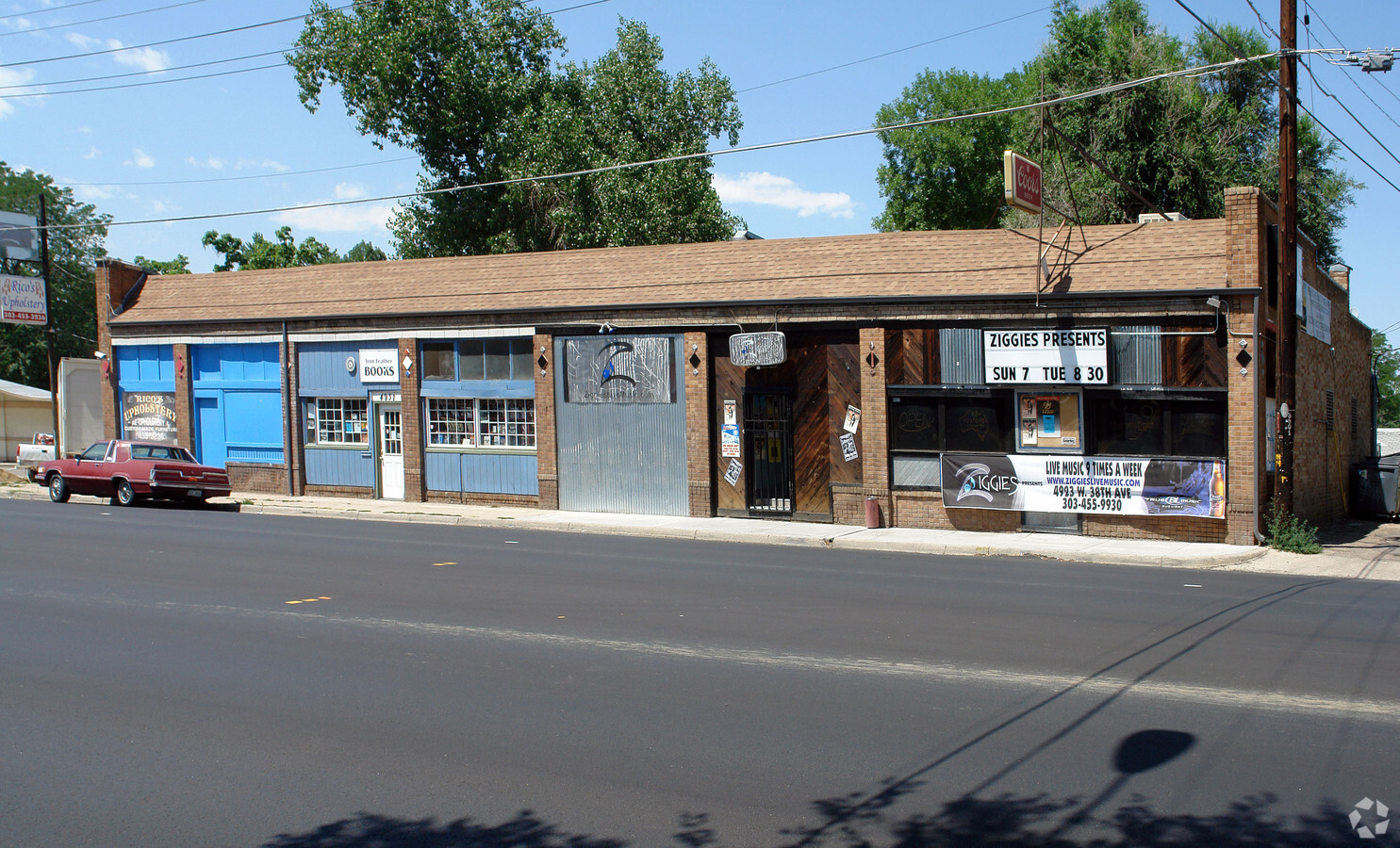
Property Record
4923 W 38Th Ave, Denver, CO 80212
NEARBY LISTINGS FOR SALE OR LEASE
Property Detail
4923 W 38Th Ave
Denver-Aurora-Lakewood, CO
Berkeley
2193-27-012
BERKELEY 02193 B3 S 62.5FT OF L19 TO 23 INC EXC E 5FT OF L23 TO CITY
Commercialbuilding
Denver
X
Colorado
0800460068H
19-23
2023
0.18 AC
2023
West
000301
Denver
7,650 SF
DEMOGRAPHICS near 4923 W 38Th Ave
1 Mile
3 Mile
5 Mile
2024 Total Population
20,991
165,172
436,638
2029 Population
21,054
167,291
441,866
Pop Growth 2024-2029
+ 0.30%
+ 1.28%
+ 1.20%
Average Age
40
38
38
2024 Total Households
9,982
77,721
201,288
HH Growth 2024-2029
+ 0.22%
+ 1.19%
+ 1.30%
Median Household Inc
$103,773
$85,114
$77,075
Avg Household Size
2.10
2.00
2.10
2024 Avg HH Vehicles
2.00
2.00
2.00
Median Home Value
$695,463
$606,260
$528,572
Median Year Built
1953
1970
1971
Nearby Places
- Restaurants
- Banks
- Shops
- Fitness
- Groceries
PUBLIC TRANSPORTATION
COMMUTER RAIL
60Th & Sheridan - Arvada Gold Strike Station Track 1 (Union Station to Wheat Ridge Ward Station - Regional Transportation District)
DRIVE
WALK
Distance
60Th & Sheridan - Arvada Gold Strike Station Track 1 (Union Station to Wheat Ridge Ward Station - Regional Transportation District)
7 min
3.1 mi
Olde Town Arvada E-Bound (Union Station to Wheat Ridge Ward Station - Regional Transportation District)
DRIVE
WALK
Distance
Olde Town Arvada E-Bound (Union Station to Wheat Ridge Ward Station - Regional Transportation District)
8 min
3.9 mi
AIRPORT
Denver International
DRIVE
WALK
Distance
Denver International
34 min
26.7 mi
Freight Ports
Tulsa Port Of Catoosa
DRIVE
WALK
Distance
Tulsa Port Of Catoosa
732 min
712.2 mi
Nearby Properties
Address
Land Use
TOTAL SIZE
Lot Size
Zoning
Address
Land Use
TOTAL SIZE
Lot Size
Zoning
1,721,086 SF
21.34 AC
C-MU-30
Address
Land Use
TOTAL SIZE
Lot Size
Zoning
688,230 SF
0.94 AC
PUD
Address
Land Use
TOTAL SIZE
Lot Size
Zoning
150,202 SF
13.24 AC
T-MU-30
Address
Land Use
TOTAL SIZE
Lot Size
Zoning
321,759 SF
0.88 AC
PUD
Address
Land Use
TOTAL SIZE
Lot Size
Zoning
405,974 SF
1.78 AC
PUD
Address
Land Use
TOTAL SIZE
Lot Size
Zoning
492,926 SF
1.16 AC
PUD
Address
Land Use
TOTAL SIZE
Lot Size
Zoning
515,064 SF
1.25 AC
D-LD
Address
Land Use
TOTAL SIZE
Lot Size
Zoning
860,132 SF
68.50 AC
R-5
Address
Land Use
TOTAL SIZE
Lot Size
Zoning
424,862 SF
32.28 AC
G-MU-3
Address
Land Use
TOTAL SIZE
Lot Size
Zoning
409,752 SF
1.26 AC
D-LD
Address
Land Use
TOTAL SIZE
Lot Size
Zoning
729,679 SF
C-MX
Address
Land Use
TOTAL SIZE
Lot Size
Zoning
285,490 SF
0.62 AC
T-MU-30
Address
Land Use
TOTAL SIZE
Lot Size
Zoning
33.40 AC
C-MU-30
Address
Land Use
TOTAL SIZE
Lot Size
Zoning
366,725 SF
1.36 AC
C-MX-5
Address
Land Use
TOTAL SIZE
Lot Size
Zoning
44.92 AC
C-MU-30
Address
Land Use
TOTAL SIZE
Lot Size
Zoning
381,044 SF
0.93 AC
D-LD
Address
Land Use
TOTAL SIZE
Lot Size
Zoning
425,117 SF
1.23 AC
PUD
Address
Land Use
TOTAL SIZE
Lot Size
Zoning
362,262 SF
1.39 AC
C-MX-5
Address
Land Use
TOTAL SIZE
Lot Size
Zoning
168,898 SF
44.89 AC
D-CPV-C
Address
Land Use
TOTAL SIZE
Lot Size
Zoning
921,863 SF
2.01 AC
C-MX
Address
Land Use
TOTAL SIZE
Lot Size
Zoning
333,925 SF
3.34 AC
C-MX-5
Address
Land Use
TOTAL SIZE
Lot Size
Zoning
269,393 SF
0.58 AC
PUD
Address
Land Use
TOTAL SIZE
Lot Size
Zoning
260,192 SF
1.03 AC
C-MX-5
Address
Land Use
TOTAL SIZE
Lot Size
Zoning
185,403 SF
1.12 AC
T-MU-30
Address
Land Use
TOTAL SIZE
Lot Size
Zoning
58,660 SF
0.88 AC
D-LD
Address
Land Use
TOTAL SIZE
Lot Size
Zoning
240,760 SF
0.89 AC
T-MU-30
Address
Land Use
TOTAL SIZE
Lot Size
Zoning
798,837 SF
1.66 AC
C-MX
Address
Land Use
TOTAL SIZE
Lot Size
Zoning
208,106 SF
1.06 AC
T-MU-30
Address
Land Use
TOTAL SIZE
Lot Size
Zoning
827,707 SF
19 AC
C-MU-30
Address
Land Use
TOTAL SIZE
Lot Size
Zoning
212,734 SF
0.77 AC
PUD
The World's #1 Commercial Real Estate Marketplace
Connect with us
© 2025 CoStar Group
The information above has been obtained from sources believed reliable. While we do not doubt its accuracy we have not verified it and make no guarantee, warranty or representation about it. It is your responsibility to independently confirm its accuracy and completeness. Any projections, opinions, assumptions, or estimates used are for example only and do not represent the current or future performance of the property. The value of this transaction to you depends on tax and other factors which should be evaluated by your tax, financial, and legal advisors. You and your advisors should conduct a careful, independent investigation of the property to determine to your satisfaction the suitability of the property for your needs.