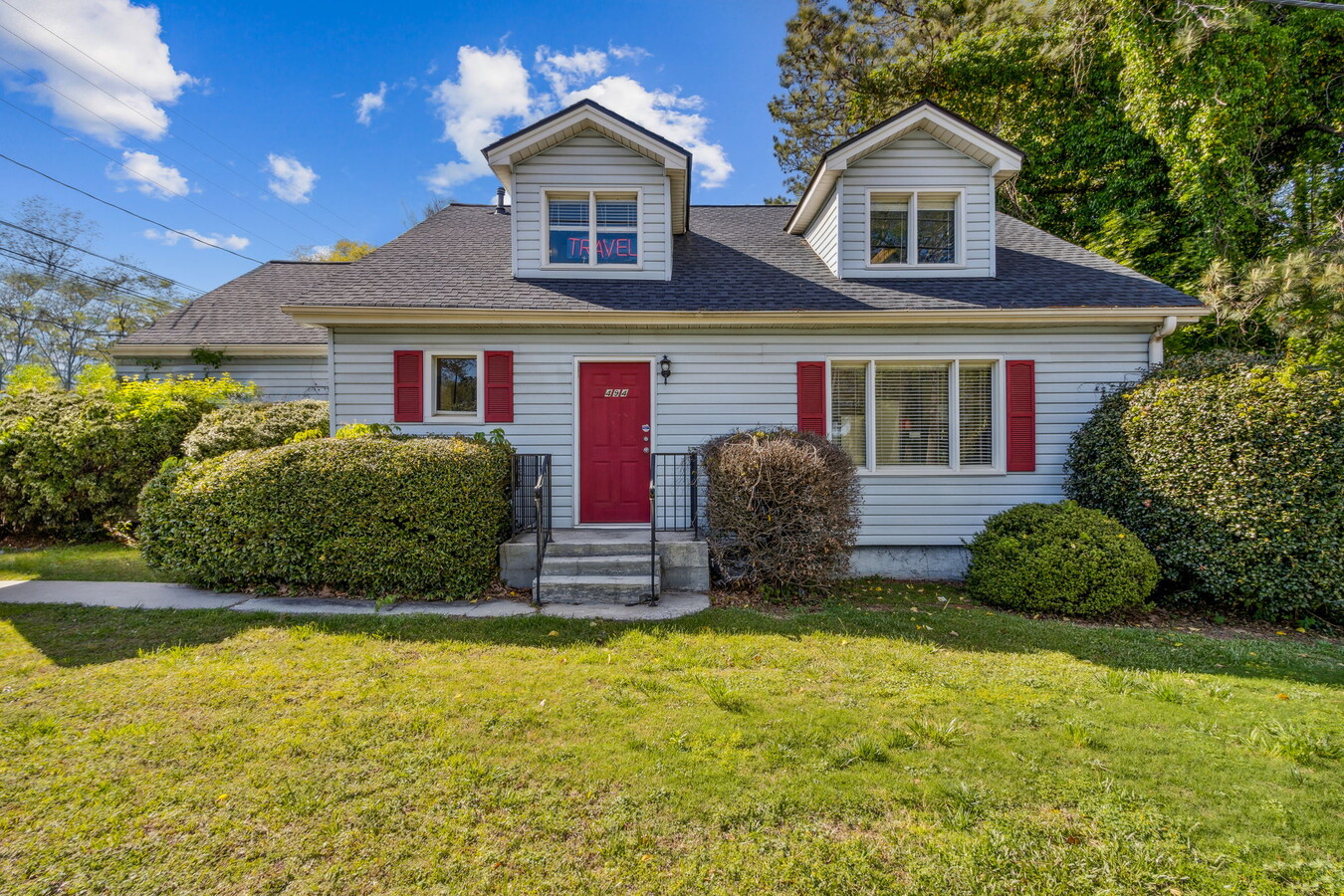
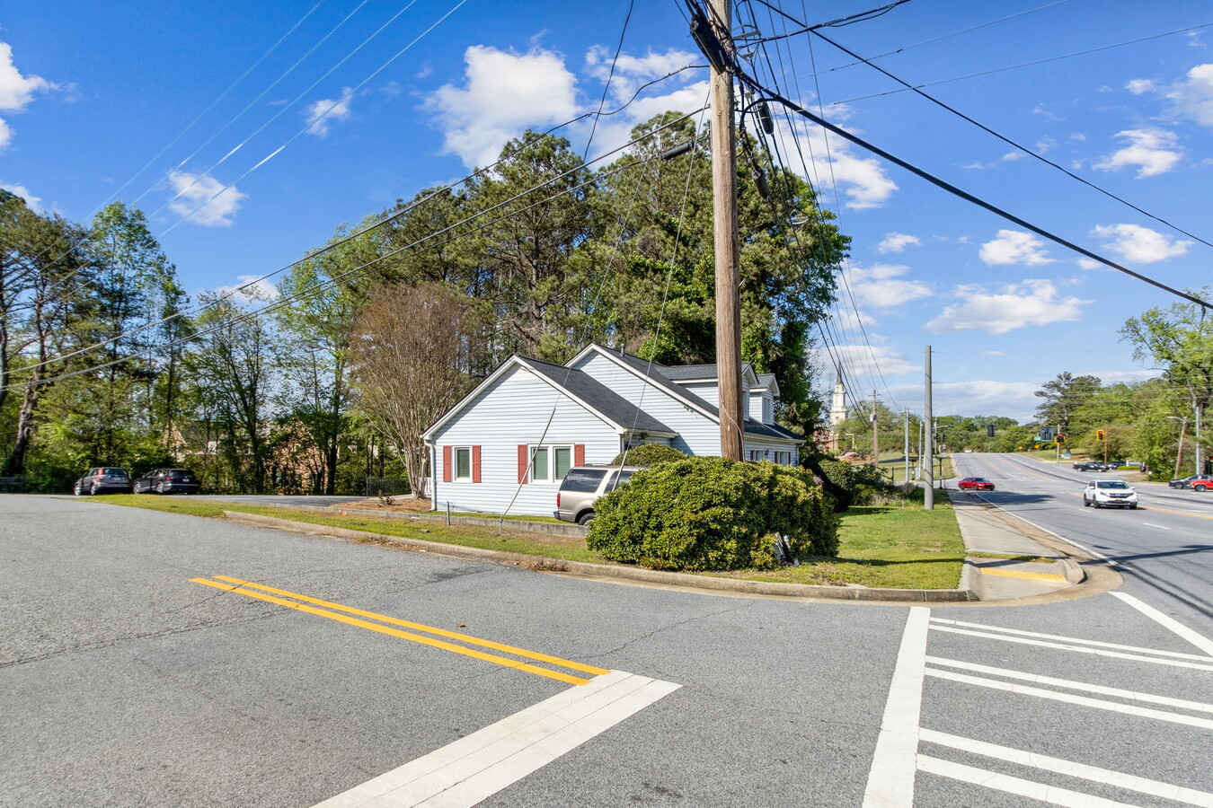
Property Record
W W Crogan St, Lawrenceville, GA 30046
NEARBY LISTINGS FOR SALE OR LEASE
Property Detail
W W Crogan St
Atlanta-Sandy Springs-Roswell, GA
Tapestry
5-146A-133
PARKING DECK LAWRENCEVILLE TAPESTRY MASTER CONDOMINIUM PLAT 150 239
Parkingstructure
Gwinnett
2023
Georgia
2023
0.01 AC
050520
Lawrenceville/Lilburn
124,446 SF
Atlanta
DEMOGRAPHICS near W W Crogan St
1 Mile
3 Mile
5 Mile
2024 Total Population
6,268
79,605
208,538
2029 Population
6,530
82,828
217,309
Pop Growth 2024-2029
+ 4.18%
+ 4.05%
+ 4.21%
Average Age
38
36
37
2024 Total Households
2,290
25,857
66,744
HH Growth 2024-2029
+ 4.24%
+ 4.22%
+ 4.31%
Median Household Inc
$57,376
$66,860
$80,582
Avg Household Size
2.60
2.90
3.00
2024 Avg HH Vehicles
2.00
2.00
2.00
Median Home Value
$289,285
$273,444
$293,672
Median Year Built
1984
1994
1995
Nearby Places
- Restaurants
- Banks
- Shops
- Fitness
- Groceries
SALE & LEASE HISTORY
LISTING DATE
SALE/LEASE

Oct 15, 2024
For Sale
Apr 20, 2024
For Sale
Nearby Properties
Address
Land Use
TOTAL SIZE
Lot Size
Zoning
Address
Land Use
TOTAL SIZE
Lot Size
Zoning
29,294 SF
24.24 AC
LM
Address
Land Use
TOTAL SIZE
Lot Size
Zoning
1,103,220 SF
66.65 AC
OI
Address
Land Use
TOTAL SIZE
Lot Size
Zoning
1,071,116 SF
74.52 AC
OI
Address
Land Use
TOTAL SIZE
Lot Size
Zoning
774,131 SF
159.36 AC
RS180
Address
Land Use
TOTAL SIZE
Lot Size
Zoning
493,072 SF
12.67 AC
BG
Address
Land Use
TOTAL SIZE
Lot Size
Zoning
641,171 SF
43.12 AC
RM13
Address
Land Use
TOTAL SIZE
Lot Size
Zoning
275,917 SF
13.34 AC
BG
Address
Land Use
TOTAL SIZE
Lot Size
Zoning
441,948 SF
91.78 AC
OI
Address
Land Use
TOTAL SIZE
Lot Size
Zoning
522,601 SF
42.40 AC
RM
Address
Land Use
TOTAL SIZE
Lot Size
Zoning
16,062 SF
89.78 AC
BG
Address
Land Use
TOTAL SIZE
Lot Size
Zoning
426,720 SF
38.98 AC
RM13
Address
Land Use
TOTAL SIZE
Lot Size
Zoning
188,749 SF
103.66 AC
RA200
Address
Land Use
TOTAL SIZE
Lot Size
Zoning
321,476 SF
38.63 AC
RMM
Address
Land Use
TOTAL SIZE
Lot Size
Zoning
834,948 SF
70.76 AC
HM
Address
Land Use
TOTAL SIZE
Lot Size
Zoning
333,734 SF
24 AC
BG
Address
Land Use
TOTAL SIZE
Lot Size
Zoning
298,990 SF
24.16 AC
OI
Address
Land Use
TOTAL SIZE
Lot Size
Zoning
231,746 SF
20.51 AC
RM13
Address
Land Use
TOTAL SIZE
Lot Size
Zoning
188,220 SF
21.43 AC
RM13
Address
Land Use
TOTAL SIZE
Lot Size
Zoning
242,492 SF
19.14 AC
RM13
Address
Land Use
TOTAL SIZE
Lot Size
Zoning
201,000 SF
29.98 AC
R75
Address
Land Use
TOTAL SIZE
Lot Size
Zoning
110,564 SF
7.76 AC
RM8
Address
Land Use
TOTAL SIZE
Lot Size
Zoning
812,946 SF
82.22 AC
BG
Address
Land Use
TOTAL SIZE
Lot Size
Zoning
153,597 SF
13.66 AC
RM13
Address
Land Use
TOTAL SIZE
Lot Size
Zoning
262,396 SF
4.57 AC
OI
Address
Land Use
TOTAL SIZE
Lot Size
Zoning
179,498 SF
6.05 AC
HSB
Address
Land Use
TOTAL SIZE
Lot Size
Zoning
113,374 SF
34.55 AC
R75-SINGLE
Address
Land Use
TOTAL SIZE
Lot Size
Zoning
278,350 SF
35.62 AC
C2
Address
Land Use
TOTAL SIZE
Lot Size
Zoning
126,160 SF
15.15 AC
BG
Address
Land Use
TOTAL SIZE
Lot Size
Zoning
357,652 SF
22.03 AC
HM-HEAVY M
Address
Land Use
TOTAL SIZE
Lot Size
Zoning
175,190 SF
11.17 AC
RM
The World's #1 Commercial Real Estate Marketplace
Connect with us
© 2025 CoStar Group
The information above has been obtained from sources believed reliable. While we do not doubt its accuracy we have not verified it and make no guarantee, warranty or representation about it. It is your responsibility to independently confirm its accuracy and completeness. Any projections, opinions, assumptions, or estimates used are for example only and do not represent the current or future performance of the property. The value of this transaction to you depends on tax and other factors which should be evaluated by your tax, financial, and legal advisors. You and your advisors should conduct a careful, independent investigation of the property to determine to your satisfaction the suitability of the property for your needs.